Chamarajanagar district

Last updated

Chamarajanagar District
Chamarajanagara
Sri Male Mahadeswara Temple (49988691058).jpg
Himavad Gopalaswamy betta Temple .jpg
Hogenakkal Falls KA.jpg
Banks of River Cauvery (7727198144).jpg
Eastern Biligirirangans8.jpg
Nickname: 
Silk City
Karnataka Chamarajanagar locator map.svg
Location in Karnataka
Coordinates: 11°55′34″N76°56′25″E / 11.9260°N 76.9402°E / 11.9260; 76.9402
CountryFlag of India.svg  India
State Karnataka
Established15 August 1997
Headquarters Chamarajanagar
Taluks Kollegal, Yelandur, Gundlupet, Chamarajanagar, Hanur
Government
  Deputy CommissionerShilpa Nag
(IAS)
Area
  Total5,101 km2 (1,970 sq mi)
Population
 (2011)
  Total1,020,791
  Density200/km2 (500/sq mi)
Languages
  Official Kannada
Time zone UTC+5:30 (IST)
PIN
571 313
Telephone code08226
ISO 3166 code IN-KA
Vehicle registration
Website chamrajnagar.nic.in
Temple chariot at M.M.Hills M.M.Hills, Kollegal.jpg
Temple chariot at M.M.Hills

Chamarajanagar or Chamarajanagara is the southernmost district in the state of Karnataka, India. It was carved out of the original larger Mysore District in 1998. Chamarajanagar town is the headquarters of this district. [1]

Contents

It is the third least populous district in Karnataka (out of 30), after Kodagu and Bangalore Rural. [2]

History

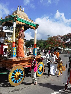
Chamarajanagar was earlier known as Sri Arikottara.[ citation needed ] Chamaraja Wodeyar, the Wodeyar of Mysuru was born here and hence this place was renamed after him. The Vijaya Parsvanath Basadi, a holy Jain shrine was constructed by Punisadandanayaka, the commander of the Hoysala king Gangaraja in the year 1117 AD.

Geography

Being the southernmost district of Karnataka, Chamarajanagar district borders the state of Tamil Nadu and Kerala. Specifically, it borders Mysore district of Karnataka to the west and north, Mandya and Ramanagara districts of Karnataka to the north-east, Dharmapuri and Krishnagiri districts of Tamil Nadu to the east, Salem to south-east, Erode districts and Nilgiris district of Tamil Nadu to the south, and to the extreme south-west, there is a very small border with Wayanad district of Kerala.

Most of the district lies in the leeward region of the Nilgiris and consists of mainly semi-arid rain-dependent flatlands along with forested hills.

Economy

The Karnataka state government has started a Rs.400 crore project on 1`,595 acres of land called Badanaguppe-Kellamballi Industrial Estate which will include sectors like automobile, food processing, textiles, leather, granite and agriculture related industries.

Many industries have set up base in the Badanaguppe-Kellamballi KIADB industrial estate. Notable ones are the KCM Appliances, Aditya Birla-Grasim Paint Plant, Kaynes Technology, Colortone Textiles among others.

Roads

Three national highways of India pass through Chamarajanagara district namely NH-766, NH-181, and NH-948. Some state highways of Karnataka pass through this district.

National Highway 948 ( previously NH 209), which starts from Bengaluru in Karnataka state and ends at Coimbatore in Tamil Nadu, passes through the following places namely Kanakapura, Malavalli, Kollegal, Chamarajanagar, Punajanur and enters Tamil Nadu.It further goes to Hasanur, Dhimbam ghat, Thalamalai, Bannari, Satyamangalam, Pullampatti, Annur ends at Coimbatore. Few KSRTC buses run on NH 948. There are many roads from Chamarajanagara district to neighbouring tamillunadu state. One road connects Kollegal to Hasanur via Dhondenling and Germalam. There is a Buddhist monastery at Dhondeling. Another road connects Kollegala to Anthiyur via Hanur, Ramapura, Burgur and Moongilpalya. The road from Kollegala to Mettur goes through Hanur Kowdalli( Cowdalli), Male Mahadeshwara Betta( MM Hills), Palar, Govindapadi, Kaveripuram and Kolathur. The above-mentioned three roads pass through forest teeming with wild animals, including elephants, Indian Bison, leopards and tigers. These roads are isolated and narrow at many stretches without any human habitation or cellular phone signals.

National Highway 181 connects Gundlupete town of Chamarajanagara district with Ooty via Bandipura and Gudalur. National Highway 766 connects Gundlupete with Kalpetta via Mulehole and Sulthan Bathery. The national highways 181 and 766 are closed for private vehicles at night in stretch between Gundlupete and neighbouring states.. Only state government buses are allowed at night in these section of highway.

Demographics

Historical population
YearPop.±% p.a.
1901334,676    
1911344,414+0.29%
1921328,501−0.47%
1931352,485+0.71%
1941390,337+1.03%
1951449,448+1.42%
1961533,759+1.73%
1971616,502+1.45%
1981768,198+2.22%
1991883,365+1.41%
2001965,462+0.89%
20111,020,791+0.56%
source: [3]
Religions in Chamarajanagar district (2011) [4]
ReligionPercent
Hinduism
92.29%
Islam
4.62%
Christianity
2.17%
Buddhism
0.48%
Other or not stated
0.44%

According to the 2011 census Chamarajanagar district has a population of 1,020,791, [2] roughly equal to the nation of Cyprus [5] or the US state of Montana. [6] This gives it a ranking of 441st in India (out of a total of 640). [2] The district has a population density of 200 inhabitants per square kilometre (520/sq mi) . [2] Its population growth rate over the decade 2001-2011 was 5.75%. [2] Chamarajanagar has a sex ratio of 989 females for every 1000 males, [2] and a literacy rate of 61.43%. 17.14% of the population lives in urban areas. Scheduled Castes and Scheduled Tribes make up 25.42% and 11.78% of the population respectively. [7]

The district has a high percentage of Scheduled Castes, with a population of 259,000, making up a quarter of the district's population. Having a large percentage of forest cover the district also has a high population of tribals, mostly the Nayakas but also forest tribes like the Soligas, Yeravas, Jenu Kurubas and Betta Kurubas. These tribals have their own languages and their total population is around 120,000, and make up 12% of the district population. [8] Other communities include Lingayats, Muslims and Vokkaligas. [9]

Languages of Chamarajanagar district (2011) [10]

   Kannada (86.11%)
   Tamil (4.58%)
   Urdu (4.42%)
   Telugu (3.29%)
  Others (1.60%)

At the time of the 2011 census, 86.10% of the population spoke Kannada, 4.58% Tamil, 4.42% Urdu and 3.29% Telugu as their first language. [10]

Crime

Since much of the southern area of the district is dense forest, it provided good refuge to the notorious bandit Veerappan, responsible for the death of over a hundred policemen in both states of Karnataka and Tamil Nadu. He was shot dead in an encounter with the specially formed Special Task Force (STF) on 18 October 2004, in Dharmapuri district, Tamil Nadu. He had been on the run for over two decades. The presence of illegal quarrying for black stone imposes a great threat to the forests in the region.

Tourist attractions

The main tourist attractions are Sri Chamarajeshwara temple in Chamarajanagar, Biligiriranga Hills, K Gudi, Male Mahadeshwara Hills, Gundal dam, Suvarnavati Dam, Hogenakal Falls, Shivasamudram, Bandipur national park, and Gopalaswamy Hills in Gundlupet.

Villages

Notable people

Related Research Articles

<span class="mw-page-title-main">Soliga people</span>

Soliga, also spelled Solega, Sholaga and Shōlaga, is an ethnic group of India. Its members inhabit the mountain ranges mostly in the Chamarajanagar district of southern Karnataka and Erode district of Tamil Nadu. Many are concentrated in the Biligiriranga Hills and associated ranges, mainly in the talukas Yelandur, Kollegal and Chamarajanagar of Karnataka. The Soliga speak Sholaga, which belongs to the Dravidian family. Under Indian law, they are recognized as a scheduled tribe, they have a population of around 40,000.

<span class="mw-page-title-main">Biligiriranga Hills</span> Wildlife sanctuary in South India

The Biligirirangana Hills or Biligirirangan Hills is a hill range situated in south-western Karnataka, at its border with Tamil Nadu in South India. The area is called Biligiri Ranganatha Swamy Temple Wildlife Sanctuary or simply BRT Wildlife Sanctuary. It is a protected reserve under the Wildlife Protection Act of 1972. Being close to the Eastern Ghats as well as the Western Ghats, the sanctuary has floral and faunal associations with both regions. The site was declared a tiger reserve in January 2011 by the Government of Karnataka, a few months after approval from India's National Tiger Conservation Authority.

<span class="mw-page-title-main">Dharmapuri</span> City in Tamil Nadu, India

Dharmapuri is a city in the north western part of Tamil Nadu, India. It serves as the administrative headquarters of Dharmapuri district which is the first district created in Tamil Nadu after the independence of India by splitting it from then Salem district on 2 October 1965. The city is located 50 km from Krishnagiri, 69 km from Salem, 60 km from Tirupattur, 90 km from Hosur, 117 km from Thiruvannamalai, 126 km from Bangalore and Erode, 181 km from Tiruppur, 200 km from Coimbatore and Tiruchirappalli, 300 km from Madurai and the state capital Chennai. It is located between latitudes N 11 47’ and 12 33’ and longitudes E 77 02’ and 78 40’. It is one of the major leading cultivators and producers of mangoes in the state along with Krishnagiri, and is often referred as Mango Capital of India.

<span class="mw-page-title-main">Mysore district</span> District of Karnataka in India

Mysore district, officially Mysuru district, is an administrative district located in the southern part of the state of Karnataka, India. It is the administrative headquarters of Mysore division. Chamarajanagar District was carved out of the original larger Mysore District in the year 1998. The district is bounded by Chamrajanagar district to the southeast, Mandya district to the east and northeast, Kerala state to the south, Kodagu district to the west, and Hassan district to the north.

Kamsale is a unique folk art performed by the devotees of God Mahadeshwara. Kamsale is a brass made musical instrument. Its origin is traced to the Mythological period.

<span class="mw-page-title-main">Male Mahadeshwara Hills</span> Pilgrimage centre in Karnataka, India

Male Mahadeshwara Betta is a pilgrim town located in the Hanur taluk of Chamarajanagar district of southern Karnataka. It is situated at about 150 km from Mysuru and about 210 km from Bengaluru. The ancient and sacred temple of Sri Male Mahadeshwara is a pilgrim centre where Mahadeshwara lived, practiced medicine as Sidda, taught ahimsa to people in and around the seven hills. It draws lakhs of pilgrims from the states of Karnataka and Tamil Nadu. The area of the present temple surroundings is 155.57 acres (0.6296 km2). In addition, the temple has lands at Talabetta, Haleyuru and Indiganatha villages. Amidst dense forest, the temple attracts not only the pilgrims but also nature lovers. The height of the hill is about 3000 feet above sea level.

<span class="mw-page-title-main">Krishnagiri district</span> District in Tamil Nadu, India

Krishnagiri district is one of the 38 districts of the state of Tamil Nadu, in India. This district is carved out from Dharmapuri District by 2004. The municipal town of Krishnagiri is the district headquarters. In Tamil Nadu, e-Governance was first introduced at Krishnagiri district under the National e-Governance Project (NEGP) in revenue and social welfare departments on a pilot basis. The district is one of the largest producers of mangoes in India. As of 2011, the district had a population of 1,879,809 with a sex-ratio of 958 females for every 1,000 males. Hosur is the most populous town in the district.

<span class="mw-page-title-main">Kollegal</span> City in Karnataka, India

Kollegala is the Major taluk in the Chamarajanagara District of Karnataka State in the south of India. Kollegala is well known for its silk industry which attracts traders from all over the state.

<span class="mw-page-title-main">Dharmapuri district</span> Place in India

Dharmapuri is one of the 38 districts in the state of Tamil-Nadu, India. It is the first district created in Tamil Nadu after the independence of India by splitting it from then-Salem district on 2 October 1965. Dharmapuri District is one of the major producers of mango in the state, fine quality granite is found in the district. It is also one of the main sericulture belts in the state. Around 30 percent of the district's area is under forest cover. Kaveri enters Tamil Nadu through this district. Dharmapuri district had the lowest literacy rate of 74.23% in Tamilnadu during the 2011 census.

<span class="mw-page-title-main">Chamarajanagar</span> City in Karnataka, India

Chamarajanagar or Chamarajanagara is a town in the southern part of Karnataka, India. Named after Chamaraja Wodeyar IX, the erstwhile Raja of Mysore, previously known as 'Arikottara'. Chamarajanagara is the headquarters of Chamarajanagar district. It is located on the interstate highway linking the neighboring states of Tamil Nadu and Kerala.

<span class="mw-page-title-main">Gundlupet</span> Town in Karnataka, India

Gundlupet is a municipal town situated in the Chamarajanagar district of Karnataka, India. It is also known as "The flower pot of India". It is situated on NH 766, 60 km away from Mysuru and approximately 200 km from the state administrative capital, Bengaluru. Gundlupet is the last town in Karnataka on the National Highway 766 which goes through Mysore, Ooty, Wayanad, and Kozhikode. It is situated very close to the Tamil Nadu and Kerala state borders. NH 181 begins from Gundlupet and ends in Nagapattinam in Tamil Nadu via Ooty and Coimbatore.

Ajjipura is a village in the southern state of Karnataka, India. It is located in the Hanur taluk of Chamarajanagar district. It is surrounded by Hanur, Ramapura, Cowdalli and Male Mahadeshwra Hills. Ajjipura is closely surrounded by Kurubaradoddi, Suleripalya (Kanchalli), Basappanadoddi and K Gundapura. Dommanagadde, G R Nagara, Naganna Nagara, Vaddaradoddi, Ambikapura are sub-villages.

Bandalli is a village in the southern state of Karnataka, India. It is located in the Kollegal taluk of Chamarajanagar district.

Ramapura is a village in the southern state of Karnataka, India. It is located in the Hanur taluk of Chamarajanagar district in Karnataka.It is surrounded by Ajjipura, Cowdhalli, Martalli, Hoogya, Kudlur, Ponnachi and Male Mahadeshwara Betta. As per Indian Postal Department, the name of this place is Ramapuram Ghat. Ramapura is very close to the border of Tamil Nadu. It was part of erstwhile Tamil Nadu state. Ramapura is closely surrounded by three more villages viz., Poojaribhovidoddi, Gopishettiyur, Gejjalanatta and Muttushettiyur. Chengadarahalli, Puduramapuram, Palanimedu are other small villages. The Postal PIN code is 571444.

<span class="mw-page-title-main">National Highway 766 (India)</span> National highway in India

National Highway 766 is a National Highway in Southern India. NH 766 connects Kozhikode in Kerala with Kollegal in Karnataka via Mysore. Of the total distance of 272 km, 117 km is in Kerala and 155 is in Karnataka. At Kollegal, it joins National Highway 948, which connects Bengaluru and Coimbatore. The highway passes through dense forests of Western ghats of India. The NH-766 passes through 19.7 km Bandipur National Park and Wayanad wild life sanctuary.

National Highway 181, commonly referred to as NH 181, is a highway connecting the city of Coimbatore in Tamil Nadu to Gundlupete in Karnataka state, South India. The city of Mysuru is connected to Ooty by road via Nanjanagudu, Gundlupete, Bandipur and Gudalur. The national highway 181 passes through Bandipur Tiger Reserve and Mudumalai Tiger Reserve, hence vehicular traffic is restricted at night from 9 p.m to 6 a.m. Wild animals like elephants, bison, bears, tiger, and leopards can be spotted sometimes on this highway in the tiger reserve stretches. NH 181 after Ooty goes to Coonoor, Mettupalayam, Karamadai and ends in Coimbatore city.

National Highway 948 is a highway in India which connects Coimbatore in Tamil Nadu with the city of Bengaluru. It is a spur road of National Highway 48. It passes through Sathyamangalam Wildlife Sanctuary. The road through the wildlife sanctuary is a single carriageway with two lanes, and it is narrow at many places. Wild animals can be spotted in this route. The movement of automobiles are not allowed from 8 pm to 6 pm through Dhimbam ghat stretch in this national highway. National Highway 948 passes through Sathyamangalam forests, which were the territory of the bandit Veerappan.

<span class="mw-page-title-main">Malai Mahadeshwara Wildlife Sanctuary</span>

Malai Mahadeshwara Wildlife Sanctuary or Male Mahadeshwara Wildlife Sanctuary is a protected Wildlife sanctuary in the Western Ghats and is located in the state of Karnataka in India. It is named after the presiding deity "Lord Male Mahadeshwara" of the famed Male Mahadeshwara Hills Temple located within the sanctuary. The sanctuary lies in the Chamarajanagar district of Karnataka. It is at a distance of 140 km (87 mi) from Mysuru and 210 km (130 mi) from Bengaluru.

<span class="mw-page-title-main">Suvarnavathi River</span>

The Suvarnavathi River, also called the Honnuhole or Honhole river, is a 88 kilometres (55 mi) southern tributary of the Kaveri River in the Indian states of Karnataka and Tamil Nadu. Its drainage area is about 1,787 square kilometres (690 sq mi). The river begins at Badibadga in the Nasurghat hills of southern Karnataka's Mysore district as the convergence of two streams, the Niredurgihalla and Araikaduhalla. It is joined by two significant tributaries, the Chikkahole and the Yenehole, on its journey, generally to the east, to the Kaveri.

Sathanur is a village in Ramanagara district of Karnataka, India. It is located around 70 km from the city of Bengaluru. The Bengaluru - Coimbatore National Highway 948 passes via this town.

References

  1. "Archived copy". Archived from the original on 9 October 2011. Retrieved 12 October 2009.{{cite web}}: CS1 maint: archived copy as title (link)
  2. 1 2 3 4 5 6 "District Census Handbook: Chamarajanagar" (PDF). censusindia.gov.in. Registrar General and Census Commissioner of India. 2011.
  3. Decadal Variation In Population Since 1901
  4. "Table C-01 Population by Religion: Karnataka". censusindia.gov.in. Registrar General and Census Commissioner of India. 2011.
  5. US Directorate of Intelligence. "Country Comparison:Population". Archived from the original on 13 June 2007. Retrieved 1 October 2011. Cyprus 1,120,489 July 2011 est.
  6. "2010 Resident Population Data". U. S. Census Bureau. Archived from the original on 19 October 2013. Retrieved 2011-09-30. Montana 989,415
  7. "Demography | Chamarajanagar District, Government of Karnataka | India".
  8. "Chamarajanagar District Population Religion - Karnataka, Chamarajanagar Literacy, Sex Ratio - Census India". www.censusindia.co.in. Retrieved 21 April 2020.
  9. "Lok Sabha Election 2019, Karnataka profile: Congress-JDS, BJP set for epic clash; Belgaum, Bangalore North, Shimoga key seats". Firstpost. 28 March 2019. Retrieved 21 April 2020.
  10. 1 2 "Table C-16 Population by Mother Tongue: Karnataka". www.censusindia.gov.in. Registrar General and Census Commissioner of India.
  11. "12°11'59.8"N 77°08'55.1"E".