This article possibly contains original research .(November 2017) |
Mandya district | |
|---|---|
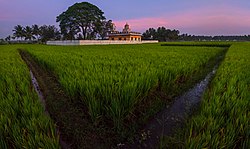
    Yoga Narasimha Temple in Melukote, Shivanasamudra Falls, Bheemeshwari in Kaveri Wildlife Sanctuary, Merger of rivers near Srirangapatna | |
 Location in Karnataka | |
 Mandya district | |
| Coordinates: 12°31′N76°54′E / 12.52°N 76.9°E | |
| Country | |
| State | |
| Division | Mysore |
| Established | 1 July 1939 [1] |
| Headquarters | Mandya |
| Talukas | Mandya Malavalli Maddur Nagamangala Krishnarajpet Pandavapura Srirangapatna |
| Government | |
| • Deputy Commissioner | Dr. Kumara (IAS) |
| • Superintendent of Police | Mallikarjuna Baladandi (IPS) |
| Area | |
• Total | 4,961 km2 (1,915 sq mi) |
| Population (2011) [3] | |
• Total | 1,805,769 |
| • Density | 364.0/km2 (942.7/sq mi) |
| Languages | |
| • Official | Kannada |
| Time zone | UTC+5:30 (IST) |
| ISO 3166 code | IN-KA-MA |
| Vehicle registration | KA-11 (Mandya), KA-54 (Nagamangala) |
| Sex ratio | 1.015 ♂/♀ |
| Literacy | 70.40 % |
| Lok Sabha constituency | Mandya Lok Sabha constituency |
| Climate | Tropical Semi-arid (Köppen) |
| Precipitation | 691 millimetres (27.2 in) |
| Avg. summer temperature | 35 °C (95 °F) |
| Avg. winter temperature | 16 °C (61 °F) |
| Website | mandya |
Mandya district is an administrative district of Karnataka, India. The district Mandya was carved out of larger Mysore district in the year 1939.
Contents
- Geography
- Rivers
- Administrative divisions
- Economy
- Transportation
- Demographics
- Notable people
- Villages
- References
- External links
Mandya is the main town in Mandya district. As of 2011, the district population was 1,808,680 (of which 16.03% was urban). [4]