Nagamangala | |
|---|---|
Town | |
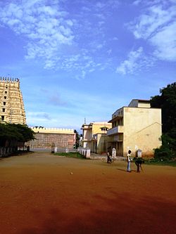 Rotary School, Nagamangala | |
 | |
| Coordinates: 12°49′N76°46′E / 12.82°N 76.76°E | |
| Country | |
| State | |
| District | Mandya |
| Area | |
• Town | 10.43 km2 (4.03 sq mi) |
| • Rural | 1,035.26 km2 (399.72 sq mi) |
| Elevation | 772 m (2,533 ft) |
| Population (2011) | |
• Town | 24,059 |
| • Density | 2,300/km2 (6,000/sq mi) |
| • Rural | 170,121 [1] |
| Languages | |
| • Official | Kannada |
| Time zone | UTC+5:30 (IST) |
| Vehicle registration | KA-54 |
| Website | www |

Nagamangala is a PuraSabhe and a taluk in Mandya district, in the Indian state of Karnataka.
Contents
Nagamangala lies on the junction between NH-150A and SH-85. It is 43 km from its district headquarter Mandya, 70 km from Mysuru, 115 km from Bengaluru, 261 km from Mangaluru and 425 km from Hubballi. Nearest railway station is B. G. Nagar at 17 km. Nearest airport is Kempegowda International Airport at 140 km.
