Related Research Articles

Chamarajanagar or Chamarajanagara is the southernmost district in the state of Karnataka, India. It was carved out of the original larger Mysore District in 1998. Chamarajanagar town is the headquarters of this district.

Mandya District is an administrative district of Karnataka, India. The district is bordered on the south by Mysore and Chamarajangar districts, on the west by Hassan District, on the north by Tumkur District and on the east by Ramanagara district. The district Mandya was carved out of larger Mysore district in the year 1939.

Kollegal is one of the major taluks in the Chamarajanagara District of Karnataka State in the south of India. It is also the largest taluk in Karnataka, Kollegal is well known for its silk industry which attracts traders from all over the state.
Cumbum, natively spelt as Kambam, is a town and municipality in Theni district, an Indian state of Tamil Nadu.

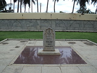
Malavalli is a town and a taluka place in Mandya district in the Indian state of Karnataka. Malavalli town in history is quoted dates back to 27 March 1799 - Fourth Anglo Mysore War. Battle of Malavalli was fought between Tippu Sultan's Mysore Army against the British East India Company led by Arthur Wellesley. The men from the town fought fiercely and laid down their lives. The postal code of Malavalli is 571430.

Shimsha is a river that flows in the state of Karnataka, India. It is one of the tributaries of the river Kaveri, which is one of the major rivers of South India. The river originates in the southern part of the Devarayanadurga hill in the Tumkur district of Karnataka and flows for about 221 km (137 mi). before joining the river Kaveri.
Pebbair is now a Municipal corporation and a Municipal corporation in Wanaparthy district in the state of Telangana, India. The Pebbair Municipal corporation extends from Pampuram village in the North to Yaparla village in the south..
Ramapura is a village in the southern state of Karnataka, India. It is located in the Hanur taluk of Chamarajanagar district in Karnataka.It is surrounded by Ajjipura, Cowdhalli, Martalli, Hoogya, Kudlur, Ponnachi and Male Mahadeshwara Betta. As per Indian Postal Department, the name of this place is Ramapuram Ghat. Ramapura is very close to the border of Tamil Nadu. It was part of erstwhile Tamil Nadu state. Ramapura is closely surrounded by three more villages viz., Poojaribhovidoddi, Gopishettiyur, Gejjalanatta and Muttushettiyur. Chengadarahalli, Puduramapuram, Palanimedu are other small villages. The Postal PIN code is 571444.

Bannari Amman temple is one of the Amman temples in Tamil Nadu, India. It is located in Bannari on NH 209, near Sathyamangalam, Erode district. The main deity at the temple is goddess Mariamman, an avatar of goddess Parvathi. The goddess is considered powerful in the Tamil and Kannada folklore, and roughly every village in the Kongu region of Tamil Nadu has a Mariamman temple.
Kirugavalu is a village in the southern state of Karnataka, India. Kirugavalu is located in the Malavalli taluk of Mandya district in Karnataka.

Yachenahalli is a panchayat town in Mysore district in the state of Karnataka, India. It is located 35 km from Mysore and 17 km from Mandya. The nearest city is Bannur with 10 km distance.

Coimbatore District was one of the districts of the erstwhile Madras Presidency of British India. It covered the areas of the present-day districts of Coimbatore, Erode and Tirupur and the Kollegal taluk of present-day Karnataka. It covered a total area of 20,400 square kilometres (7,860 sq mi) and was sub-divided into 10 taluks. The administrative headquarters was Coimbatore city. Most of Coimbatore's inhabitants were Tamil-speaking but there were also large numbers of Malayalam, Telugu and Kannada speaking people.

Kenchanagudda is a village in the southern state of Karnataka, India. The village is located in the Siruguppa taluk of Ballari district.

National Highway 766 is a National Highway in Southern India. NH 766 connects Kozhikode in Kerala with Kollegal in Karnataka via Mysore. Of the total distance of 272 km, 117 km is in Kerala and 155 is in Karnataka. At Kollegal, it joins National Highway 948, which connects Bengaluru and Coimbatore. The highway passes through dense forests of Western ghats of India. The NH-766 passes through 19.7 km Bandipur National Park and Wayanad wild life sanctuary.

Shivagange is a mountain peak with a height of 1,368 metres (4,488 ft) and Hindu pilgrimage center located near Dobbaspet, in Bengaluru Rural district India. It is 25 km (16 mi) from the town of Tumakuru and 54 km (34 mi) from Bengaluru. The sacred mountain is shaped as a shivalinga and a spring flows near locally called "Ganga", thereby giving the place its name. It is also known as Dakshina Kashi and has various temples such as Gangadhareshwara temple, Sri Honnammadevi Temple, Olakal Teertha, Nandi Statue, Patalagang Sharadambe temple and several theerthas such as Agasthya theertha, Kanva theertha, Kapila theertha, Pathala Gange
Kammanahalli is a small village located in Tumkur District, Turuvekere Taluk, Mayasandra Hobli and Vittalapura Post in India's Karnataka State. The village is about 12 km from Yadiyur which is famous for the Lord Siddalingeshwara Temple and is about 100 km from Bangalore.
Mudenahalli comes under Mudenahalli Panchayath. It is located 29 KM towards South from District headquarters Ramanagara. 39 KM from State capital Bangalore. Mudenahalli Pin code is 562112 and postal head office is Harohalli. Mudenahalli is surrounded by Ramanagara Taluk towards North, Thally Taluk towards East, Channapatna Taluk towards west, Maddur Taluk towards west. Ramanagaram, Maddur, Malavalli. Bangalore is the nearby Cities to Mudenahalli.

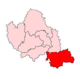
Malavalli Assembly constituency is one of the 224 constituencies in the Karnataka Legislative Assembly of Karnataka a south state of India. It is also part of Mandya Lok Sabha constituency.

Kollegal Assembly constituency is one of the 224 Legislative Assembly constituencies of Karnataka state in India.