Kollegal

Last updated

Kollegala
City
Kollegala
Birds Eyeview of Kollegal City from Maradigudda.jpg
Kollegala City from Maradi Gudda
Nickname: 
Silk City
India Karnataka location map.svg
Red pog.svg
Kollegala
Location in Karnataka, India
India location map 3.png
Red pog.svg
Kollegala
Kollegala (India)
Coordinates: 12°09′14″N77°06′03″E / 12.1539301°N 77.1009671°E / 12.1539301; 77.1009671
CountryFlag of India.svg  India
State Karnataka
District Chamarajanagar
Founded byKolava Muni, Galava Muni[ citation needed ]
Government
  BodyCity Municipal Council
Area
  City27.47 km2 (10.61 sq mi)
  Rural
395 km2 (153 sq mi)
Elevation
660 m (2,170 ft)
Population
 (2011)
  City57,149
  Density2,100/km2 (5,400/sq mi)
   Rural
289,638
Languages
  Official Kannada
Time zone UTC+5:30 (IST)
PIN
571440
Area code 08224
Vehicle registration KA-10
Website www.kollegalacity.mrc.gov.in
BSNL office, Kollegal Kollegal (3).jpg
BSNL office, Kollegal

Kollegala is the Major taluk in the Chamarajanagara District of Karnataka State in the south of India. Kollegala is well known for its silk industry which attracts traders from all over the state.

Contents

History

Until 1956, Kollegala was part of the Coimbatore district of the Madras Presidency. The States Reorganisation Act of 1956 moved Kollegala to Karnataka primarily organising it along linguistic lines. Kollegal is the name derived from the names of two hermits namely 'Kauhala' and 'Galava' who were believed to be instrumental in the development of Kollegala. Kollegala, also called "Silk City", is famous for its handloom silk saree industry.

Kollegala serves as a center for pre-university education in the region. Well known schools in Kollegal include Lions High School, Sree Vasavi Vidya Kendra, St. Francis Assisi High School, Nisarga Independent PU college, Seventh Day Adventist High School, and Mudigundam Gurukaar Subappa Veerappa (MGSV), and Mahadeshwara Degree College.

Singanalur, Kollegala is the hometown of Legendary Kannada thespian, the demigod of Karnataka, Dr.Rajkumar. Kollegala was one of the areas which played host to the activities of Veerappan, a notorious bandit who smuggled sandalwood and poached elephants for their tusks.

Nanjundeswara Temple Entrance to Nanjundeswara temple, Mysore (02).jpg
Nanjundeswara Temple

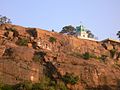
Many tourists visit the Kollegala area. The Malai Mahadeshwara Hills, and the waterfalls at Hogenakkal near Male Mahadeshwara hills and the waterfalls of Gagana Chukki and Barachukki at Shivanasamudra (also known as Bluff) are popular destinations. In Kollegala, there is a small hill called "Maradi Gudda" which is located in the heart of the city. Gundal dam is just 15 km (9.3 mi) away from Kollegala. It also includes BRT Tiger Reserve (2011) Biligiriranga Hills which is approximately 25–30 km from the town, which is a home to many fauna and flora including mammals like Tigers, Leopards, Indian Elephant, Indian Guar and the Sloth Bear.

Transportation

Kollegala is connected by two national highways:

  1. NH 948 (Bengaluru-Coimbatore Highway)
  2. NH 766 this starts from Kollegala to Calicut, via Tirumakudalu Narasipura, Mysore and Gundlupet,Bandipur National Park,Sultan Bathery,Kalpetta

The nearest railway stations are Chamarajanagara 38 km (24 mi) and Mysuru (MYS) 60 km (37 mi). The nearest airport is Kempegowda International Airport (BLR), 150 km (93 mi), Mysore airport (MYQ), 60 km (37 mi)and Coimbatore International Airport (CJB), 165 km (103 mi) away. Kollegala

is the main junction where you can enter Salem, Coimbatore, Ooty, Kozhikode from Mysuru & Bengaluru. The Biligiri Rangana Betta (known as BR hills) is just 30 km (19 mi) away from the town. The K.Gudi (Kyathadevara Gudi) Wilderness camp run by the jungle lodges and resorts (a government of Karnataka undertaking) is near the B.R hills.

There are two bus routes from Bengaluru to Kollegala:

Karnataka government buses from Bengaluru ply from MCTC which is popularly known as Satellite bus terminal in Mysuru Road and also from Kalasipalyam. Since the town was in Coimbatore district in the past, buses run between Coimbatore and Kollegala.

Geography

Kollegala is located at 12°09′N77°07′E / 12.15°N 77.12°E / 12.15; 77.12 . [1] It has an average elevation of 588 m (1,929 ft). Since the town is on the foothills of the Western Ghats, it is home to a mixed topography. Temperature is moderate.[ citation needed ]

Until 2018, Kollegala taluk was the largest taluk in Karnataka,in terms of area;2,800 square kilometres (1,100 sq mi). Then the Government of Karnataka carved out Hanur taluk from Kollegala, significantly reducing its size. [2]

Demographics

As of 2011 India census [3] Kollegala had a population of 57,149. Males constitute 51% of the population and females 49%. Kollegala has an average literacy rate of 69%, higher than the national average of 59.5%: male literacy is 74%, and female literacy is 64%. In Kollegala, 10% of the population is under 6 years of age.

People in Kollegala speak a variation of Kannada distinct from that spoken in Mysuru and Bengaluru. There are 2500 Tamil native in Kollegal Taluk. There was a trust for Tamil peoples welfare activity named Kollegal Tamil Sangam.

College and schools

MGSV Junior College, Kollegala Kollegal (2).jpg
MGSV Junior College, Kollegala

MCKC High School, Lions School and PU college, Seventh Day Adventist English school, St. Francis Assisi School and PU college, RC mission, Sree Vasavi Vidya Kendra, Mahadeshwara College, JSS Women's College And College For Nursing are the oldest educational institutions in Kollegal offering best education. Manasa degree college and school and its PU college is a decade old private institution. Wisdom school is a recently opened private institution.

See also

Related Research Articles

<span class="mw-page-title-main">Madikeri</span> City in Karnataka, India

Madikeri is a hill station town in Madikeri taluk and headquarters of Kodagu district in Karnataka, India. Its original name was Muddurajanakeri which means "the capital of Maharaja Mudduraja".

<span class="mw-page-title-main">Chamarajanagar district</span> District of Karnataka in India

Chamarajanagar or Chamarajanagara is the southernmost district in the state of Karnataka, India. It was carved out of the original larger Mysore District in 1998. Chamarajanagar town is the headquarters of this district.

<span class="mw-page-title-main">Yelandur</span> Town in Karnataka, India

Yelandur is a taluk and town in Chamarajanagar district in southern Karnataka, India. It has historic and cultural importance in this region. Along with three other taluks, it was officially included into Chamarajanagar district when the district was notified upon bifurcation of Mysore district in 1997.

<span class="mw-page-title-main">Arsikere</span> City in Karnataka, India

Arsikere is a city and taluka in the Hassan district in the state of Karnataka, India. It is the second largest city in Hassan district, demographically. Arsikere city municipal council consists of 35 wards. This region is known for its coconut production and is also called Kalpataru Nadu. Arsikere Junction is a major railway junction in the South Western Railway which links Mangalore and Mysore to North Karnataka and a central place for tourists who visit nearby places that do not have rail access, such as Belur, Halebidu and Shravanabelagola, Harnahalli, and Kodimata.

<span class="mw-page-title-main">Bhadravati, Karnataka</span> City in Karnataka, India

Bhadravati or Bhadravathi is an industrial city or Steel Town and taluk in the Shivamogga District of Karnataka state, India. It is situated at a distance of about 255 kilometres (158 mi) from the state capital Bengaluru and at about 20 kilometres (12 mi) from the district headquarters, Shivamogga. The town is spread over an area of 67.0536 square kilometres (25.8895 sq mi) and has a population of 151,102 as per the census held in 2011.

<span class="mw-page-title-main">Mandya district</span> District of Karnataka in India

Mandya district is an administrative district of Karnataka, India. The district is bordered on the south by Mysore and Chamarajangar districts, on the west by Hassan district, on the north by Tumkur district and on the east by Ramanagara district. The district Mandya was carved out of larger Mysore district in the year 1939.

<span class="mw-page-title-main">Male Mahadeshwara Hills</span> Pilgrimage centre in Karnataka, India

Male Mahadeshwara Betta is a pilgrim town located in the Hanur taluk of Chamarajanagar district of southern Karnataka. It is situated at about 150 km from Mysuru and about 210 km from Bengaluru. The ancient and sacred temple of Sri Male Mahadeshwara is a pilgrim centre where Mahadeshwara lived, practiced medicine as Sidda, taught ahimsa to people in and around the seven hills. It draws lakhs of pilgrims from the states of Karnataka and Tamil Nadu. The area of the present temple surroundings is 155.57 acres (0.6296 km2). In addition, the temple has lands at Talabetta, Haleyuru and Indiganatha villages. Amidst dense forest, the temple attracts not only the pilgrims but also nature lovers. The height of the hill is about 3000 feet above sea level.

Junje Gowda is the legendary builder of the Male Mahadeshwara temple in hanur taluk of Chamarajanagara District. He was a local landlord belonging to the Kuruba Gowda community and a devotee of Shri Mahadeshwara Swamy.

<span class="mw-page-title-main">Chamarajanagar</span> City in Karnataka, India

Chamarajanagar or Chamarajanagara is a town in the southern part of Karnataka, India. Named after Chamaraja Wodeyar IX, the erstwhile Raja of Mysore, previously known as 'Arikottara'. Chamarajanagara is the headquarters of Chamarajanagar district. It is located on the interstate highway linking the neighboring states of Tamil Nadu and Kerala.

Challakere is a city municipality (taluk) in Chitradurga district in the state of Karnataka, India. It is called Oil City with numerous edible oil mills around the city and also Science City as several science and research organizations such as IISc, DRDO, BARC and ISRO have set up their establishments here.

Harapanahalli is a city and a taluk in Vijayanagara District in the Indian state of Karnataka. It is the sub-division and administrative headquarters of the Harapanahalli Taluk.

Kampli is a town in the Bellary district, Kampli taluk, in the Indian state of Karnataka. It is a headquarters of Kampli Taluk. The town is situated about 15 km away from Hampi.

Tekkalakote, also known as Tekkalakota, is a Panchayat town and Pre-historic Neolithic site in Siruguppa taluk of Ballari district in the Indian state of Karnataka.

Vanavasi is a Town Panchayat in Mettur Taluka, Salem District, in the Indian state of Tamil Nadu.

Ajjipura is a village in the southern state of Karnataka, India. It is located in the Hanur taluk of Chamarajanagar district. It is surrounded by Hanur, Ramapura, Cowdalli and Male Mahadeshwra Hills. Ajjipura is closely surrounded by Kurubaradoddi, Suleripalya (Kanchalli), Basappanadoddi and K Gundapura. Dommanagadde, G R Nagara, Naganna Nagara, Vaddaradoddi, Ambikapura are sub-villages.

<span class="mw-page-title-main">Belakavadi</span> Village in Karnataka, India

Belakavadi or Belakawadi is a village in the southern state of Karnataka, India. It is located in the Malavalli taluk of Mandya district in Karnataka. As per the records of Hoysala rulers Belakavadi was one of the central places of administrative divisions. Temples include Shanbhulingeshwara Temple, Kashi Vishwanatheshwara Temple and maramma temple, Mayamma temple, Mandalakamma temple etc..

<span class="mw-page-title-main">National Highway 766 (India)</span> National highway in India

National Highway 766 is a National Highway in Southern India. NH 766 connects Kozhikode in Kerala with Kollegal in Karnataka via Mysore. Of the total distance of 272 km, 117 km is in Kerala and 155 is in Karnataka. At Kollegal, it joins National Highway 948, which connects Bengaluru and Coimbatore. The highway passes through dense forests of Western ghats of India. The NH-766 passes through 19.7 km Bandipur National Park and Wayanad wild life sanctuary.

Cheluvanahalli is a small village in the southern state Karnataka in India, Chamrajnagar district, Kollegal taluk (sub-district), Saraguru post, Palya hobli, and Dhanagere village panchayath. Pin:571440, L&L:12.199934N,77.148640E.

<span class="mw-page-title-main">Sutturu</span> Place in Karnataka, India

Sutturu is a village on the banks of the river Kapila, in the state of Karnataka, India. It is located in the Nanjangud taluk in the district of Mysore. It is famous for the Suttur Mutt which is one of the most prominent spiritual centres of India.

<span class="mw-page-title-main">Mysuru Road Bus Station</span>

Mysuru Road Bus Station (MRBS), is one of the four major bus stations that serve as mofussil bus station hubs for the city of Bengaluru, India. It is located on Mysuru road. The other three major bus stations in Bengaluru are Kempegowda Bus Station (KBS), Shantinagara Bus Station (SBS) and Basaveshwara Bus Station (BBS). It is the second busiest mofussil bus station in Bengaluru only after Kempegowda Bus Station. It started functioning in 2005.

References

  1. Falling Rain Genomics, Inc – Kollegal
  2. "New taluk declaration" . Retrieved 11 July 2023.
  3. "Census of India 2001: Data from the 2001 Census, including cities, villages and towns (Provisional)". Census Commission of India. Archived from the original on 16 June 2004. Retrieved 1 November 2008.