Mysore State

Last updated

Mysore State
State of India
1947–1973
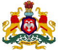
Seal of Karnataka.svg
Coat of arms
Mysore in India (1951).svg
Mysore State, 1951
Karnataka in India (claims hatched).svg
Mysore state, 1956
Anthem
"Kāyou Śrī Gowrī"

(English: "Great Gowrī (Parvati)")
Capital Bangalore
Government
Rajpramukh  
 1950–1956
Jayachamarajendra Wadiyar
History 
 Accession of the Kingdom of Mysore to the Indian Union
9 August 1947
 Renamed Karnataka State
1 November 1973
Preceded by
Succeeded by
Blank.png Kingdom of Mysore
Karnataka Blank.png
Today part of India

Mysore State, colloquially Old Mysore, was a political territory within the Dominion of India and the subsequent Republic of India from 1947 until 1956. The state was formed by renaming the Kingdom of Mysore, [1] and Bangalore replaced Mysore as the state's capital. When Parliament passed the States Reorganisation Act in 1956, Mysore State was considerably enlarged when it became a linguistically homogeneous Kannada-speaking state [2] within the Republic of India by incorporating territories from Andhra, Bombay, Coorg, Hyderabad, and Madras States, as well as other petty fiefdoms. It was subsequently renamed Karnataka in 1973.

Contents

History

The Kingdom of Mysore was one of the three largest princely states in British India. Upon India's independence from Britain in 1947, Maharaja Jayachamarajendra Wadiyar signed the instrument of accession, incorporating his realm with the Union of India, on 15 August 1947. The territories of the erstwhile princely state of Mysore were then reconstituted into a state within the Union. [3]

Reorganisation

In 1956, the Government of India effected a comprehensive re-organisation of provincial boundaries, based upon the principle of shared language. As a result of the States Reorganisation Act on 1 November 1956, the Kannada-speaking districts of Belgaum (exclusing Chandgad), Bijapur, Dharwad, and North Canara were transferred from Mumbai to Mysore. [4] Bellary was transferred from Andhra; South Canara was transferred from Madras; and Koppal, Raichur, Kalaburagi and Bidar districts from Hyderabad. Also, the small Coorg State was merged, becoming a district in Mysore. [5] [6] The state was renamed Karnataka on 1 November 1973. [7]

Maharaja of Mysore

NoPortraitNameTerm of officeDurationSelected former office(s)
1 Court portrait of Jayachamarajendra Wadiyar of Mysore.jpg Jayachamarajendra Wadiyar 15 August 1947 25 January 19502 years, 163 days Yuvaraja of Mysore

RajPramukh of Mysore

NoPortraitNameTerm of officeDurationSelected former office(s)
1 Court portrait of Jayachamarajendra Wadiyar of Mysore.jpg Jayachamarajendra Wadiyar 26 January 1950 31 October 19566 years, 279 days Maharaja of Mysore

Governors of Mysore

NoPortraitNameTerm of officeDurationSelected former office(s)
1 Court portrait of Jayachamarajendra Wadiyar of Mysore.jpg Jayachamarajendra Wadiyar 1 November 1956 4 May 19647 years, 185 days Maharaja of Mysore, Rajpramukh of Mysore
2 General Satyawant Mallana Srinagesh.jpg S. M. Shrinagesh 4 May 1964 2 April 1965333 days Chief of the Army Staff
3 VV Giri 1974 stamp of India (cropped).jpg V. V. Giri 2 April 1965 13 May 19672 years, 41 daysFourth President of India
4 Gopal Swarup Pathak 13 May 1967 30 August 19692 years, 109 daysFourth Vice-president of India
-   Justice A. R. Somanath Iyer (Acting)30 August 1969 23 October 1969 54 daysChief Justice of Karnataka High Court
5 Dharma Vir, ICS.jpg Dharma Vira 23 October 1970 1 February 19721 year, 101 daysGovernor of Punjab, Haryana, and West Bengal
6 Mohan Lal Sukhadia 1988 stamp of India.jpg Mohanlal Sukhadia 1 February 1972 31 October 19764 years, 273 daysChief Minister of Rajasthan, Governor of United Andhra Pradesh and Tamil Nadu

Prime ministers of Mysore State

# [lower-alpha 1] PortraitNameConstituencyTerm [8]
(tenure length)
Assembly [9]
(election)
Party [lower-alpha 2]
1 K. C. Reddy.jpg K. Chengalaraya Reddy N/A 25 October 194726 January 19502 years, 93 daysNot established yet Indian National Congress

Chief ministers of Mysore State

# [lower-alpha 3] PortraitNameConstituencyTerm [8]
(tenure length)
Assembly [9]
(election)
Party [lower-alpha 4]
1 K. C. Reddy.jpg K. Chengalaraya Reddy N/A 26 January 195030 March 19522 years, 64 daysNot established yet Indian National Congress
2 Kengal Hanumanthaiah.gif Kengal Hanumanthaiah Ramanagara 30 March 195219 August 19564 years, 142 days1st
(1952 election)
continued...
3 Kadidalmanjappa.webp Kadidal Manjappa Tirthahalli 19 August 195631 October 195673 days
Chief Minister of Mysore (following the state's reorganisation) [lower-alpha 5]
4
Siddavanahalli Nijalingappa stamp (cropped).jpg
S. Nijalingappa Molakalmuru 1 November 195616 May 19581 year, 197 days...continued
1st
(1952)
Indian National Congress
2nd
(1957)
5 B.D Jatti (cropped).png B. D. Jatti Jamkhandi 16 May 195814 March 19623 years, 302 days
6 S. R. Kanthi Hungud 14 March 196221 June 196299 days3rd
(1962)
(4)
Siddavanahalli Nijalingappa stamp (cropped).jpg
S. Nijalingappa Shiggaon 21 June 196229 May 19685 years, 343 days
Bagalkot [11] 4th
(1967)
7 Veerendra Patil Chincholi 29 May 196818 March 19712 years, 293 days Indian National Congress (O)
Emblem of India.svg
Vacant [lower-alpha 6]
(President's rule)
N/A19 March 197120 March 19721 year, 1 dayDissolvedN/A

See also

Note

  1. A parenthetical number indicates that the incumbent has previously held office.
  2. This column only names the chief minister's party. The state government he headed may have been a complex coalition of several parties and independents; these are not listed here.
  3. A parenthetical number indicates that the incumbent has previously held office.
  4. This column only names the chief minister's party. The state government he headed may have been a complex coalition of several parties and independents; these are not listed here.
  5. On 1 November 1956, via the States Reorganisation Act, Mysore State was significantly expanded along linguistic lines. The Kannada-speaking districts of Bombay, Hyderabad and Madras states, as well as the entirety of Coorg, were added to it. [10]
  6. President's rule may be imposed when the "government in a state is not able to function as per the Constitution", which often happens because no party or coalition has a majority in the assembly. When President's_rule#Karnataka

Related Research Articles

<span class="mw-page-title-main">States and union territories of India</span> Indian national administrative sub-divisions

India is a federal union comprising 28 states and 8 union territories, for a total of 36 entities. The states and union territories are further subdivided into 806 districts and smaller administrative divisions.

<span class="mw-page-title-main">Bombay State</span> Former state of India

Bombay State was a large Indian state created in 1950 from the erstwhile Bombay Presidency, with other regions being added to it in the succeeding years. Bombay Presidency and Vidarbha) was merged with the princely states of Baroda, Western India and Gujarat and the Deccan States.

<span class="mw-page-title-main">Kanara</span> Region in Karnataka, India

Kanara or Canara, also known as Karavali, is the historically significant stretch of land situated by the southwestern Konkan coast of India, alongside the Arabian Sea in the present-day Indian state of Karnataka. The subregion comprises three civil districts, namely: Uttara Kannada, Udupi, and Dakshina Kannada. Kasaragod was included prior to the States Reorganisation Act.

The Indian Republic held its first elections in 1951–52.

<span class="mw-page-title-main">Karnataka Rajyotsava</span> Karnataka formation day

Karnataka Rajyotsava, also known as Karnataka State Day, is a public holiday celebrated annually on 1 November in the Indian state of Karnataka. It commemorates the merger in 1956 of the Kannada-speaking regions of southwestern India under the States Reorganisation Act to form the state.

<span class="mw-page-title-main">Government of Karnataka</span> Indian State Government

The Government of Karnataka, abbreviated as GoK or GoKA, formerly known as Government of Mysore (1956–1974), is a democratically elected state body with the governor as the ceremonial head to govern the Southwest Indian state of Karnataka. The governor who is appointed for five years appoints the chief minister and on the advice of the chief minister appoints their council of ministers. Even though the governor remains the ceremonial head of the state, the day-to-day running of the government is taken care of by the chief minister and their council of ministers in whom a great amount of legislative powers are vested.

<span class="mw-page-title-main">Unification of Karnataka</span> Formation of the Indian state of Karnataka

The Unification of Karnataka or Karnataka Ekikarana refers to the formation of the Indian state of Karnataka in 1956 when several Indian states were created by redrawing borders based on linguistic demographics. Decades earlier during British rule, the demand for a state based on Kannada demographics had been made.

<span class="mw-page-title-main">Karnataka Legislative Assembly</span> Lower house of the state legislature of Karnataka

The Karnataka Legislative Assembly is the lower house of the bicameral legislature of the southern Indian state of Karnataka. Karnataka is one of the six states in India where the state legislature is bicameral, comprising two houses: the Vidhan Sabha and the Vidhan Parishad .

Rao Bahadur Pemmanda K. Monnappa was a police officer of South India. He served in three Southern states, Madras, Hyderabad and Mysore (Karnataka), at different times. However, he is to be best remembered for his contributions towards the integration of Hyderabad into the Union. Monnappa had a career in the Public Service reflected by his titles and medals.

<span class="mw-page-title-main">C. M. Poonacha</span> Indian politician

Cheppudira Muthana Poonacha was the Chief Minister of Coorg, Minister in Mysore State, Member of Parliament, Union Railway Minister of India and Governor of Madhya Pradesh and Governor of Orissa.

<span class="mw-page-title-main">States Reorganisation Act, 1956</span> Indian act reforming state boundaries

The States Reorganisation Act, 1956 was a major reform of the boundaries of India's states and territories, organising them along linguistic lines.

<span class="mw-page-title-main">1952 Mysore State Legislative Assembly election</span>

Elections to the Legislative Assembly of the Indian state of Mysore were held on 26 March 1952. 394 candidates contested for 99 seats in 80 constituencies in the Assembly. There were 19 two-member constituencies and 61 single-member constituencies, accounting for 99 seats.

<span class="mw-page-title-main">1957 Mysore State Legislative Assembly election</span>

Elections to the Mysore Legislative Assembly were held on 25 February 1957. 589 candidates contested for the 208 seats of the 179 constituencies in the Assembly.

References

  1. "States of India since 1947". World Statesman. Archived from the original on 1 July 2014. Retrieved 9 July 2014.
  2. "Rajyotsava: The hows and whys of Karnataka". Bangalore Mirror.
  3. Sadasivan, S. N. (2005). Political and administrative integration of princely states By S. N. Sadasivan. Mittal Publications. ISBN   9788170999683.
  4. "States Reorganization Act 1956". Commonwealth Legal Information Institute. Archived from the original on 25 July 2011. Retrieved 1 July 2008.
  5. "Google Books". books.google.com.
  6. Ramaswamy, Harish (1 June 2007). Karnataka Government and Politics. Concept Publishing Company. ISBN   9788180693977 via Google Books.
  7. Ninan, Prem Paul (1 November 2005). "History in the making". Deccan Herald. Archived from the original on 22 December 2015. Retrieved 31 July 2020.
  8. 1 2 Chief Ministers of Karnataka since 1947. Karnataka Legislative Assembly. Archived on 6 December 2016.
  9. 1 2 Assemblies from 1952. Karnataka Legislative Assembly. Archived on 6 December 2016.
  10. M. S. Prabhakara. "New names for old". The Hindu. 24 July 2007.
  11. kla.kar.nic.in http://kla.kar.nic.in/assembly/member/3assemblymemberslist.htm . Retrieved 6 November 2021.{{cite web}}: Missing or empty |title= (help)

12°18′N76°39′E / 12.30°N 76.65°E / 12.30; 76.65