Ajmer State

Last updated

Ajmer State
Former State
1950–1956
Ajmer in India (1951).svg
Location of Ajmer State in India
CountryFlag of India.svg  India
Region North India
Formation26 January 1950
Consolidation1 November 1956 (into Rajasthan)
Dissolution1 November 1956 (by States Reorganisation Act, 1956)
Capital
and largest city
Ajmer
Government
  Chief minister
 24 March 1952 – 31 October 1956
Haribhau Upadhyaya (First and Last)
Area
  Total7,021 km2 (2,711 sq mi)
Population
  Total460,722
Time zone UTC+05:30 (IST)
Preceded by
Succeeded by
British Raj Red Ensign.svg Ajmer-Merwara
Rajasthan ..Rajasthan Flag(INDIA).png

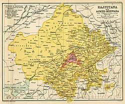
Ajmer State was a separate state within India from 1950 to 1956 with Ajmer as its capital. [1] Ajmer State was formed in 1950 out of the territory of former province of Ajmer-Merwara, which became a province of the Indian Union on 15 August 1947. It formed an enclave within the state of Rajasthan. Following the States Reorganisation Act in 1956 it was merged with Rajasthan. [2]

Contents

History

A 1909 map of Rajputana, showing Ajmer-Merwara as separate territory Rajputana 1909.jpg
A 1909 map of Rajputana, showing Ajmer-Merwara as separate territory

Ajmer State was formed out of territory of Ajmer-Merwara, which was a British controlled province during British India. The territory of Ajmer-Merwara had been purchased by British from the Marathas in 1818. Upon the independence of India, Ajmer-Merwara became a province of the Union of India.

It was a Province until it was established as a Class "C" State, named Ajmer State, on 26 January 1950 within Republic of India. Class "C" States were under direct rule of Central Government. [1]

Dissolution

In 1956, when India's state boundaries were reorganised, it became a district of the then Rajasthan state. [1] [3] Ajmer state was merged into Rajasthan state on 1 November 1956. Kishangarh sub-division of erstwhile Jaipur district was added to it to form Ajmer district. [4]

Government

Chief Minister

Haribhau Upadhyaya was the first and last Chief Minister of Ajmer State from 24 March 1952 until 1956. [1]

NoPortraitName Constituency TenureAssembly ElectionParty [lower-alpha 1]
1 Pt. Haribhau Upadhyaya.jpg Haribhau Upadhyaya Shreenagar24 March 195231 October 19564 years, 221 days1st

(1952)

Indian National Congress

Chief Commissioner

List of Chief Commissioners of Ajmer State: [1]

No.NameTerm
1Shankar Prasada1947–1948
2Chandrakant Balwantrao Nagarkar1948–1951
3Anand Dattahaya Pandit1952 to March 1954
4Moti K. KripalaniMarch 1954 to 31 October 1956

See also

Related Research Articles

<span class="mw-page-title-main">Ajmer</span> City in Rajasthan, India

Ajmer is one of the major and oldest cities in the Indian state of Rajasthan and the centre of the eponymous Ajmer District. It is located at the centre of Rajasthan. It is also known as heart of Rajasthan. The city was established as "Ajayameru" by a Chahamana ruler, either Ajayaraja I or Ajayaraja II, and served as their capital until the 12th century CE.

<span class="mw-page-title-main">Ajmer-Merwara</span> Former province of British India

Ajmer-Merwara was a former province of British India in the historical Ajmer region. The territory was ceded to the British by Daulat Rao Sindhia by a treaty on 25 June 1818. It was under the Bengal Presidency until 1836 when it became part of the North-Western Provinces. Finally on 1 April 1871, it became a separate province as Ajmer-Merwara-Kekri. It became a part of independent India on 15 August 1947 when the British left India.

<span class="mw-page-title-main">Rajasthan</span> State in Northwestern India

Rajasthan is a state in northern India. It covers 342,239 square kilometres (132,139 sq mi) or 10.4 per cent of India's total geographical area. It is the largest Indian state by area and the seventh largest by population. It is on India's northwestern side, where it comprises most of the wide and inhospitable Thar Desert and shares a border with the Pakistani provinces of Punjab to the northwest and Sindh to the west, along the Sutlej-Indus River valley. It is bordered by five other Indian states: Punjab to the north; Haryana and Uttar Pradesh to the northeast; Madhya Pradesh to the southeast; and Gujarat to the southwest. Its geographical location is 23°.3' to 30°.12' North latitude and 69°.30' to 78°.17' East longitude, with the Tropic of Cancer passing through its southernmost tip.

<span class="mw-page-title-main">States and union territories of India</span> Indian national administrative subdivisions

India is a federal union comprising 28 states and 8 union territories, for a total of 36 entities. The states and union territories are further subdivided into districts and smaller administrative divisions.

<span class="mw-page-title-main">Bombay State</span> Former state of India

Bombay State was a large Indian state created in 1950 from the erstwhile Bombay Presidency, with other regions being added to it in the succeeding years. Bombay Presidency was merged with the princely states of Baroda, Western India and Maharashtra State.Current Madhya Pradesh was a Central and Berar province, which was historically a Marathi state but hindinized later.

<span class="mw-page-title-main">Rajputana Agency</span> Former political office of the British Indian Empire

The Rajputana Agency was a political office of the British Indian Empire dealing with a collection of native states in Rajputana, under the political charge of an Agent reporting directly to the Governor-General of India and residing at Mount Abu in the Aravalli Range. The total area of the states falling within the Rajputana Agency was 127,541 square miles (330,330 km2), with eighteen states and two estates or chiefships.

<span class="mw-page-title-main">Rajpramukh</span> Administrative title in India (1947–56)

Rajpramukh was an administrative title in India which existed from India's independence in 1947 until 1956. Rajpramukhs were the appointed governors of certain Indian provinces and states.

The Indian Republic held its first elections in 1951–52.

<span class="mw-page-title-main">North-Western Provinces</span> Administrative region of British India (1836–1902)

The North-Western Provinces was an administrative region in British India. The North-Western Provinces were established in 1836, through merging the administrative divisions of the Ceded and Conquered Provinces. In 1858, the Nawab-ruled kingdom of Oudh was annexed and merged with the North-Western Provinces to form the renamed North-Western Provinces and Oudh. In 1902, this province was reorganized to form the United Provinces of Agra and Oudh. Allahabad served as its capital from 1858, when it also became the capital of India for a day.

<span class="mw-page-title-main">Ajmer district</span> District of Rajasthan in India

Ajmer District is a district of the state of Rajasthan in western India. The city of Ajmer is the district headquarters.

<span class="mw-page-title-main">Presidencies and provinces of British India</span> 1612–1947 British directly-ruled administrative divisions in India

The provinces of India, earlier presidencies of British India and still earlier, presidency towns, were the administrative divisions of British governance on the Indian subcontinent. Collectively, they have been called British India. In one form or another, they existed between 1612 and 1947, conventionally divided into three historical periods:

Ajmer is a historical region in central Rajasthan, a central part of a Shakambari Chahamana (Chauhan) kingdom in 11–12th centuries during the reign of Prithviraj Chauhan.

<span class="mw-page-title-main">Union territory</span> Form of administrative division in India

A union territory is a type of administrative division in the Republic of India. Unlike the states of India, which have their own governments, union territories are federal territories governed, in part or in whole, by the Union Government of India. There are currently eight union territories in India, namely, Andaman and Nicobar Islands, Chandigarh, Dadra and Nagar Haveli and Daman and Diu, Delhi, Jammu and Kashmir, Ladakh, Lakshadweep and Puducherry.

<span class="mw-page-title-main">Kutch State</span> State of the Republic of India, 1947-1956

Kutch State was a state within India from 1947 to 1956. Its capital was Bhuj.

<span class="mw-page-title-main">Haribhau Upadhyaya</span> 1st Chief Minister of Ajmer State, India

Haribhau Upadhyaya was an Indian politician and an Indian independence activist. He was the Chief Minister of Ajmer State from 1952 to 1956.

<span class="mw-page-title-main">Coorg State</span> Former State in South India, India

Coorg State was a Part-C state in India which existed from 1950 to 1956. When the Constitution of India came into force on 26 January 1950, most of the existing provinces were reconstituted into states. Thus, Coorg Province became Coorg State. Coorg State was ruled by a Chief Commissioner with Mercara as its capital. The head of the government was the Chief Minister. Coorg State was abolished on 1 November 1956 as per the States Reorganisation Act, 1956 and its territory were merged with Mysore State. Presently, Coorg forms a district of Karnataka state.

<span class="mw-page-title-main">States Reorganisation Act, 1956</span> Indian act reforming state boundaries

The States Reorganisation Act, 1956 was a major reform of the boundaries of India's states and territories, organising them along linguistic lines.

Ajmer is a tehsil in Ajmer district of Rajasthan state in India. It consists of 4 census towns and 85 villages. The capital of the tehsil is the eponymous Ajmer.

References

  1. This column only names the chief minister's party. The state government he heads may be a complex coalition of several parties and independents; these are not listed here.
  1. 1 2 3 4 5 Ajmer State : Chief Commissioners
  2. "States Reorganisation Act, 1956". India Code Updated Acts. Ministry of Law and Justice, Government of India. 31 August 1956. pp. section 9. Retrieved 16 May 2013.
  3. Census of India, 1961: Rajasthan
  4. Sharma, Nidhi (2000). Transition from Feudalism to Democracy, Jaipur: Aalekh Publishers, ISBN   81-87359-06-4, pp.197–201,205–6

26°27′N74°38′E / 26.45°N 74.64°E / 26.45; 74.64