Madhya Pradesh is a state in central India. Its capital is Bhopal, and its largest city is Indore. Other major cities of the state are Jabalpur and Gwalior. Madhya Pradesh is the second largest Indian state by area and the fifth largest state by population with over 72 million residents. It borders the states of Uttar Pradesh to the northeast, Chhattisgarh to the east, Maharashtra to the south, Gujarat to the west, and Rajasthan to the northwest.

Khandwa is a city and a nagar nigam in the Nimar region of Madhya Pradesh, India. It is the administrative headquarters of the Khandwa district, formerly known as East Nimar District.

Nimar / Nimad is the southwestern region of Madhya Pradesh state in west-central India. This region has sub-regions which include Nimar, Khargone Khandwa Barwani Burhanpur and Dhar.
Jaora is a city and a municipality in Ratlam district in the Indian state of Madhya Pradesh. Jaora is located in the Malwa region, between Ratlam and Mandsaur. It was the capital of the Jaora princely state of Jaora before Independence. During the Mourning of Muharram, thousands of people from all over the world visit the shrine of Hussain Tekri. Jains visit Jaora as a place that the Jain ascetic Rajendrasuri practiced tapasya.
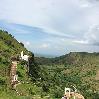
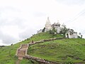
Bawangaja is a famous Jain pilgrim center in the Barwani district of southwestern Madhya Pradesh in India. Located about 6 kilometers south of River Narmada, its main attraction is the world's second largest monolithic statue of Lord Rishabhadeva, the first Jain Tirthankara. The statue is 84 feet (26 m) high. The center is located in the Satpura Range and is about 8 km from a Barwani town.

Khargone district, formerly known as West Nimar district, is a district of Madhya Pradesh state in central India. The district lies in the Nimar region and is part of the Indore Division. The district headquarters is the city of Khargone, which lies south of the Indore metropolis, the headquarters of Indore district.

Barwani District is one of the districts of Madhya Pradesh state of India. The administrative headquarters of the district is at Barwani.

Burhanpur District is a district of Madhya Pradesh state in central India. The city of Burhanpur is the district headquarters.

Dhar district is a district of Madhya Pradesh state in central India. The historic town of Dhar is administrative headquarters of the district.

Khandwa district, formerly known as the East Nimar district, is a district of the Madhya Pradesh state in central India. The city of Khandwa is the administrative headquarters of the district. Other notable towns in the district include Mundi, Harsud, Punasa, Pandhana and Omkareshwar.

Khargone is a city and administrative headquarters of the Khargone district in the Indian state of Madhya Pradesh. The city is located on the bank of the Kunda river and is known for its cotton and chilly production. It is also known for Navgraha Mandir, a temple devoted to the nav grahas. Khargone topped the nation in municipality and received a national award for 'India's Fastest Moving City' under a population of two lakh. Khargone ranked 10th Cleanest city in India in Swachh Survekshan 2020 City ranked the 15th cleanest city in India in Swachh Survekshan 2018 and ranked 17th cleanest city in India in Swachh Survekshan 2017.

Barwaha is a municipality and sub district in Khargone district in the state of Madhya Pradesh, India situated on the banks of Narmada river. Barwaha is second biggest city of District after Khargone city. The Barwaha city is divided into 28 wards for which elections are held every 5 years. The Barwaha Municipality has population of 61,973 of which 32,940 are males while 29,033 are females as per report released by Census India 2011. Literacy rate of Barwaha is 87.27% higher than state average of 69.32%. The male and female literacy rate is around 92.73% and 81.23%.
Bhainsdehi is a city and a Nagar Parishad in Betul district in the state of Madhya Pradesh, India. According to mythological beliefs, Bhainsdehi was known as Mahishmati, the capital of Raghuvanshi King Gaya. Which later changed from Mahishmati to Mahishvati and then to Mahishadehi and then to Bhainsdehi. Kukru is the second highest point of Mahadeo hills. Bhainsdehi is the originating place of the river Purna. It is predominantly a tribal tehsil. Bhainsdehi is surrounded by the mountain ranges of Satpura. Prachin Shiv mandir one of the most beautiful place in Bhainsdehi city
Erandol is a town and a taluka in Jalgaon district in the Indian state of Maharashtra state. It is situated on the banks of the Anjani River. The vehicle registration is changed now it's MH-54.
Kukshi is a town in Dhar district of Madhya Pradesh state, India. Kukshi has population of around 37,482 making it a Tier-3 city and a Semi-Urban centre. It is a Nagar Parishad. Kukshi is famous for the business of cotton, chilli, gold and silver, and ready made garments.

Mundi is a city and tehsil in the Khandwa district of Nimar region in the Indian state of Madhya Pradesh. It is situated in North Side of East Nimar District.

Sanawad is an Indian town and Municipality in Khargone district in the Indian state of Madhya Pradesh. It is a popular center for the trade of cotton and wheat. Nearby cities include Khargone, Khandwa, Barwaha and Indore.

Sendhwa is a city with a municipal government in Barwani district in the Indian state of Madhya Pradesh. It is the headquarters for Sendhwa Tehsil.

Tourism in Madhya Pradesh has been an attraction of India because of its location in the centre of the country. Madhya Pradesh has won Best Tourism State National award for 3 consecutive years i.e. 2017, 2016 and 2015.
Banapura is a small town in the Hoshangabad District of Madhya Pradesh, India. Banapura is a twin city of Seoni Malwa.