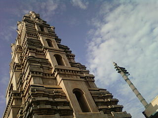
Puttur is a city in Dakshina Kannada district, in Karnataka state of India. The Puttur Shree Mahalingeshwara Temple is located here.

Hansi, is a city and municipal council in Hisar district in the Indian state of Haryana. It appears that at one time Hansi was larger, more prosperous and more important than Hisar. The town has several important buildings of archeological importance.

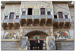
Mandawa is a town, just 29 km from Jhunjhunu city in Jhunjhunu district of Rajasthan, India. It is part of Shekhawati region. Mandawa is located at 28.05°N 75.15°E. It has an average elevation of 316 metres (1036 ft). The nearest railway station is Jhunjhunu railway station.
Phillaur is a town and a municipal council as well as a tehsil in Jalandhar district in the Indian state of Punjab. The city is situated 20 km from Ludhiana, 45 km from Jalandhar and 140 km from Amritsar. Situated on Doaba and Puadh regions Border. Phillaur is in Doaba region.

Hungund or Hunagunda is a taluk in the northern district of Bagalkot in Karnataka, India. Major towns in the taluk are Amingad, Hunagunda. Kudalasangama, where the social reformist Basavanna died, is located in the taluk. Hunagunda Taluk also contains Aihole and Pattadkal which were once under the rule of Chalukyas of Badami. Amingad is known for Amingad karadantu, a sweet dish.

Bilagi is a panchayat town and taluka in the Bagalkot district of Karnataka, India. It is located at a distance of 30 km from the district headquarters of Bagalkote. The main occupation of people in this taluka is agriculture. Most of the farmers grow sugarcane.
Begun is a city and a municipality in Chittaurgarh district in the state of Rajasthan, India. Begun was offered along with Gothlai to Chunda ji, who renounced his right to the throne for his brother Rana Mokal in 15th century. Since then, Begun was ruled by Chundawat Sisodia Rajputs of Mewar. It is also one of the historical towns of Chittorgarh district. One of Mewar's important rivers, Brahmani, flows through Begun. Begun also has a fort which is surrounded by a small river.
Jasdan city is famous for a handicrafted things, agriculture machinery and also famous for the diamond polishing in the Indian state of Gujarat. Jasdan is the biggest sub district in the Rajkot district. Jasdan city has its own Municipality that is known as "Jasdan Municipality" JMP. This city is important for those whose village doesn't have a market, so jasdan is being the capital for those villagers.
Kandra is a census town in the Adityapur CD block in the Seraikela Sadar subdivision of the Saraikela Kharsawan district in the Indian state of Jharkhand.
Kumbhraj is a town in Guna district in the Indian state of Madhya Pradesh. Kumbhraj is one of the largest producer of coriander seeds in the world. Many multinational companies like Tata procure coriander seeds from Kumbhraj. Kumbhraj name is given by Rana Kumbha.
Manawar is a town with tehsil in Dhar district in the Indian state of Madhya Pradesh. The name Manawar came from name of river Mān that flows at southern edge of the town. Pin code of Manawar is 454446.
Narasimharajapura is town and taluk headquarter in Chikkmagaluru district, Karnataka, India. It is situated in the Malenadu region of the district. In 1915, Yuvaraja Shri Narasimharaja Wodeyar visited Yedehalli and in his memory, the town was named after him. The taluk was ruled by Ganga, Kadamba, Santhara, Hoysala and Vijayanagara kings.
Navalgund or Navalagunda is a panchayat town in Dharwad district in the Indian state of Karnataka. Navalagunda or Navilagunda means hill of peacocks. Navalgund is famous for Navalagunda durries. Navalagunda durries has been accorded Geographical Indication (GI) tag. Its GI tag number is 51.
Raybag is a taluka in Belgaum district in the Indian state of Karnataka. It derives its name from the two words namely "Rai" and "bagh" in which "Rai" means king and "bagh" means tiger.
Terdal is a Municipal town in Bagalkot district in the Indian state of Karnataka.

Uluberia is a city and a municipal area of Howrah district in the Indian state of West Bengal. It is the headquarter of the Uluberia subdivision. It is a part of the area covered by Kolkata Metropolitan Development Authority (KMDA). This city is famous for its industrial belts.
Manpur is a town and a nagar panchayat in Mhow Tehsil of Indore district in the Indian state of Madhya Pradesh.

Bikkavolu is a village in East Godavari district in the state of Andhra Pradesh in India. The village is known for its famous Subrahmanya Swamy Temple.
Shirahatti is a panchayat town in Gadag district in the Indian state of Karnataka.
Bengeri is a village in the Hubballi City of Karnataka, India.


