Panna district

Last updated

Panna district
Ajaygarh temples.jpg
0122321 Mritangeshvara Shiva temple, Nandchand Madhya Pradesh 008.jpg
Pawai Chaandee Waterfalls Madhya Pradesh 017.jpg
Parnami temple panna.jpg
Panna Tiger Reserve 04.jpg
Clockwise from top-left: Ajaygarh Temple, Mritangeshwara Temple in Nandchand, Parnami Temple, Ken River in Panna National Park, Pawai Chandi Waterfalls
MP Panna district map.svg
Location of Panna district in Madhya Pradesh
Coordinates(Panna, India): 24°43′N80°10′E / 24.717°N 80.167°E / 24.717; 80.167
CountryIndia
State Madhya Pradesh
Division Sagar
Headquarters Panna, India
Tehsils
  1. Panna,
  2. Ajaygarh,
  3. Pawai,
  4. Amanganj,
  5. Gunour,
  6. Shahnagar,
  7. Raipura,
  8. Devendranagar
  9. Simariya
Government
  BodyLegislative Assembly of Panna, pawai and Gunour
  Collector & District MagistrateShri Harjinder Singh(IAS)
   Lok Sabha constituencies Khajuraho
  member of parliament V.D.Sharma(BJP)
Area
  Total7,135 km2 (2,755 sq mi)
Population
 (2011)
  Total1,016,520
  Density140/km2 (370/sq mi)
Demographics
   Literacy 66.08%
  Sex ratio907
Time zone UTC+05:30 (IST)
Vehicle registration MP-35
Major highways NH 39 State highway 49
Website panna.nic.in

Panna district is a district of the Sagar Division, within the Madhya Pradesh state in central India. The town of Panna is the district headquarters.

Contents

History

Panna district was created in 1950, shortly after Indian independence, from the territory of several former princely states of British India, including the states of Panna, Jaso, most of Ajaigarh, and a portion of Paldeo. Panna District was part of the new Indian state of Vindhya Pradesh, which was merged into Madhya Pradesh on 1 November 1956.

Geography

Panna district lies between 23°27′N79°27′E / 23.45°N 79.45°E / 23.45; 79.45 and 25°06′N80°24′E / 25.10°N 80.40°E / 25.10; 80.40 . [1] It has an area of 7,135 km2. [2]

The Ken River flows through the district. The Pandav Falls and the Gatha Falls are located in the district. Panna National Park is a major tourist attraction in the district. [3]

Economy

In 2006 the Ministry of Panchayati Raj named Panna one of the country's 250 most backward districts (out of a total of 640). [4] It is one of the 24 districts in Madhya Pradesh currently receiving funds from the Backward Regions Grant Fund Programme (BRGF). [4] It is among the five poorest districts in the state in terms of income. It ranks 41st out of 45 districts in human development index (HDI) in Madhya Pradesh. [5]

Divisions

Gram panchayats under Panna district

This intermediate subdivisions are also called block, [6] intermediate panchayat, [7] tehsil [8] or tahsil. [8] Inside Panna district, there are the following nine subdivisions:

Demographics

Historical population
YearPop.±% p.a.
1901165,440    
1911207,021+2.27%
1921202,725−0.21%
1931215,137+0.60%
1941249,226+1.48%
1951259,659+0.41%
1961331,257+2.47%
1971429,077+2.62%
1981539,978+2.33%
1991687,945+2.45%
2001856,558+2.22%
20111,016,520+1.73%
source: [9]
Religions in Panna district (2011) [10]
ReligionPercent
Hinduism
95.89%
Islam
3.46%
Jainism
0.47%
Other or not stated
0.18%

According to the 2011 census Panna District has a population of 1,016,520, [11] roughly equal to the nation of Cyprus [12] or the US state of Montana. [13] This gives it a ranking of 442nd in India (out of a total of 640). [11] The district has a population density of 142 inhabitants per square kilometre (370/sq mi) . [11] Its population growth rate over the decade 2001–2011 was 18.62%. [11] Panna has a sex ratio of 907 females for every 1000 males, [11] and a literacy rate of 66.08%. 12.33% of the population lives in urban areas. Scheduled Castes and Tribes made up 20.46% and 16.81% of the population respectively. [11]

Languages

Languages of Panna district (2011) [14]

   Hindi (69.08%)
   Bundeli (29.73%)
  Others (1.19%)

At the time of the 2011 Census of India, 69.08% of the population in the district spoke Hindi and 29.73% Bundeli as their first language. [14]

Among Panna's languages is Bundeli, which has a lexical similarity of 72–91% with Hindi and is spoken by about 3 million people in Bagelkhand. [15]

Mining

Panna district is famous for its diamond mines located in a belt of about 80 km across the Panna town. [2] In olden days the most productive mines were located in the village of Sukariuh. [16] Nowadays, Majhagaon is the only active diamond mine in Asia. [17]

Tourist places

Villages

Related Research Articles

Ajaigarh or Ajaygarh is a town and a nagar panchayat in the Panna District of Madhya Pradesh state in central India.

<span class="mw-page-title-main">Panna, India</span> City in Madhya Pradesh, India

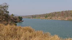
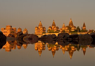
Panna is a city and a municipality in Panna district in the Indian state of Madhya Pradesh. It is famous for its diamond mines and temples. It is the administrative center of Panna District.

<span class="mw-page-title-main">Banda district, India</span> District in Uttar Pradesh, India

Banda district is a district of Uttar Pradesh state of India, and Banda is the district headquarters. It is a part of Chitrakoot Division.

<span class="mw-page-title-main">Chhatarpur district</span> District in Madhya Pradesh, India

Chhatarpur District is a district of Madhya Pradesh state of central India. The town of Chhatarpur is the district headquarters.

<span class="mw-page-title-main">Rewa district</span> City and district of Madhya Pradesh in India

Rewa district is a district of the Madhya Pradesh state in central India. The city of Rewa is the district headquarter. Rewa is sometimes called the "Land of White Tigers", as the first White Tiger was discovered here in 1951 by the Maharaja of the province, Martand Singh, in the nearby jungle of Govindgarh. Rewa was the capital city of a former state, Vindhya Pradesh.

<span class="mw-page-title-main">Shahdol district</span> District of Madhya Pradesh in India

Shahdol District is a district of Madhya Pradesh state in east central India. It old name was Matsya raj or Virat kingdom in the name of great king Maharaja Virata. With a total area of 6,205 km2 (2,396 sq mi) and a population of 10,66,063. Shahdol is an important district of Madhya Pradesh. The town of Shahdol is the district headquarters. The district formerly comprised Shahdol division.

<span class="mw-page-title-main">Umaria district</span> District of Madhya Pradesh in India

Umaria district is a district of Madhya Pradesh. The town of Umaria is the district headquarters. The district is part of Shahdol Division.

<span class="mw-page-title-main">Satna</span> City in Madhya Pradesh, India

Satna is a city in the Indian state of Madhya Pradesh. It serves as the headquarters of Satna district. It is 7th largest city and 8th most populous city of the state. The city is 500 km east of the state capital Bhopal. The city is distributed over a land area of 111.9 square kilometres.

<span class="mw-page-title-main">Sagar district</span> District of Madhya Pradesh in India

Sagar district is a district of Madhya Pradesh state in central India. The town of Sagar serves as its administrative center.

<span class="mw-page-title-main">Barwani district</span> District of Madhya Pradesh in India

Barwani district is one of the districts of Madhya Pradesh state of India. The administrative headquarters of the district is at Barwani. Barwani district has an area of 5,427 km² and a population 1,385,881. The district lies in the southwestern corner of Madhya Pradesh; the Narmada River forms its northern boundary. The Satpura Range lies to its south. The district is bordered by Maharashtra state to the south, Gujarat state to the west, Dhar District to the north and Khargone District to the east.

<span class="mw-page-title-main">Tikamgarh district</span> District of Madhya Pradesh in India

Tikamgarh district is one of the 52 districts of Madhya Pradesh state in central India. Tikamgarh town is the district headquarters. The district is part of Sagar Division.

<span class="mw-page-title-main">Damoh district</span> District of Madhya Pradesh in India

Damoh District is a district of Madhya Pradesh state in central India. The town of Damoh is the district headquarters. The district is part of the Sagar Division.

<span class="mw-page-title-main">Ujjain district</span> District of Madhya Pradesh in India

Ujjain district is a district of Madhya Pradesh state in central India. The historic city of Ujjain is the district headquarters. The district has an area of 6,091 km2, and a population of 19,86,864, a 16.12% increase from its 2001 population of 17,10,982.

<span class="mw-page-title-main">Indore district</span> District of Madhya Pradesh, India

The Indore District is a district of Madhya Pradesh state in central India. It is believed that the city is named after its Indreshwar Mahadev Temple, Where Indra is the presiding deity. The Gupta inscriptions name Indore as "Indrapura". It is also called the administrative capital. This district forms part of the Indore Division.

<span class="mw-page-title-main">Lalitpur district, India</span> District in Uttar Pradesh, India

Lalitpur is one of the 75 districts in the northern Indian state of Uttar Pradesh. Lalitpur district is a part of Jhansi Division. Lalitpur is the main town and administrative headquarters. The district occupies an area of 5,039 km2.

<span class="mw-page-title-main">Shivpuri district</span> District of Madhya Pradesh in India

Shivpuri District is a district of Madhya Pradesh state of India. The town of Shivpuri is the district headquarters. National Highway 3 (NH-3) runs through the district.

<span class="mw-page-title-main">Morena district</span> District of Madhya Pradesh in India

Morena district is one of the 53 districts of the central Indian state of Madhya Pradesh, located in the Chambal division.

Devendranagar is a town and a nagar panchayat in Panna district in the state of Madhya Pradesh, India. Earlier before the merger it was part of Erstwhile Princely State of Ajaigarh.

<span class="mw-page-title-main">Satna district</span> District of Madhya Pradesh in India

Satna District is a district of Madhya Pradesh state in central India. The city of Satna is the district headquarters. The district has an area of 7,502 km2, and a population of 22,28,935(2011 census), 20.63% of which is urban. The district has a population density of 249 persons per km2.

<span class="mw-page-title-main">Niwari district</span> District of Madhya Pradesh in India

Niwari district is one of the 52 districts of the Madhya Pradesh state in India. Niwari is administrative headquarter of Niwari district.

References

  1. "Panna district map". Maps of India. Retrieved 18 August 2010.
  2. 1 2 "Panna District". india9. Archived from the original on 12 March 2011. Retrieved 18 August 2010.
  3. "Panna – a city of diamonds". Panna district administration. Archived from the original on 20 August 2010. Retrieved 18 August 2010.
  4. 1 2 Ministry of Panchayati Raj (8 September 2009). "A Note on the Backward Regions Grant Fund Programme" (PDF). National Institute of Rural Development. Archived from the original (PDF) on 5 April 2012. Retrieved 27 September 2011.
  5. "Mining Map: Hotspots – Madhya Pradesh". cseindia.org. Archived from the original on 21 May 2017. Retrieved 22 May 2017.
  6. 1 2 3 National Habitation Survey 2003: LIST OF QUALITY AFFECTED HABITATIONS Archived 21 July 2011 at the Wayback Machine
  7. Village Panchayat Names of AJAIGARH Archived 10 March 2016 at the Wayback Machine
  8. 1 2 State elections 2008 candidates
  9. "Table A-02 Decadal Variation in Population Since 1901: Madhya Pradesh" (PDF). census.gov.in. Registrar General and Census Commissioner of India.
  10. "Table C-01 Population By Religion: Madhya Pradesh". census.gov.in. Registrar General and Census Commissioner of India.
  11. 1 2 3 4 5 6 "District Census Handbook: Panna" (PDF). Census of India . Registrar General and Census Commissioner of India. 2011.
  12. US Directorate of Intelligence. "Country Comparison:Population". Archived from the original on 13 June 2007. Retrieved 1 October 2011. Cyprus 11,20,489 July 2011 est.
  13. "2010 Resident Population Data". U. S. Census Bureau. Retrieved 30 September 2011. Montana 989,415
  14. 1 2 "Table C-16 Population by Mother Tongue: Madhya Pradesh". censusindia.gov.in. Registrar General and Census Commissioner of India.
  15. Bagheli at Ethnologue (25th ed., 2022) Closed Access logo transparent.svg
  16. Streeter, Edwin W. "Precious stones and Gems". The Indian Diamond. George Bell & Sons (1898). Archived from the original on 22 May 2011. Retrieved 18 August 2010.
  17. "Panna Diamond Mines". Subh Yatra. Archived from the original on 8 July 2010. Retrieved 18 August 2010.

.

Famous personalities

Nidhi khare – Author