Kheda, also known as Kaira, is a city and a municipality in the Indian state of Gujarat. It was former administrative capital of Kheda district. Kheda city is famous for Tobacco Farming. Kheda city is most developed city and district in Gujarat state of India. Nearest railway station is "Mahemadavad Kheda Road". Nearest Airporta is Ahmedabad airport. Nearest Bus Station is "Kheda Bus Station". Sardar Patel was born in Kheda District of Gujarat State.
Anand is the administrative centre of Anand District in the state of Gujarat, India. It is administered by Anand Municipality. It is part of the region known as Charotar, consisting of Anand and Kheda Districts.
Umreth is a taluka and the administrative center of Anand District in the state of Gujarat, India. It is administered by Umreth Nagarpalika. It is part of the region known as Charotar, located in Anand and Kheda districts.

Asind is a city and a municipality in Bhilwara district, Rajasthan, India. It is a Tehsil (sub-division) for many villages The city have a magistrate office, lower justice court and many administrative hub for many major villages. Some of major villages and towns are, Badnor,Shambhugrah,Patan, Motras,Parasoli. Asind is popular for Devnarayan temple. Mythology has it that he was an incarnation of Vishnu and he is worshipped as a folk deity, mostly in Rajasthan and north-western Madhya Pradesh.[2][3] According to tradition, he was born to Sri Sawai Bhoj and Sadu mata Gurjari[4] on the seventh day of the bright half of the month of Maagh in the Hindu Calendar in Vikram Samvat 968 .According to one view historical Devnarayan belonged to 10th century of Vikram Samvat, according another view, he lived in between 1200-1400 .First view is endorsed by many scholars

Athipattu is a census town in Chennai in Thiruvallur district in the state of Tamil Nadu, India. The neighbourhood is served by Athipattu railway station of the Chennai Suburban Railway network. it is a suburb in northern part of Chennai.

Birwadi is a census town in Raigad district in the state of Maharashtra, India.
Chaklasi is a city and a municipality in Kheda district in the state of Gujarat, India.
Chinnasekkadu is a neighbourhood of Chennai in Chennai district in the state of Tamil Nadu, India. Chinnasekkadu used to be a town panchayat in Thiruvallur district. In 2011, Chinnasekkadu town panchayat wss merged with Chennai Corporation. Chinnasekkadu comes under ward 29 in Zone 3(Madhavaram) of Chennai Corporation.

Desur is a Town panchayat in Tiruvanamalai district in the Indian state of Tamil Nadu.
Kapadwanj is a town as well as one of the Taluka of the Kheda district in the Gujarat India. It is located on bank of river Mohar. It is 71 km away from Ahmedabad and 93 km away from Vadodara.
Mahudha is a municipality in Kheda district in the Indian state of Gujarat.
Naravarikuppam is a town in Thiruvallur district in the Indian state of Tamil Nadu.also called redhills
Peerkankaranai is a town in Southern part of the metropolitan city of Chennai in the Indian state of Tamil Nadu.

Saidpur is a town and a nagar panchayat in the Badaun district of the Indian state of Uttar Pradesh.

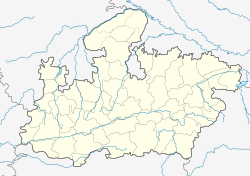
Soyat kalan or Soyat is a town and a Nagar Parishad in Agar Malwa district in the Indian state of Madhya Pradesh. It is located on the Indore – Kota highway at the bank of Kanthal River. It is surrounded by the Rajasthan border from three sides. It is a well-known center of transport business between the two states.Chief Minister of Madhya Pradesh has announced Soyat to be new Tehsil on August,11,2018.
Thevaram is a Town Panchayat in Theni district in the Indian state of Tamil Nadu. Thevaram is located in Tamil Nadu near on border of Kerala at the Eastern side foot-hill of Western Ghats. The State Highway SH-100 passes through this town.
Uniara is a town and a municipality in Tonk district in the Indian state of Rajasthan. it is a tehsil of Tonk district.
Vengathur is a census town in Thiruvallur district in the Indian state of Tamil Nadu.

Venkatapur is a census town in Bhatkal Taluk in Uttara Kannada district of Karnataka.
Kerur is a City in Bagalkot district in Karnataka, which located on NH 218. It has an average elevation of 617 meters (2024 feet). Its a birthplace of Jagadish Shettar, a former Chief Minister of Karnataka. Kerur is a Town Panchayat city in district of Bagalkot, Karnataka. The Kerur city is divided into 16 wards for which elections are held every five years. The Kerur Town Panchayat has population of 19,731 of which 9,929 are males while 9,802 are females as per report released by Census India 2011.