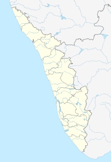
Puthunagaram is a town and gram panchayat in the Palakkad district, state of Kerala, India.

Birwadi is a census town in Raigad district in the state of Maharashtra, India.

Bommasandra is located at Bangalore in the state of Karnataka, India.

Chinnasekkadu is a neighbourhood of Chennai in Chennai district in the state of Tamil Nadu, India. Chinnasekkadu used to be a town panchayat in Thiruvallur district. In 2011, Chinnasekkadu town panchayat wss merged with Chennai Corporation. Chinnasekkadu comes under ward 29 in Zone 3(Madhavaram) of Chennai Corporation.

Desur is a Town panchayat in Tiruvanamalai district in the Indian state of Tamil Nadu.

Dhampur is a city and a municipal board in Bijnor district in the state of Uttar Pradesh, India. It is located at 29.51°N 78.50°E, and lies in Northern India.

Dhanuha is a census town in Jaunpur district in the state of Uttar Pradesh, India.

Herohalli is a census town in Bangalore district in the Indian state of Karnataka.

Kothnur is a census town in Bangalore district in the Indian state of Karnataka.

Kumbhkot is a census town in Kota district in the Indian state of Rajasthan.

Kureekkad is a census town in Ernakulam district in the Indian state of Kerala.

Red Hills is a town in Thiruvallur district in the Indian state of Tamil Nadu.

Peerkankaranai is a neighborhood in Southern part of the metropolitan city of Chennai in the Indian state of Tamil Nadu.

Perumbaikad is a census town in Kottayam district in the Indian state of Kerala.

Sahnewal is a town and a municipal council in Ludhiana district in the Indian state of Punjab. The town is situated on National Highway No. 44, between Khanna and Ludhiana.

Salumbar is a statutory town in Udaipur district in the Indian state of Rajasthan.

Thevaram is a town in Theni district in the Indian state of Tamil Nadu. Thevaram is located in Tamil Nadu near on border of Kerala at the Eastern side foot-hill of the Western Ghats. It is connected with State Highway SH100.
Vengathur is a census town in Thiruvallur district in the Indian state of Tamil Nadu.

Jafarabad is a town and nagar panchayat in Jaunpur district in the Indian state of Uttar Pradesh.

Kerur is a City in Bagalkot district in Karnataka, which located on NH 218. It has an average elevation of 617 meters (2024 feet). It's a birthplace of Jagadish Shettar, a former Chief Minister of Karnataka. Kerur is a Town Panchayat city in district of Bagalkot, Karnataka. The Kerur city is divided into 16 wards for which elections are held every five years. The Kerur Town Panchayat has population of 19,731 of which 9,929 are males while 9,802 are females as per report released by Census India 2011.


