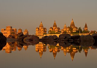
Kurwai is a town and a Nagar Panchayat in Vidisha district in the Indian state of Madhya Pradesh. its also tehsil headquarter and assembly constituency.
Amanganj is a town and a Nagar Panchayat and a tehsil in Panna district in the state of Madhya Pradesh, India.
Anjad is a City and a Tehsil in Barwani district in the state of Madhya Pradesh, India.Anjad is famous for the business of cotton and Gining industries, gold and silver, and ready made garments and most famous for the temple of Nagari Mata.

Badagaon Dhasan is a town and a Nagar Parishad in Tikamgarh district in the state of Madhya Pradesh, India.
Khargapur is a town and a nagar panchayat in Tikamgarh district in the Indian state of Madhya Pradesh. Khargapur is an assembly constituency.
Khategaon is a town and a nagar palika in Dewas district in the Indian state of Madhya Pradesh. It's a tehsil headquarter and a assembly constituency in Madhya Pradesh.
Mahroni is a town and a nagar panchayat in Lalitpur district in the Indian state of Uttar Pradesh. It is one of the tehsils of Lalitpur District also a legislative assembly constituency Mehroni Assembly constituency and is situated 37 km away from Lalitpur. It is very close to Madhya Pradesh and Uttar Pradesh border. Twitter
Meghnagar is a City Council and a Tehsil Headquarter in Jhabua district in the India state of Madhya Pradesh.

Sendhwa is a city with a municipal government in Barwani district in the Indian state of Madhya Pradesh. It is the headquarters for Sendhwa Tehsil.

Sonkatch is a town and a Nagar panchayat in Dewas district in the Indian state of Madhya Pradesh. It's also a Tehsil headquarter of District.
Susner is a town and a Nagar panchayat and Sub division in Agar Malwa district in the Madhya pradesh state of India. Its also a tehsil and a assembly.

Khargapur Assembly constituency is one of the 230 Vidhan Sabha constituencies of Madhya Pradesh state in central India. This constituency came into existence in 1967, following the delimitation of the Legislative Assembly constituencies and it was reserved for the candidates belonging to the scheduled castes from 1967 to 2008.

Niwari district is one of the 52 districts of the Madhya Pradesh state in India. Niwari is administrative headquarter of Niwari district.

Daolda or Dalauda is a town and a tehsil in Mandsaur district, Madhya Pradesh, India. Out of 8 tehsils Dalauda is also a part of Mandsaur district. Dalauda currently operates under janpad panchayat government, but recently announced that Dalauda nagar parishad will be declared soon. This will be a part of Dalauda Choupati and Dalauda Rail, both in the soon-to-be Dalauda nagar parishad.

Banda(बंडा) is city and a Nagar panchayat in Sagar district of Madhya pradesh in India. Banda also a tehsil headquarter in Sagar.

Chhapara or Seoni Chhapara is a town and a Nagar Panchayat in Seoni District of Madhya Pradesh, India.
Dahi (डही) is a town and Nagar Panchayat located in Dhar District of Madhya Pradesh, India.
Suwasra is a town and a Nagar Parishad in Mandsaur District of Madhya Pradesh, India. It's also a Tehsil Headquarter And Assembly Constituency.
Chaand is a Town and a Nagar Panchayat in Chhindwara District of Madhya Pradesh in India, it is also a Tehsil Headquarter.

Badoni is a town and a Nagar Parishad in Datia District of Madhya Pradesh in India. A Tehsil headquarter, it is 12 km away from the district headquarters Datia.


