
The Godavari is India's second longest river after the Ganga River and drains the third largest basin in India, covering about 10% of India's total geographical area. Its source is in Trimbakeshwar, Nashik, Maharashtra. It flows east for 1,465 kilometres (910 mi), draining the states of Maharashtra (48.6%), Telangana (18.8%), Andhra Pradesh (4.5%), Chhattisgarh (10.9%) and Odisha (5.7%). The river ultimately empties into the Bay of Bengal through an extensive network of distributaries. Its 312,812 km2 (120,777 sq mi) drainage basin is one of the largest in the Indian subcontinent, with only the Ganga and Indus rivers having a larger drainage basin. In terms of length, catchment area and discharge, the Godavari is the largest in peninsular India, and had been dubbed as the Dakshina Ganga.

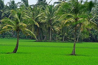
Coastal Andhra, also known as Kosta Andhra, is a geographic region in the Indian state of Andhra Pradesh, comprising the coastal districts of the state between the Eastern Ghats and the Bay of Bengal, from the northern border with Orissa to Rayalaseema in the south. It includes major cities such as Visakhapatnam and Vijayawada as well as the state capital Amaravati and is recognized for its fertile lands, rich cultural heritage, and economic importance. Coastal Andhra plays a significant role in the state's agricultural output, particularly in rice and tobacco production, supported by abundant water resources from the Godavari, Krishna, and Penna rivers.

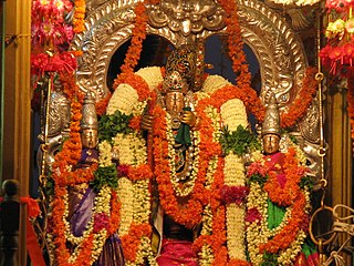
Rajahmundry, officially Rajamahendravaram, is a city in the Indian state of Andhra Pradesh and district headquarters of East Godavari district. It is the seventh most populated city in the state. During British rule, the district of Rajahmundry was created in the Madras Presidency in 1823. It was reorganised in 1859 and bifurcated into the Godavari and Krishna districts. Kakinada was the headquarters of Godavari district, which was further bifurcated into East Godavari and West Godavari districts in 1925. It is administered under Rajahmundry revenue division of the East Godavari district. The city is known for its floriculture, history, culture, agriculture, economy, tourism, and its heritage. It is known as the "Cultural Capital of Andhra Pradesh".

The West Godavari district is a coastal district in the Indian state of Andhra Pradesh with an administrative headquarters in Bhimavaram. As of the 2011 Census of India, the district has an area of 2,178 km2 (841 sq mi) and a population of 1,779,935. It is bounded by the Krishna district and Bay of Bengal to the south, East Godavari district to the east, and Eluru district, Kolleru Lake and Upputeru Drain to the northwest.

Kakinada is a port city and municipal corporation in the Indian state of Andhra Pradesh. Situated along the Bay of Bengal, it serves as the headquarters of Kakinada district and is a significant economic and cultural centre in the region. It is the sixth most populous city in the state and is recognised as one of the most liveable and cleanest cities in India among those with a population under one million. Nicknamed the "Pensioners' Paradise," Kakinada is known for its well-planned layout and modern infrastructure.

Eluru is a city and the district headquarters of Eluru district in the Indian state of Andhra Pradesh. It is one of the 14 municipal corporations in the state and the mandal headquarters of Eluru mandal in the Eluru revenue division. Situated on the banks of the Tammileru River, Eluru is strategically positioned in the southeastern part of Andhra Pradesh. It was historically known as Helapuri. As of 2011 Census of India, the city had a population of 214,414, where as Eluru Urban Development Authority has a population around 2,760,160, reflecting its status as a major urban centre. The city's historical significance dates back to the second century CE, with evidence of its ancient roots found in various archaeological sites and historical records. Eluru was a prominent town under the rule of the Qutub Shahis, who governed the region in the 16th century. It came under the control of the Mughal Empire in the 17th century as the empire expanded its influence across South India. The town later became part of the Nawab of Hyderabad's dominions in the 18th century. During British India, Eluru was incorporated into the Madras Presidency and made capital for Northern Circars in the early 19th century. The British established administrative and infrastructural developments in the town, shaping its modern identity.

Kovvur is a town in the East Godavari district of the Indian state of Andhra Pradesh. It is a municipality and the mandal headquarters of Kovvur mandal in Kovvur revenue division.

Tadepalligudem is a city in West Godavari district of the Indian state of Andhra Pradesh. Tadepalligudem is the judicial headquarter of West Godavari. It is a Selection Grade municipality and the mandal headquarters of Tadepalligudem mandal and Tadepalligudem Revenue Division. Tadepalligudem is one of the biggest cities in West Godavari district

Nidadavolu is a town in East Godavari district of the Indian state of Andhra Pradesh. It is a municipality and the mandal headquarters of Nidadavole mandal in Kovvur revenue division.

Samarlakota is a town in Kakinada district of the Indian state of Andhra Pradesh. The town forms a part of Kakinada Urban Development Authority. It was previously known as Chamarlakota, which dates back to a local kaifiyat that was written in the mid-eighteenth century.

The Butterley Company was an English manufacturing firm founded as Benjamin Outram and Company in 1790. Its subsidiaries existed until 2009.
Narasapuram is a town in West Godavari district of the Indian state of Andhra Pradesh. It is a municipality and mandal headquarters of Narasapuram mandal in Narasapuram revenue division. The city is situated on the banks of the Vasista Godavari River. The lace industry is prevalent in the city and its surroundings.
The Godavari is a river in India.
The Godavari Bridge or Kovvur–Rajahmundry Bridge is a truss bridge spanning the Godavari River in Rajahmundry, India. It is India's fourth longest road-cum-rail bridge crossing a water body, the first one being the Bogibeel Bridge over the Brahmaputra in Assam, and second is Digha–Sonpur Bridge over the Ganga in Bihar.

Gollaprolu is a town in Kakinada district of the Indian state of Andhra Pradesh. It is a Municipality in Gollaprolu mandal of Kakinada revenue division. Business is the main occupation of this town. The town also forms a part of Godavari Urban Development Authority.
Mummidivaram is a town in Dr. B.R. Ambedkar Konaseema district of Andhra Pradesh, India. The Mummidivaram revenue block was formed out of the Amalapuram tehsil in July 1969. It is the second largest town in Konaseema district.

The Godavari Arch Bridge is a bowstring-girder bridge that spans the Godavari River in Rajahmundry, India. It is the latest of the three bridges that span the Godavari river at Rajahmundry. The Havelock Bridge being the earliest, was built in 1897, and having served its full utility, was decommissioned in 1997. The second bridge known as the Godavari Bridge is a truss bridge and is India's third longest road-cum-rail bridge crossing a water body.

There are various modes of transportation available in Rajahmundry and its region in India. Although Auto rickshaws, bicycles are mostly used, mass transit systems – such as buses and trains. It is home for a domestic airport located near Madhurapudi and is named as Rajahmundry Airport.

Konaseema district, is a district in Konaseema region of Andhra Pradesh in India. It is situated between the tributaries of the Godavari River in the Coastal Andhra. It was carved out of East Godavari district on 4 April 2022 by the Government of Andhra Pradesh. Amalapuram is the district headquarters and the largest city in this district. The district shares boundaries with West Godavari, East Godavari and Kakinada districts.
Kakinada district is a district in the Coastal Andhra Region in the Indian state of Andhra Pradesh. With Kakinada as its administrative headquarters, it was proposed on 26 January 2022 to become one of the resultant twenty six districts in the state after the final notification has been issued on 4 April 2022 by the government of Andhra Pradesh. The district was formed from Kakinada and Peddapuram revenue divisions from East Godavari district. Incidentally, during earlier times, the region comprising towns Pithapuram, Kakinada and Peddapuram were referred as Prolunadu or Polnaud, which now roughly corresponds to the areas in this district.


