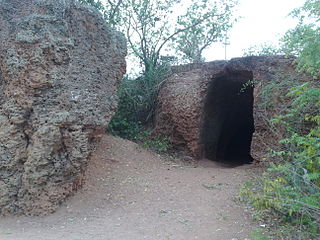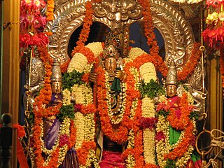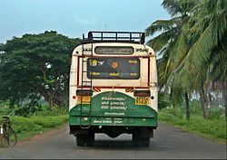
Krishna district is a district in the coastal Andhra Region in Indian state of Andhra Pradesh, with Machilipatnam as its administrative headquarters. It is surrounded on the East by Bay of Bengal, West by Guntur, Bapatla and North by Eluru and NTR districts and South again by Bay of Bengal. In 2022 Krishna district was divided into Krishna and NTR districts.

East Godavari is a district in the Coastal Andhra region of Andhra Pradesh, India. Its district headquarters is at Rajamahendravaram.

Rajahmundry, officially known as Rajamahendravaram, is a city in the Indian state of Andhra Pradesh and district headquarters of East Godavari district. It is the fifth most populated city in the state. During British rule, the District of Rajahmundry was created in the Madras Presidency in 1823. It was reorganised in 1859 and bifurcated into the Godavari and Krishna districts. Rajahmundry was the headquarters of Godavari district, which was further bifurcated into East Godavari and West Godavari districts in 1925. When the Godavari district was bifurcated, Kakinada became the headquarters of East Godavari and Eluru became the headquarters of West Godavari. It is administered under Rajahmundry revenue division of the East Godavari district. The city is known for its floriculture, history, culture, agriculture, economy, tourism, and its heritage. It is known as the "Cultural Capital of Andhra Pradesh".

The West Godavari district is a coastal district in the Indian state of Andhra Pradesh with an administrative headquarters in Bhimavaram. As of the 2011 Census of India, the district has an area of 2,178 km2 (841 sq mi) and a population of 1,779,935. It is bounded by the Krishna district and Bay of Bengal to the south, East Godavari district to the east, and Eluru district, Kolleru Lake and Upputeru Drain to the northwest.

Kovvur is a town in East Godavari district of the Indian state of Andhra Pradesh. It is a municipality and the mandal headquarters of Kovvur mandal in Kovvur revenue division.

Vizianagaram district is one of the six districts in the Uttarandhra region of the Indian state of Andhra Pradesh with its headquarters located at Vizianagaram. The district was once the part of ancient Kalinga.Saripilli Dibbilingeswara temple, Jayathi Mallikarjuna Temple are the finest examples of ancient Eastern Ganga Dynasty built monuments in the district. The district is bounded on the east by the district of Srikakulam, north by Parvathipuram Manyam south by Visakhapatnam, Anakapalli, southeast by the Bay of Bengal, and west by Alluri Sitharama Raju district. It was formed on 1 June 1979, with some parts carved from the neighbouring districts of Srikakulam and Visakhapatnam. The district is named after the princely state of Vizianagaram. In 2011, it was the least populous district in Andhra Pradesh.

Peddapuram is a town in the Kakinada district of Andhra Pradesh in South India. The town also forms a part of Godavari Urban Development Authority.
Mandapeta was originally called "Mandavyapuram", which came from Sage Mandukya. Mandapeta is a second-grade municipality established on October 1, 1958 in Dr. B.R. Ambedkar Konaseema District in the Indian state of Andhra Pradesh. It is located at mean elevation of about 15.48 msl at 16.520 N, 81.560 E.

Narasapuram, or Narsapur, is a town in West Godavari district of the Indian state of Andhra Pradesh. It is a municipality and mandal headquarters of Narasapuram mandal in Narasapuram revenue division. The city is situated on the banks of the Vasista Godavari River. The lace industry is prevalent in the city and its surroundings.
Pamidimukkala is a village in Krishna district of the Indian state of Andhra Pradesh. It is located in Pamidimukkala mandal of vuyyuru revenue division.

Cherukupalli Mandal is one of the fifty seven mandals in Bapatla district of the Indian state of Andhra Pradesh. It is under the administration of Repalle revenue division of the district. The village of Cherukupalli is the administrative seat of the mandal.
Rajahmundry Rural mandal, officially known as Rajamahendravaram Rural mandal, is one of the 19 mandals in East Godavari district of the state of Andhra Pradesh, India. The mandal is bounded by Seethanagaram mandal, Korukonda mandal, Rajanagaram mandal, Kadiam mandal and Atreyapuram mandal.
Penikeru is a village of in East Godavari district of the Indian state of Andhra Pradesh. It is located in Alamuru mandal of Rajahmundry revenue division.
Rameswaram is a village in the Kakinada district of Andhra Pradesh, India. The village is situated 5 kilometres west to the district headquarters Kakinada.
Rajahmundry Urban mandal, officially known as Rajamahendravaram Urban mandal, is one of the 19 mandals in East Godavari of the state of Andhra Pradesh, India. It has its headquarters at Rajahmundry city, that covers the entire urban mandal. The mandal is surrounded by Rajahmundry (rural) mandal and lies on the banks of Godavari River.
Kovvur mandal is one of the 19 mandals in East Godavari district of the Indian state of Andhra Pradesh. Its headquarters are located in the town of Kovvur. The mandal is bounded by Nidadavole, Chagallu, Devarapalle, Tallapaudi mandals and on the east by the Godavari River.
Ganapavaram mandal is one of the 28 mandals in West Godavari district of the Indian state of Andhra Pradesh. It is under the administration of Bhimavaram revenue division and the headquarters are located at Ganapavaram. Ganapavaram Mandal is bounded by Nidamarru Mandal towards west, Pentapadu Mandal towards North, Undi Mandal towards South, Unguturu Mandal towards North. Tadepalligudem, Bhimavaram, Tanuku, Eluru are the nearby Cities to Ganapavaram. It is located 55 km from Eluru and 22 km from Bhimavaram.

Namana Rambabu is an Indian politician from Andhra Pradesh. He is the Telugu Desam Party state organizing secretary. He is worked as 21st ZP chairman for East Godavari District, Andhra Pradesh.

Eluru district is a district in coastal Andhra Region in the Indian state of Andhra Pradesh. With Eluru as its administrative headquarters, it was proposed on 26 January 2022 to become one of the resultant twenty six districts in the state once a final notification is issued by the government of Andhra Pradesh. It is formed from Eluru revenue division and Jangareddygudem revenue division from West Godavari district and Nuzvid revenue division from Krishna district.

Konaseema district is one of the 26 districts in the Indian state of Andhra Pradesh. It is situated between the tributaries of the Godavari river in the Konaseema region of Coastal Andhra. It was carved out of East Godavari district on 4 April 2022 by the Government of Andhra Pradesh. Amalapuram is the district headquarters and the largest city in this district. Other significant towns in the district are Mandapeta, Ramachandrapuram, and Mummidivaram.


