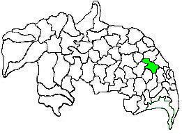
Krishna district is a district in the coastal Andhra Region in Indian state of Andhra Pradesh, with Machilipatnam as its administrative headquarters. It is surrounded on the East by Bay of Bengal, West by Guntur, Bapatla and North by Eluru and NTR districts and South again by Bay of Bengal.
Bhagat is a term used in the Indian subcontinent to describe religious personalities who have obtain high acclaim in their community for their services and devoutness. It is also one of the clan in Mahar caste with clan totem as King Cobra and also a surname found among Marathas, Bania communities and Punjabi Brahmins.
Manthani is a municipal town in Manthani mandal in Peddapalli district of the Indian state of Telangana. It is located in Manthani mandal on the banks of the river Godavari..Manthani is nearest town of Godavarikhani, Ramagundam & Peddapalli.

Vizianagaram district is one of the six districts in the Uttarandhra region of the Indian state of Andhra Pradesh with its headquarters located at Vizianagaram. The district was once the part of ancient Kalinga.Saripilli Dibbilingeswara temple, Jayathi Mallikarjuna Temple are the finest examples of ancient Eastern Ganga Dynasty built monuments in the district. The district is bounded on the east by the district of Srikakulam, north by Parvathipuram Manyam south by Visakhapatnam, Anakapalli, southeast by the Bay of Bengal, and west by Alluri Sitharama Raju district. It was formed on 1 June 1979, with some parts carved from the neighbouring districts of Srikakulam and Visakhapatnam. The district is named after the princely state of Vizianagaram. In 2011, it was the least populous district in Andhra Pradesh.

Khammam district is a district in the eastern region of the Indian state of Telangana. The city of Khammam is the district headquarters. The district shares boundaries with Suryapet, Mahabubabad, Bhadradri districts and with Eluru and NTR districts.

Chittoor district is one of the eight districts in the Rayalaseema region of the Indian state of Andhra Pradesh. It has a population of 18,72,951 according to 2011 census of India. It is a major market centre for mangoes, grains, sugarcane, and peanuts. The district headquarters is located at Chittoor.

Guntur district is one of the twenty six districts in the Coastal Andhra region of the Indian state of Andhra Pradesh. The administrative seat of the district is located at Guntur, the largest city of the district in terms of area and with a population of 670,073. It has a coastline of approximately 100 km (62 mi) on the right bank of Krishna River, that separates it from Krishna district and NTR district. It is bounded on the south by Bapatla district and on the west by Palnadu district. It has an area of 2,443 km2 (943 sq mi) and with a population of 20,91,075 as per 2011 census of India.

Srikakulam district is one of the twenty-six districts of the Indian state of Andhra Pradesh, located in the Uttarandhra region of the state, with its headquarters located at Srikakulam. It is one of the six districts, located in the extreme northeastern direction of the state. It was formerly known as Chicacole, and was under Ganjam district till 1936 April 1, then merged under Vizagapatam district. Srikakulam district forms the core area of Kalinga where most of its historical capitals like Kalinganagari, pithunda, Dantapuram are located.

Hanumakonda district, is a district located in the northern region of the Indian state of Telangana. The district headquarters are located at Hanumakonda. The district borders the districts of Jangaon, Karimnagar, Warangal, Bhupalpally and Siddipet.

Cherukupalli Mandal is one of the fifty seven mandals in Bapatla district of the Indian state of Andhra Pradesh. It is under the administration of Repalle revenue division of the district. The village of Cherukupalli is the administrative seat of the mandal.
The States Reorganisation Commission (SRC) constituted by the Central Government of India in December 1953 to recommend the reorganization of state boundaries. In September 1955, after two years of study, the Commission, comprising Justice Fazal Ali, K. M. Panikkar and H. N. Kunzru, submitted its report. The commission's recommendations were accepted with some modifications and implemented in the States Reorganisation Act in November, 1956. The act provided that India's state boundaries should be reorganized to form 14 states and 6 centrally administered territories. On December 10, 1948, the report of Dar Commission was published but the issue remained unsolved.
A tehsil is a local unit of administrative division in India and Pakistan. It is a subdistrict of the area within a district including the designated populated place that serves as its administrative centre, with possible additional towns, and usually a number of villages. The terms in India have replaced earlier terms, such as pargana (pergunnah) and thana.

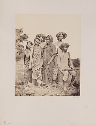
The Mang, or Matang, community is an Indian caste mainly residing in the state of Maharashtra. Matang are known as Madiga "kommati" in Telangana, Andhra Pradesh and Karnataka.

Gorasara is a village located in Dildarnagar Kamsar, Uttar Pradesh, India.

Mangalagiri mandal is one of the 18 mandals in Guntur district of the Indian state of Andhra Pradesh. It is under the administration of Tenali revenue division and the headquarters are located at Mangalagiri town part of Mangalagiri Tadepalli Municipal Corporation. The mandal is bounded by Thullur, Tadepalle, Tadikonda, Pedakakani and Duggirala mandals and a portion of the mandal lies on the banks of Krishna River.

Tenali mandal is one of the 18 mandals in Guntur district of the Indian state of Andhra Pradesh. It is under the administration of Tenali revenue division, headquartered at Tenali. The mandal is located in Velanadu region, bounded by Pedakakani, Duggirala, Kollipara, Vemuru, Amruthalur, Tsundur and Chebrole mandals.
Salur mandal is one of the 34 mandals in Parvathipuram Manyam district of the Indian state of Andhra Pradesh. It is administration under Parvathipuram revenue division and headquartered at Salur. The mandal is bounded by Makkuva, Ramabhadrapuram, Pachipenta and Bobbili mandals. A portion of it also borders the state of Odisha.

Warangal district, formerly Warangal Rural district, is a district in the Indian state of Telangana. The district shares boundaries with Mahabubabad, Jangaon, Hanamkonda, Mulugu and Bhupalpally districts.

Bapatla district is a district in coastal Andhra in the Indian state of Andhra Pradesh (AP) established on 4 April 2022. The administrative headquarters are in Bapatla. The district is formed from parts of the erstwhile Prakasam district and Guntur districts.
Kagithalapuru or Kakitalupuru is a small village in Manubolu mandal of Nellore district of Andhra Pradesh, India.


