Palnadu district

Last updated

Palnadu District
Kotappa konda 4.jpg
Dhyana Buddha Project.jpg
Sri Lakhsmichnnakesava swami temple45.jpg
Anupu ei01-45.jpg
Spot-billed Pelican in Uppalapadu P1110580.jpg
Ethipothala water falls.JPG
Clockwise from top-left: Kotappakonda, Dhyana Buddha statue in Amaravati, Lakshmi Channakeshava Swami Temple in Macherla, Pelicans in Uppalapadu Bird Sanctuary, Ethipothala Falls, Buddhist monuments in Anupu
Palnadu in Andhra Pradesh (India).svg
Location of Palnadu district in Andhra Pradesh
Palnadu district
Interactive map outlining district
CountryFlag of India.svg  India
State Andhra Pradesh
Region Coastal Andhra
Headquarters Narasaraopet
Administrative divisions
Government
   District collector and magistrate P. Arun Babu, I.A.S. [1]
   Superintendent of Police Kanchi Srinivasa Rao, I.P.S.
   Lok Sabha constituency Narasaraopet
   MP Lavu Sri Krishna Devarayalu
   Assembly constituencies 07
Area
[2]
  Total
7,298 km2 (2,818 sq mi)
Population
 (2011) [3]
  Total
2,041,723
  Density280/km2 (720/sq mi)
Time zone UTC+05:30 (IST)
Website palnadu.ap.gov.in

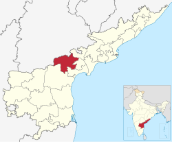
Palnadu district is a district in coastal Andhra Region in the Indian state of Andhra Pradesh. With Narasaraopet as its administrative headquarters, it was formed on 4 April 2022 to become one of the resultant twenty-six districts The district was formed from Gurazala, Sattenapalli and Narasaraopet revenue divisions from Palnadu district. [4] [5] [6] [7] The district covers most of the Palnadu region.

Contents

Etymology

This district has derived its name from the Palnadu or Pallava Nadu region .

Geography

Palnadu district is bordered by NTR district at North, Bapatla district at South East, Prakasam district at South West and Guntur district at East. It is also surrounded by Suryapet district and Nalgonda district in Telangana state at west.

Land utilisation

The total geographical area of the district is 730,123 hectares (7,301.23 km2) and 150,759 ha (1,507.59 km2) is covered by forest. The net area sown is 315,650 ha (3,156.5 km2). The total cropped area in the district is 347,114 ha (3,471.14 km2). The area sown more than once during the year is 31,464 ha (314.64 km2).

Natural and Mineral Resources

The district is rich in mineral resources. The principal minerals available are limestone, lime Lime Stonekankar at Piduguralla. Napa slabs, Copper and Lead. Lime stone is being utilised by the cement factories of Macherla. There are copper mines at Agnigundala of Ipur Mandal.

Climate

The normal rainfall of the district is 775.3 mm (30.5 in) The climate is generally warm in summer and the heat is very severe in Rentachintala Mandal, where the maximum temperature in the state is recorded.

Summer (March to June): the summer months are hot and dry, with temperatures often reaching high levels. This period is characterized by high temperatures and low rainfall.

Monsoon (July to September): the monsoon season brings rainfall to the region. During this period, the district receives the majority of its annual precipitation. The monsoon rains are essential for agriculture and overall water supply.

Post-monsoon/winter (October to February): after the monsoon season, the region experiences a post-monsoon period, followed by relatively cooler months during winter. The temperatures are milder during this time.

Demographics

Religions in Palnadu district (2011) [8]
ReligionPercent
Hinduism
86.73%
Islam
11.30%
Christianity
1.59%
Other or not stated
0.38%
Distribution of religions

At the time of the 2011 census, the district had a population of 20,41,723, of which 458,551 (22.46%) lived in urban areas. Palnadu district has a sex ratio of 994 females per 1000 males. Scheduled Castes and Scheduled Tribes made up 3,75,554 (18.39%) and 1,42,944 (7.00%) of the population respectively. [3] :77–82

Languages of Palnadu district (2011) [9]

   Telugu (87.12%)
   Urdu (9.90%)
   Lambadi (2.41%)
  Others (0.57%)

At the time of the 2011 census, 87.12% of the population spoke Telugu, 9.90% Urdu and 2.41% Lambadi as their first language. [9]

Politics

There are one parliamentary and seven assembly constituencies in Palnadu district. The parliamentary constituencies are

The assembly constituencies are [10]

#NameDistrictMembersParty
85 Pedakurapadu PalnaduBhashyam Praveen Telugu Desam Party
96 Chilakaluripeta Prathipati Pulla Rao
97 Narasaraopeta Dr. Chadalavada Aravinda Babu
98 Sattenapalle Kanna Lakshminarayana
99 Vinukonda G. V. Anjaneyulu
100 Gurajala Yarapathineni Srinivasa Rao
101 Macherla Julakanti Brahmananda Reddy

Administrative divisions

Mandals of Palnadu district (Overpass-turbo)

The district is divided into 3 revenue divisions: Gurazala, Narasaraopet and Sattenapalle, which are further subdivided into a total of 28 mandals. [11]

Mandals

The list of 28 mandals in Palnadu district, divided into 3 revenue divisions, is given below.

Cities and towns

List of towns in Palnadu District
CityCivic status of townrevenue divisionpopulation
Narasaraopet Municipality Grade - 1Narasaraopet117,489
Chilakaluripet Municipality Grade - 1Narasaraopet101,398
Piduguralla Municipality Grade - 2Gurazala63,103
Vinukonda Municipality Grade - 2Narasaraopet62,550
Macherla Municipality Grade - 2Gurazala57,290
Sattenapalle Municipality Grade - 2Sattenapalle56,721
Dachepalle Municipality Grade - 2Gurazala36,280
Gurazala Municipality Grade - 2Gurazala30,464

Erstwhile Talukas

S.No.Erstwhile Talukas

in 1971

Newly formed Talukas

in 1978

Newly formed Mandals

in 1985

1NarsaraopetaNarsaraopetaNarasaraopeta, Nakirekallu, Rompicherla,
ChilakaluripetaChilakaluripeta, Edlapadu, Nadendla, Pedanandipadu [part],
2VinukondaVinukondaVinukonda, Nuzendla, Savalyapuram [part]
IpurIpur, Bollapalle, Savalyapuram [part]
3PalnaduPalnaduGurajala, Karempudi, Rentachintala [part],
MacherlaMacherla, Durgi, Veldurthy, Rentachintala [part],
PidugurallaPiduguralla, Dachepalle, Machavaram,
4SattenapalleSattenapalleSattenapalle, Phirangipuram, Medikonduru,
RajupalemRajupalem, Bellamkonda, Muppala, Krosuru [part]
TalluruAtchampet, Pedakurapadu, Amaravathi [part], Krosuru [part]

Tourist attractions

Palnadu district
Palnadu district tourist attractions (After zooming, move the cursor over icons for more details)

Notable people

References

  1. https://palnadu.ap.gov.in/
  2. CPO 2022, p. V.
  3. 1 2 "District Census Hand Book – Guntur" (PDF). Census of India . Registrar General and Census Commissioner of India.
  4. Raghavendra, V. (26 January 2022). "With creation of 13 new districts, AP now has 26 districts". The Hindu . ISSN   0971-751X. Archived from the original on 26 January 2022. Retrieved 26 January 2022.
  5. "AP issues draft gazette notification on 26 districts". Deccan Chronicle . 26 January 2022. Archived from the original on 29 January 2022. Retrieved 11 February 2022.
  6. "New districts to come into force on April 4". The Hindu . 30 March 2022. Retrieved 31 March 2022.
  7. "కొత్త జిల్లా తాజా స్వరూపం". Eenadu.net (in Telugu). 31 March 2022. Retrieved 31 March 2022.
  8. "Population by Religion - Andhra Pradesh". censusindia.gov.in. Registrar General and Census Commissioner of India. 2011.
  9. 1 2 "Table C-16 Population by Mother Tongue: Andhra Pradesh". Census of India . Registrar General and Census Commissioner of India.
  10. "District-wise Assembly-Constituencies". ceoandhra.nic.in.
  11. Gopi Dara (12 November 2022). "Andhra Pradesh: 3 mandals to be shifted to other divisions | Vijayawada News - Times of India". The Times of India. Retrieved 23 January 2023.

Books

CPO (2022). District Hand Book of Statistics – Palnadu district (PDF).

16°12′N80°00′E / 16.2°N 80.0°E / 16.2; 80.0