Anakapalli district

Last updated

Anakapalli district
Main Stupa Bojjannakonda.jpg
Anakapalle Gandhi Nagar.jpg
NTPC Simhadri Super thermal power plant at Parawada.jpg
Panchadharla Temples and Monuments, Dharapalem village, Andhra Pradesh - 71.jpg
Anakapalle Sarada River Bridge.jpg
Clockwise from top-left: Stupa at Bojjannakonda, Gandhi Nagar in Anakapalle, Dharmalingeswara Temple at Panchadharla, Bridge over the Sarada River, NTPC Simhadi Super Thermal Power Plant
Anakapalli in Andhra Pradesh (India).svg
Anakapalli district in Andhra Pradesh
Anakapalli district
Interactive map outlining district
Coordinates: 17°41′N83°00′E / 17.69°N 83.00°E / 17.69; 83.00
CountryFlag of India.svg  India
State Flag placeholder.svg Andhra Pradesh
Region Uttarandhra
Headquarters Anakapalli
Government
   District collector Sri Pattaneshetti Ravi Subhash IAS Collector & District Magistrate
   Lok Sabha constituencies Anakapalli
   MP Dr. Beesetti Venkata Satyavathi
   Assembly constituencies 07
Area
  Total4,292 km2 (1,657 sq mi)
Population
 (2011) [1]
  Total1,726,998
  Density400/km2 (1,000/sq mi)
   Urban
250,359
Time zone UTC+05:30 (IST)
Website anakapalli.ap.gov.in

Anakapalli district is a district in the Indian state of Andhra Pradesh. It was formed on 4 April 2022 from Anakapalli and Narsipatnam revenue divisions of the old Visakhapatnam district. The administrative headquarters are at Anakapalli. [2] [3] [4] [5]

Contents

Etymology

This district is derived from its headquarters Anakapalli.[ citation needed ]

Geography

This district is surrounded by Alluri Sitharama Raju district to the north, Kakinada district to the west, the Bay of Bengal to the south and Vizianagaram district and Visakhapatnam district to the east.[ citation needed ]

Politics

There are one parliamentary and 7 assembly constituencies in Anakapalli district. The parliamentary constituencies are

The assembly constituencies are [6]

Constituency numberNameReserved for
(SC/ST/None)
Parliament
26 Chodavaram None Anakapalli
27 Madugula None
30 Anakapalli None
31 Pendurthi (partially)None
32 Elamanchili None
33 Payakaraopet SC
34 Narsipatnam None

Administrative divisions

Satellite view of Anakapalli district Anakapalli.png
Satellite view of Anakapalli district

The district is divided into 2 revenue divisions: Anakapalli and Narsipatnam, which are further subdivided into a total of 24 mandals, each headed by a sub-collector. [7]

Mandals

The list of 24 mandals in Anakapalli district, divided into 2 revenue divisions, is given below.

Cities and towns

The district consists of two municipalities and 8 census towns. Anakapalli zone fall under Greater Visakhapatnam Municipal Corporation and the two municipalities in the district are Elamanchili and Narsipatnam. [8] The census towns are Bowluvada, Chodavaram, Kantabamsuguda, Mulakuddu, Nakkapalle, Narsipatnam, Peda Boddepalle, Payakaraopeta.[ citation needed ]

Notable people from Anakapalli district

Demographics

Religions in Anakapalli district (2011) [9]
ReligionPercent
Hinduism
98.12%
Islam
0.84%
Christianity
0.78%
Other or not stated
0.26%
Distribution of religions

At the time of the 2011 census, Anakapalli district had a population of 1,726,998, of which 250,359 (14.50%) live in urban areas. Anakapalli district had a sex ratio of 1020 females per 1000 males. Scheduled Castes and Scheduled Tribes make up 158,060 (9.15%) and 47,975 (2.78%) of the population respectively. [1] :90–94

Telugu was the predominant language, spoken by 98.87% of the population. [10]

Related Research Articles

<span class="mw-page-title-main">West Godavari district</span> District of Andhra Pradesh in India

The West Godavari district is a coastal district in the Indian state of Andhra Pradesh with an administrative headquarters in Bhimavaram. As of the 2011 Census of India, the district has an area of 2,178 km2 (841 sq mi) and a population of 1,779,935. It is bounded by the Krishna district and Bay of Bengal to the south, East Godavari district to the east, and Eluru district, Kolleru Lake and Upputeru Drain to the northwest.

<span class="mw-page-title-main">Vizianagaram district</span> District of Andhra Pradesh in India

Vizianagaram district is one of the six districts in the Uttarandhra region of the Indian state of Andhra Pradesh with its headquarters located at Vizianagaram. The district was once the part of ancient Kalinga.Saripilli Dibbilingeswara temple, Jayathi Mallikarjuna Temple are the finest examples of ancient Eastern Ganga Dynasty built monuments in the district. The district is bounded on the east by the district of Srikakulam, north by Parvathipuram Manyam south by Visakhapatnam, Anakapalli, southeast by the Bay of Bengal, and west by Alluri Sitharama Raju district. It was formed on 1 June 1979, with some parts carved from the neighbouring districts of Srikakulam and Visakhapatnam. The district is named after the princely state of Vizianagaram. In 2011, it was the least populous district in Andhra Pradesh.

<span class="mw-page-title-main">Srikakulam district</span> District of Andhra Pradesh in India

Srikakulam district is one of the twenty-six districts of the Indian state of Andhra Pradesh, located in the Uttarandhra region of the state, with its headquarters located at Srikakulam. It is one of the six districts, located in the extreme northeastern direction of the state. It was formerly known as Chicacole, and was under Ganjam district till 1936 April 1, then merged under Vizagapatam district. Srikakulam district forms the core area of Kalinga where most of its historical capitals like Kalinganagari, pithunda, Dantapuram are located.
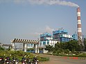
<span class="mw-page-title-main">Visakhapatnam district</span> District in Andhra Pradesh, India

Visakhapatnam district is one of the six districts in the Uttarandhra region of the Indian state of Andhra Pradesh, headquartered at Visakhapatnam. It is one of the twenty-six districts in Andhra Pradesh state. The district shares borders within the north and east, Vizianagaram district and South Anakapalli district in the south-west and Bay of Bengal in the south.

<span class="mw-page-title-main">Narsipatnam</span> City in Andhra Pradesh, India

Narsipatnam is a census town in Anakapalle district of the Indian state of Andhra Pradesh. It was upgraded from a gram panchayat into municipality in 2012. The town is spread over an area of 42 km2 (16 sq mi) The resting place of the revolutionary Indian freedom fighter Alluri Sitarama Raju is located in Krishna Devi Peta village of From Narsipatnam to labasingi Village 30 km only.. labasingi most popular winter tourism place..so many Tourists enjoy -2 degree's temparature there.. Narsipatnam town is 43 km away from Tuni. And it is 72 km away from Visakhapatnam.

<span class="mw-page-title-main">Chodavaram, Anakapalli district</span> Census town in Andhra Pradesh, India

Chodavaram is a town in Anakapalli district in the Indian state of Andhra Pradesh. The town is located on the country's east coast. It falls under Visakhapatnam Metropolitan Region Development Authority. The town has one of the largest cooperative Sugar factories in state.

<span class="mw-page-title-main">Ganta Srinivasa Rao</span> Indian politician

Ganta Srinivasa Rao is an Indian politician from Telugu Desam Party and former member of Andhra Pradesh Legislative Assembly representing Visakhapatnam North constituency from 23rd May, 2019 to 23rd January, 2024. He was the minister of Human Resources Development of Andhra Pradesh in India. He hails from Kamepalli village in Prakasam district.

<span class="mw-page-title-main">Visakhapatnam revenue division</span> Revenue division in Visakhapatnam district in Andhra Pradesh, India

Visakhapatnam Revenue Division is an administrative division in the Visakhapatnam district of the Indian state of Andhra Pradesh. It is one of the two revenue divisions managing the district's six mandals. The city of Visakhapatnam is the divisional headquarters.

<span class="mw-page-title-main">Anakapalli revenue division</span> Revenue division in Anakapalli district in Andhra Pradesh, India

Anakapalli revenue division is an administrative division in the Anakapalli district of the Indian state of Andhra Pradesh. It is one of the two revenue divisions in the district which consists of twelve mandals under its administration. Anakapalli is the divisional headquarters.

<span class="mw-page-title-main">Narsipatnam revenue division</span> Revenue division in Anakapalli district in Andhra Pradesh, India

Narsipatnam revenue division is a revenue division in the Anakapalli district of the Indian state of Andhra Pradesh. It is one of the two revenue divisions in the district which consists of twelve mandals under its administration. Narsipatnam is the divisional headquarters.

Anakapalli mandal is one of the mandals in located in Anakapalli district of the state of Andhra Pradesh, India. It is administered under Anakapalli revenue division and its headquarters are located at Anakapalli. It is bounded by Kasimkota Mandal towards west, Munagapaka Mandal towards South, Paravada Mandal towards East, Achutapuram Mandal towards South.

<span class="mw-page-title-main">NTR district</span> District in Andhra Pradesh, India

NTR district is a district in coastal Andhra Region in the Indian state of Andhra Pradesh. The district headquarters is located at Vijayawada. The district is named after former Chief Minister of Andhra Pradesh N. T. Rama Rao. The district shares boundaries with Guntur, Palnadu, Krishna, Eluru, Khammam and Suryapet districts

<span class="mw-page-title-main">Alluri Sitharama Raju district</span> New district in Andhra Pradesh, India

Alluri Sitharama Raju district, also known as Alluri district and by its initials as ASR district, is a district in the Indian state of Andhra Pradesh. The headquarters of the district is located at Paderu. Named after Alluri Sitarama Raju, a revolutionary in the Indian independence movement who hailed from the region, the district was effective since 4 April 2022 and became one of the twenty-six districts in the state. The district is known for its scenery and lies in the Eastern Ghats.

<span class="mw-page-title-main">Eluru district</span> District of Andhra Pradesh in India

Eluru district is a district in coastal Andhra Region in the Indian state of Andhra Pradesh. With Eluru as its administrative headquarters, it was proposed on 26 January 2022 to become one of the resultant twenty six districts in the state once a final notification is issued by the government of Andhra Pradesh. It is formed from Eluru revenue division and Jangareddygudem revenue division from West Godavari district and Nuzvid revenue division from Krishna district.

<span class="mw-page-title-main">Tirupati district</span> District in Andhra Pradesh, India

Tirupati district is one of the eight districts of Rayalaseema region in the Indian state of Andhra Pradesh. The district headquarters is located at Tirupati city. This district is known for its numerous historic temples, including the Hindu shrine of Tirumala Venkateswara Temple and Sri Kalahasteeswara temple. The district is also home to Satish Dhawan Space Centre, a rocket launch centre located in Sriharikota. The river Swarnamukhi flows through Tirupati, Srikalahasti and joins the Bay of Bengal.

<span class="mw-page-title-main">Parvathipuram Manyam district</span> District in Andhra Pradesh, India

Parvathipuram Manyam district is a district in the Indian state of Andhra Pradesh. With Parvathipuram as its administrative headquarters, it became functional from 4th April 2022. The district was formed from Parvathipuram revenue division from Vizianagaram district and part of Palakonda revenue division of Srikakulam district. The district was once part of ancient Kalinga. The famous Kamalingeswara swamy temple was built in the regin of King Rajaraja Deva of Eastern Ganga Dynasty of Odisha in 11th century CE.

<span class="mw-page-title-main">Konaseema district</span> District in Andhra Pradesh, India

Konaseema district, is one of the 26 districts in the Indian state of Andhra Pradesh. It is situated between the tributaries of the Godavari river in the Konaseema region of Coastal Andhra. It was carved out of East Godavari district on 4 April 2022 by the Government of Andhra Pradesh. Amalapuram is the district headquarters and the largest city in this district. The district shares boundaries with West Godavari, East Godavari and Kakinada districts.

<span class="mw-page-title-main">Bapatla district</span> District in Andhra Pradesh, India

Bapatla district is a district in coastal Andhra in the Indian state of Andhra Pradesh (AP) established on 4 April 2022. The administrative headquarters are in Bapatla. The district is formed from parts of the erstwhile Prakasam district and Guntur districts.

<span class="mw-page-title-main">Kakinada district</span> District in Andhra Pradesh in India

Kakinada district is a district in the Coastal Andhra Region in the Indian state of Andhra Pradesh. With Kakinada as its administrative headquarters, it was proposed on 26 January 2022 to become one of the resultant twenty six districts in the state after the final notification has been issued on 4 April 2022 by the government of Andhra Pradesh. The district was formed from Kakinada and Peddapuram revenue divisions from East Godavari district. Incidentally, during earlier times, the region comprising towns Pithapuram, Kakinada and Peddapuram were referred as Polnaud or Prolunadu, which now roughly corresponds to the areas in this district.

<span class="mw-page-title-main">Palnadu district</span> District in Andhra Pradesh, India

Palnadu district is a district in coastal Andhra Region in the Indian state of Andhra Pradesh. With Narasaraopet as its administrative headquarters, it was formed on 4 April 2022 to become one of the resultant twenty-six districts The district was formed from Gurazala, Sattenapalli and Narasaraopet revenue divisions from Palnadu district. The district covers most of the Palnadu region.

References

  1. 1 2 "District Census Hand Book – Visakhapatnam" (PDF). Census of India . Registrar General and Census Commissioner of India.
  2. Raghavendra, V. (26 January 2022). "With creation of 13 new districts, AP now has 26 districts". The Hindu . ISSN   0971-751X. Archived from the original on 26 January 2022. Retrieved 26 January 2022.
  3. "ANDHRA PRADESH GAZETTE". G.O.Rt.No.60, Revenue (Lands-IV), 25 [ 1 ] Th January, 2022: 117. 25 January 2022.
  4. "New districts to come into force on April 4". The Hindu . 30 March 2022. Retrieved 31 March 2022.
  5. "కొత్త జిల్లా తాజా స్వరూపం". Eenadu.net (in Telugu). 31 March 2022. Retrieved 31 March 2022.
  6. "District-wise Assembly-Constituencies". ceoandhra.nic.in.
  7. "GO issued for creation of Anakapalle revenue division". The Hindu. Viskhapatnam. 4 April 2013. Retrieved 21 November 2015.
  8. "Adminsistrative divisions of Visakhapatnam district". Official Website of Visakhapatnam District. National Informatics Centre. Retrieved 16 January 2015.
  9. "Population by Religion - Andhra Pradesh". censusindia.gov.in. Registrar General and Census Commissioner of India. 2011.
  10. "Table C-16 Population by Mother Tongue: Andhra Pradesh". Census of India . Registrar General and Census Commissioner of India.