
Andhra Pradesh is a state in the south-eastern coastal region of India. It is the seventh-largest state by area covering an area of 162,975 km2 (62,925 sq mi) and tenth-most populous state with 49,386,799 inhabitants, with the state capital being Amaravati and the largest city being Visakhapatnam. It is bordered by Telangana to the north-west, Chhattisgarh to the north, Odisha to the north-east, Tamil Nadu to the south, Karnataka to the west and the Bay of Bengal to the east. It has the second longest coastline in India after Gujarat, of about 974 km (605 mi). Andhra State was the first state to be formed on a linguistic basis in India on 1 October 1953. On 1 November 1956, Andhra State was merged with the Telugu-speaking areas of the Hyderabad State to form Andhra Pradesh. The state was then reorganised in June 2014 to form a separate Telangana state.

Visakhapatnam, also known as Vizag, Viśākha or Waltair, is the largest and most populous city in the Indian state of Andhra Pradesh, and its proposed administrative capital. It is between the Eastern Ghats and the coast of the Bay of Bengal. It is the second-largest city on the east coast of India after Chennai, and the fourth-largest in South India. It is one of the four smart cities of Andhra Pradesh selected under the Smart Cities Mission and serves as the headquarters of Visakhapatnam district. With an estimated output of $43.5 billion, it is the ninth-largest contributor to India's gross domestic product as of 2016.

Araku Valley is a hill station in Alluri Sitharama Raju district in the Indian state of Andhra Pradesh, lying 111 km west of Visakhapatnam city. This place is often referred to as Ooty of Andhra. It is a valley in the Eastern Ghats inhabited by different tribes, mainly Araku Tribes.

Visakhapatnam district is one of the nine districts in the Coastal Andhra region of the Indian state of Andhra Pradesh, headquartered at Visakhapatnam. It is one of the nine coastal districts of the state.The district share broders with in the north and east, Vizianagaram district, Anakapalle district in the south-west and Bay of Bengal in the south.

Gajuwaka is a major residential area of Visakhapatnam City, India. This neighborhood of Visakhapatnam is considered the biggest shopping district in Andhra Pradesh by revenue. Though conceived as a residential locality, it is now one of the principal shopping districts of the city. The Gajuwaka area of Visakhapatnam has the highest per capita income in Andhra Pradesh.

Tadepalligudem is a City in West Godavari district of the Indian state of Andhra Pradesh. It is a Selection Grade municipality and the mandal headquarters of Tadepalligudem mandal in Bhimavaram revenue division. Tadepalligudem is second biggest town next to Bhimavaram city in west godavari District as per 2011 census in terms of population.

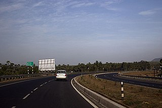
Andhra Pradesh State Road Transport Corporation is the state-owned road transport corporation in the Indian state of Andhra Pradesh. Its headquarters is located at NTR Administrative Block of RTC House in Pandit Nehru bus station of Vijayawada. Many other Indian metro towns in Telangana, Tamil Nadu, Karnataka, Odisha, Yanam, Kerala, Maharashtra and Chhattisgarh are also linked with the APSRTC services.
Anandapuram is a suburb and a mandal of Visakhapatnam district in the state of Andhra Pradesh, India.

Parawada is a suburb of Visakhapatnam and a Mandal in Anakapalli district in the state of Andhra Pradesh in India.
Pedagantyada is a neighbourhood in the city of Visakhapatnam, India. It is one of the 46 mandals in Visakhapatnam District. It is under the administration of Visakhapatnam revenue division and the headquarters is located at Pedagantyada beside Gajuwaka. The Mandal is bounded by Mulagada and Gajuwaka mandals. It is a major Suburb in Visakhapatnam and got merged in Greater Visakhapatnam Municipal Corporation in 2005. Organisations like Visakhapatnam Steel Plant, and Gangavaram Port are located in this area.

Pendurthi is a neighborhood in the city of Visakhapatnam, India. The neighborhood is considered as the major residential and commercial area in the city. It is located within the jurisdiction of the Greater Visakhapatnam Municipal Corporation, which is responsible for the civic amenities in Pendurthi. It is located on the west fringe of Visakhapatnam city.

Elamanchili is a town in Anakapalli district of the Indian state of Andhra Pradesh. It is a municipality and also the mandal headquarters of Elamanchili mandal. The town is spread over an area of 39 km2 (15 sq mi), which is under the jurisdiction of Visakhapatnam Metropolitan Region Development Authority. This town has historical importance dating back to 7th Century AD.
Uttarandhra, also known as Kalinga Andhra or North Andhra, is a region consisting of six northern districts of the Indian state of Andhra Pradesh. It comprises the districts of Srikakulam, Parvathipuram Manyam, Vizianagaram, Visakhapatnam, Alluri Sitharama Raju and Anakapalli. As of 2011 census of India, the region with six districts has a population of 9,338,177.
Visakhapatnam East Assembly constituency is a constituency in Visakhapatnam district of Andhra Pradesh, representing the state legislative assembly in India. It is one of the seven assembly segments of Visakhapatnam, along with Bheemili, Visakhapatnam South, Visakhapatnam North, Visakhapatnam West and Gajuwaka. Ramakrishna Babu Velagapudi is the present MLA of the constituency, who won the 2019 Andhra Pradesh Legislative Assembly election from Telugu Desam Party. As of 25 March 2019, there a total of 271,215 electors in the constituency.
Visakhapatnam South Assembly constituency is a constituency in Visakhapatnam district of Andhra Pradesh, representing the state legislative assembly in India. It is one of the seven assembly segments of Visakhapatnam, along with Bheemili, Visakhapatnam East, Visakhapatnam North, Visakhapatnam West and Gajuwaka. Vasupalli Ganesh Kumar is the present MLA of the constituency, who won the 2019 Andhra Pradesh Legislative Assembly election from Telugu Desam Party but later defected to YSR Congress Party. As of 25 March 2019, there a total of 209,186 electors in the constituency.
Visakhapatnam West Assembly constituency is a constituency in Visakhapatnam district of Andhra Pradesh. It is one of the seven assembly segments of Visakhapatnam, along with Bheemili, Visakhapatnam East, Visakhapatnam South, Visakhapatnam North and Gajuwaka. Gana Venkata Reddy Naidu Pethakamsetti is the present MLA of the constituency, who won the 2019 Andhra Pradesh Legislative Assembly election from Telugu Desam Party. As of 25 March 2019, there a total of 236,310 electors in the constituency.
Gajuwaka Assembly constituency is a constituency in Visakhapatnam district of Andhra Pradesh. It is one of the seven assembly segments of Visakhapatnam, along with Bheemili, Visakhapatnam East, Visakhapatnam South, Visakhapatnam North and Visakhapatnam West. Nagireddy Tippala is the present MLA of the constituency, who won the 2019 Andhra Pradesh Legislative Assembly election from YSR Congress Party. As of 25 March 2019, in terms of registered number of electors, it is the largest assembly constituency in the state with a total of 309,326 electors.

The Greater Visakhapatnam Municipal Corporation (GVMC) is the civic body that governs the city of Visakhapatnam, largest city of the Indian state of Andhra Pradesh. Its jurisdiction encompasses an area of 681.96 km2 (263.31 sq mi). It is also part of the planning body of the Visakhapatnam Metropolitan Region Development Authority. Established in the year 1979, the executive power of the GVMC is vested in the Municipal Commissioner, an Indian Administrative Service officer appointed by the Government of Andhra Pradesh. The position is held by G. Lakshmisha. Golagani Hari Venkata Kumari (YSRCP) was elected as the Mayor and Jiyyani Sridhar (YSRCP) as the Deputy Mayor by the newly elected general body in March 2021. In January 2021, the number of wards were increased to 98 from 81 earlier.


