Visakhapatnam, also known as Vizag, Viśākha or Waltair, is the largest and most populous metropolitan city in the Indian state of Andhra Pradesh. It is between the Eastern Ghats and the coast of the Bay of Bengal. It is the second largest city on the east coast of India after Chennai, and the fourth largest in South India. It is one of the four smart cities of Andhra Pradesh selected under the Smart Cities Mission and is the headquarters of Visakhapatnam district. With an estimated output of $43.5 billion, it is the ninth largest contributor to India's gross domestic product as of 2016.

Visakhapatnam district is one of the six districts in the Uttarandhra region of the Indian state of Andhra Pradesh, headquartered at Visakhapatnam. It is one of the twenty-six districts in Andhra Pradesh state. The district shares borders within the north and east, Vizianagaram district and South Anakapalli district in the south-west and Bay of Bengal in the south.

Indira Gandhi Zoological Park is located amidst Kambalakonda Reserve Forest in Visakhapatnam, Andhra Pradesh, India. It is the third largest zoo in the country.

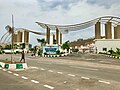
Dr. NTR University of Health Sciences, is a public university in the city of Vijayawada, Andhra Pradesh.
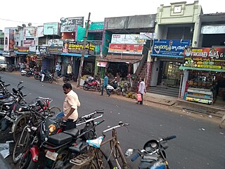
Kasibugga is a twin-town in Srikakulam district of the Indian state of Andhra Pradesh. It is a municipality and the part in mandal of Palasa.

Visakhapatnam Junction is an important railway station located in Visakhapatnam in the Indian state of Andhra Pradesh. It has a staggering eight platforms with 508 trains passing by everyday. It is on the Howrah–Chennai main line and is being operated by East coast Railway till now and it may take some time to be administered under the South Coast Railway zone by Indian Railways. Originally named the Waltair railway station, it was founded in 1896. It was renamed as Visakhapatnam junction in 1987.

Tetagunta is one of the villages in Tuni mandal in Kakinada district in Andhra Pradesh State and is located 14.1 km from its Mandal main town Tuni. It is 44.3 km from its district main city Kakinada. It has a population of 11,967 and people mostly depend on farming. Tetagunta village of Tuni Mandal is having the largest area of 4,033 hectares in the East Godavari District.It is located at a distance of 120 km from the state main city Visakhapatnam. Pincode:533406

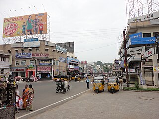
Maddilapalem is an area of Visakhapatnam, in the Indian state of Andhra Pradesh.

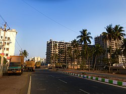
Pothinamallayya Palem or PM Palem, is a residential neighbourhood situated in Visakhapatnam city in the Indian state of Andhra Pradesh. It is located in the Greater Visakhapatnam Municipal Corporation area. It is located to the north of Visakhapatnam city on National Highway 16 (NH16) to Srikakulam. This place is well connected to other parts of the city such as Asilmetta and Maddilapalem. The only international cricket stadium in Andhra Pradesh is located here.

National Highway 5 (NH5) is a primary national highway in India, running from West to East, connecting Firozpur in Punjab to the Sino-Indian border at Shipki La. The highway passes through Moga, Jagraon, Ludhiana, Mohali, Chandigarh, Panchkula, Kalka, Solan, Shimla, Theog, Narkanda, Kumarsain, Rampur Bushahr and continues along the Sutlej River till its terminus near the Tibet border.
GMR Visakhapatnam International Airport is an international airport and a greenfield airport under construction at Bhogapuram in Vizianagaram district, about 40 kilometres (25 mi) north-east of Visakhapatnam.
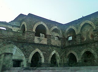
One Town also called the "old town", is located in Visakhapatnam City, India. The area falls under the local administrative limits of Greater Visakhapatnam Municipal Corporation,
Transport in Visakhapatnam is the network of roads, railways, rapid transit system in the largest city of Andhra Pradesh. The city of Visakhapatnam also serves as the central hub of transport and logistics on the East coast of India and hence it is called as City Of Destiny.
Town Kotha Road, also called Main Road of Visakhapatnam, is one of the important and old business roads in city.

Kapuluppada is a neighborhood situated on the northern part of Visakhapatnam City, India. The area, which falls under the local administrative limits of Greater Visakhapatnam Municipal Corporation, is about 25 km from the Visakhapatnam Railway Station.

Visalakshinagar is a neighborhood situated on the northern part of Visakhapatnam City, India. The area, which falls under the local administrative limits of Greater Visakhapatnam Municipal Corporation, is about 5 km from the Dwaraka Nagar which is city centre. Visalakshinagar is located at the entrance of Visakhapatnam City on National Highway 16.
Chinnamushidiwada is a neighborhood situated on the western part of Visakhapatnam City, India. The area, which falls under the local administrative limits of Greater Visakhapatnam Municipal Corporation, is about 18 km from the Dwaraka Bus Station. Chinnamushidiwada is located near to the Pendurthi and is served by the Visakhapatnam Bus Rapid Transit System.

Scindia is an important neighborhood situated on the coastal part of Visakhapatnam City, India. The area, which falls under the local administrative limits of Greater Visakhapatnam Municipal Corporation, it is one of the main industrial area in the city.
HB Colony is a neighborhood situated on the northern part of Visakhapatnam City, India. The area, which falls under the local administrative limits of Greater Visakhapatnam Municipal Corporation, is one of the residential area in the city.

The CBM Compound, also called the Canadian Baptist Mission Compound (CBM), is a neighborhood situated in the central part of Visakhapatnam City, India. The area, which falls under the local administrative limits of Greater Visakhapatnam Municipal Corporation, is one of the up-market localities. It is a commercial center of the old residential area in the Visakhapatnam City.