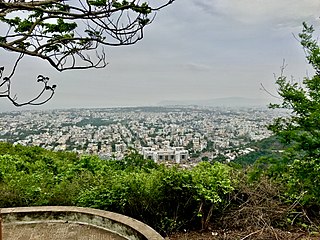
Visakhapatnam, also known as Vizag, Viśākha or Waltair, is the largest and most populous metropolitan city in the Indian state of Andhra Pradesh. It is between the Eastern Ghats and the coast of the Bay of Bengal. It is the second largest city on the east coast of India after Chennai, and the fourth-largest in South India. It is one of the four smart cities of Andhra Pradesh selected under the Smart Cities Mission and is the headquarters of Visakhapatnam district. With an estimated output of $43.5 billion, it is the ninth-largest contributor to India's gross domestic product as of 2016.

Asansol is a city in the Indian state of West Bengal. It is the one of the most populated cities of West Bengal and the 33rd largest urban agglomeration in India by population. Asansol is the district headquarters of Paschim Bardhaman district. According to a 2010 report released by the International Institute for Environment and Development, a UK-based policy research non-governmental body, Asansol was ranked 11th among Indian cities and 42nd in the world in its list of 100 fastest-growing cities. Asansol is classed as a Y-category city for calculation of HRA for public servants making it a "Tier-II" city.

Gajuwaka is a major residential area of Visakhapatnam City, India. This neighborhood of Visakhapatnam is considered the biggest shopping district in Andhra Pradesh by revenue. Though conceived as a residential locality, it is now one of the principal shopping districts of the city. The Gajuwaka area of Visakhapatnam has the highest per capita income in Andhra Pradesh.

Anakapalli is a residential neighborhood in the city of Visakhapatnam, also the headquarters of Anakapalli district of Andhra Pradesh. In 2015 Anakapalli municipality was merged with the Greater Visakhapatnam Municipal Corporation. It falls under zone 7 of GVMC. India's second largest jaggery market is located over here.

Parvathipuram is a municipality located at Parvathipuram Manyam district of Indian state of Andhra Pradesh. It is the administrative headquarters of Parvathipuram Manyam district and headquarters of Parvathipuram revenue division and Parvathipuram mandal. This revenue division shares a border with various districts in Odisha.

Pendurthi is a neighbourhood in the city of Visakhapatnam, India. The neighbourhood is considered as the major residential and commercial area in the city. It is located within the jurisdiction of the Greater Visakhapatnam Municipal Corporation, which is responsible for the civic amenities in Pendurthi. It is located on the west fringe of Visakhapatnam city. Pendurthi is one of the peaceful neighborhoods of Vizag.

NAD Kotha Road, or NAD X Road, is one of the major junctions and commercial centers in Visakhapatnam, India. It is named for the Naval Armament Depot. The Naval Armament Depot and (NSTL) Naval Science and Technological Laboratories is located here.

Pothinamallayya Palem or PM Palem, is a residential neighbourhood situated in Visakhapatnam city in the Indian state of Andhra Pradesh. It is located in the Greater Visakhapatnam Municipal Corporation area. It is located to the north of Visakhapatnam city on National Highway 16 (NH16) to Srikakulam. This place is well connected to other parts of the city such as Asilmetta and Maddilapalem. The only international cricket stadium in Andhra Pradesh is located here.
Isukathota is a locality in the Maddilapalem neighbourhood of Visakhapatnam, India. It is situated between Sivajipalem and Venkojipalem.

Greater Visakhapatnam Municipal Corporation (GVMC) is the civic body that governs the city of Visakhapatnam, largest city of the Indian state of Andhra Pradesh. Its jurisdiction encompasses an area of 640 km2 (250 sq mi). It is also part of the planning body of the Visakhapatnam Metropolitan Region Development Authority. Established in the year 1979, the executive power of the GVMC is vested in the Municipal Commissioner, an Indian Administrative Service officer appointed by the Government of Andhra Pradesh. The position is held by Saikanth Varma. Golagani Hari Venkata Kumari (YSRCP) was elected as the Mayor and Jiyyani Sridhar (YSRCP) as the Deputy Mayor by the newly elected general body in March 2021. In January 2021, the number of wards were increased to 98 from 81 earlier.
Prahaladapuram is a suburban area in Visakhapatnam city under Greater Visakhapatnam Municipal Corporation of Pendurthi in Andhra Pradesh, India. It is located 14 km Nomet from Visakhapatnam city center.

Adavivaram is a neighborhood situated on the western part of Visakhapatnam City, India. The area, which falls under the local administrative limits of Greater Visakhapatnam Municipal Corporation, is about 15 km from the Dwaraka Nagar which is city centre. Adavivaram is located at the foothill of Simhachalam temple and is served by the Visakhapatnam Bus Rapid Transit System.

Visalakshinagar is a neighborhood situated on the northern part of Visakhapatnam City, India. The area, which falls under the local administrative limits of Greater Visakhapatnam Municipal Corporation, is about 5 km from the Dwaraka Nagar which is city centre. Visalakshinagar is located at the entrance of Visakhapatnam City on National Highway 16.

Ramnagar is a neighborhood situated on the central part of Visakhapatnam City, India. The area, which falls under the local administrative limits of Greater Visakhapatnam Municipal Corporation. Ramnagar is located near Dwaraka Nagar, Asilmetta and Daba Gardens.

Scindia is an important neighborhood situated on the coastal part of Visakhapatnam City, India. The area, which falls under the local administrative limits of Greater Visakhapatnam Municipal Corporation, it is one of the main industrial area in the city.
HB Colony is a neighborhood situated on the northern part of Visakhapatnam City, India. The area, which falls under the local administrative limits of Greater Visakhapatnam Municipal Corporation, is one of the residential area in the city.

Waltair Uplands is a neighbourhood situated in the central part of Visakhapatnam City. The area, which falls under the local administrative limits of Greater Visakhapatnam Municipal Corporation, is one of the most expensive residential and commercial areas in the city. Waltair Uplands is located between Ramnagar and Siripuram and is known for the city's famous coffee shops like Third wave of coffee, Barista Lavazza, Yallop Gourmet Lavazza and Café Coffee Day. Waltair Uplands has become an area in which young people congregate. It is also known for its many shopping outlets.

The CBM Compound, also called the Canadian Baptist Mission Compound (CBM), is a neighborhood situated in the central part of Visakhapatnam City, India. The area, which falls under the local administrative limits of Greater Visakhapatnam Municipal Corporation, is one of the up-market localities. It is a commercial center of the old residential area in the Visakhapatnam City.
Mulagada is a neighbourhood in the city of Visakhapatnam, India. It is one of the 46 mandals in Visakhapatnam District. It is under the administration of Visakhapatnam revenue division and the headquarters is located at Mulagada. It is located on the south fringe of Visakhapatnam city.
Chengal Rao Peta is one of the oldest settlements in the city of Visakhapatnam in the Indian state of Andhra Pradesh.The area, which falls under the local administrative limits of Greater Visakhapatnam Municipal Corporation, is about 4 km from the Dwaraka bus station.