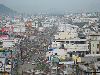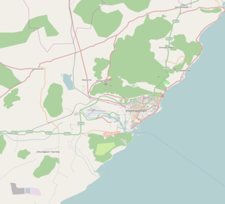
Visakhapatnam, formerly known as Vizagapatam is the proposed executive capital of the Indian state of Andhra Pradesh. It is also the most populated and largest city of Andhra Pradesh. It lies between the Eastern Ghats and the coast of the Bay of Bengal. It is the second largest city in the east coast of India after Chennai and also the fourth largest city in South India. It is one of the four smart cities of Andhra Pradesh selected under Smart Cities Mission. It also serves as the headquarters of Visakhapatnam district. With an estimated output of $43.5 billion, the city is the ninth largest contributor to India's overall Gross domestic product as of 2016. In 2020, Visakhapatnam emerged as the finalist in the World Smart City Awards under Living and Inclusion category.

Visakhapatnam district is one of the nine districts in the Coastal Andhra region of the Indian state of Andhra Pradesh, headquartered at Visakhapatnam. It is one of the nine coastal districts of the state, bounded by Odisha in the north, Vizianagaram district in the east, East Godavari district in the south-west and Bay of Bengal in the south.

Gajuwaka is a major residential area of Visakhapatnam City, India. The neighborhood of Visakhapatnam is considered the biggest shopping district in Andhra Pradesh by revenue. Though conceived as a residential locality, it is now one of the principal shopping districts of the city. Gajuwaka area of Visakhapatnam has the Highest per capita income in Andhra Pradesh.

Dr. Y. S. Rajasekhara Reddy International Cricket Stadium is a multi-purpose stadium in Visakhapatnam, Andhra Pradesh, India with a lush green outfield. It is primarily used for Cricket.
Indira Priyadarsini Stadium is located in the coastal city of Visakhapatnam, Andhra Pradesh.
Gangavaram Port, located in Visakhapatnam, Andhra Pradesh. Inaugurated in July 2009, it has a depth of 21m. It is managed by Gangavaram Port Ltd., a special-purpose company floated by Mr. DVS Raju, who serves as its chairman and managing director. The company is owned by the DVS Raju Group (58.1%), Adani Ports (31.5%) and the Andhra Pradesh Government (10.4%).

Visakhapatnam Port is one of 13 major ports in India and the only major port of Andhra Pradesh. It is India's third largest state-owned port by volume of cargo handled and largest on the Eastern Coast. It is located midway between the Chennai and Kolkata Ports on the Bay of Bengal.

The Khurda Road–Visakhapatnam section is a railway line connecting Khurda Road in the Indian state of Odisha and Visakhapatnam in Andhra Pradesh. The main line is part of the Howrah–Chennai main line.

Duvvada railway station located in the Indian state of Andhra Pradesh, serves Duvvada, the southern outskirts of Visakhapatnam. It lies on the Howrah–Chennai main line.

Maddilapalem is an area of Visakhapatnam, in the Indian state of Andhra Pradesh.

Seethammadhara is a neighborhood in the city of Visakhapatnam, India. The neighborhood is considered as the major residential area in the district. It is located within the jurisdiction of the Greater Visakhapatnam Municipal Corporation, which is responsible for the civic amenities in Seethammadhara. It is located in the central of Visakhapatnam city.

Malkapuram is a neighbourhood in the city of Visakhapatnam, India. The neighbourhood is considered as the major residential area in the district. It is located within the jurisdiction of the Greater Visakhapatnam Municipal Corporation, which is responsible for the civic amenities in Malkapuram. It is located on the south fringe of Visakhapatnam city.

Sriharipuram is a neighbourhood in the city of Visakhapatnam, India. The neighbourhood is considered as the major residential area in the district. It is located within the jurisdiction of the Greater Visakhapatnam Municipal Corporation, which is responsible for the civic amenities in Sriharipuram. It is located on the south fringe of Visakhapatnam city.

Simhachalam railway station, located in the Indian state of Andhra Pradesh, serves Simhachalam in Visakhapatnam district. It lies on the Howrah–Chennai main line.

The Greater Visakhapatnam Municipal Corporation (GVMC) is the civic body that governs the city of Visakhapatnam largest city of the Indian state of Andhra Pradesh. Its jurisdiction encompasses an area of 681.96 km2 (263.31 sq mi). It is also part of the planning body of the Visakhapatnam Metropolitan Region Development Authority. Established in the year 1979, the executive power of the GVMC is vested in the Municipal Commissioner, an Indian Administrative Service (IAS) officer appointed by the Government of Andhra Pradesh. The position is held by G. Srijana, IAS. Golagani Hari Venkata Kumari (YSRCP) was elected as the Mayor and Jiyyani Sridhar (YSRCP) as the Deputy Mayor by the newly elected general body in March 2021. In January 2021, the number of wards were increased to 98 from 81 earlier.

Kapuluppada is a neighborhood situated on the northern part of Visakhapatnam City, India. The area, which falls under the local administrative limits of Greater Visakhapatnam Municipal Corporation, is about 25 km from the Visakhapatnam Railway Station.

Mulagada is a neighbourhood in the city of Visakhapatnam, India. It is one of the 46 mandals in Visakhapatnam District. It is under the administration of Visakhapatnam revenue division and the headquarters is located at Mulagada. It is located on the south fringe of Visakhapatnam city.

The Visakhapatnam Metropolitan Region Development Authority (VMRDA) is the urban planning agency of Visakhapatnam in the Indian state of Andhra Pradesh. It was formed by expanding the existing Visakhapatnam Urban Development Authority (VUDA). The VMRDA administers the Visakhapatnam Metropolitan Region, spread over an area of 7,328.86 km2 (2,829.69 sq mi) and covers the districts of Visakhapatnam and Vizianagaram. It was set up for the purposes of planning, co-ordination, supervising, promoting and securing the planned development of the Visakhapatnam Metropolitan Region. It coordinates the development activities of the municipal corporations, municipalities and other local authorities.
South Coast Railway Zone (SCoR) has been announced as the newest railway zone of the Indian Railways and is headquartered at Visakhapatnam, Andhra Pradesh. The formal notification for operationalization of this Zone is yet to be issued.

Prakashraopeta is a neighborhood in the city of Visakhapatnam, India. It is one of the important neighborhood in Visakhapatnam city. It is under the administration of Greater Visakhapatnam Municipal Corporation and have so many commercial shops including District Court of Visakhapatnam.


