Gajuwaka is a major residential area of Visakhapatnam City, India. The neighborhood of Visakhapatnam is considered the biggest shopping district in Andhra Pradesh by revenue. Though conceived as a residential locality, it is now one of the principal shopping districts of the city. Gajuwaka area of Visakhapatnam has the Highest per capita income in Andhra Pradesh.

Anakapalle is a suburb of Visakhapatnam in the Indian state of Andhra Pradesh. The municipality was merged with Greater Visakhapatnam Municipal Corporation. It has the second largest jaggery market of the country.

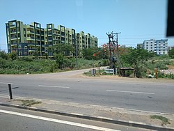
Duvvada is a suburban area of Visakhapatnam city, under the Revenue Mandal of Gajuwaka in Greater Visakhapatnam Municipal Corporation.
A sub-post Office located at Duvvada with pincode 530046 and 530049

Pedagantyada is a neighbourhood in the city of Visakhapatnam, India. It is one of the 46 mandals in Visakhapatnam District. It is under the administration of Visakhapatnam revenue division and the headquarters is located at Pedagantyada beside Gajuwaka. The Mandal is bounded by Mulagada and Gajuwaka mandals. It is a major Suburb in Visakhapatnam and got merged in Greater Visakhapatnam Municipal Corporation in 2005. Organisations like Visakhapatnam Steel Plant, and Gangavaram Port are located in this area.
Thunglam is a suburban area in Visakhapatnam, India.

Kurmannapalem is a Neighbourhood area of the city of Visakhapatnam, India and belongs to the Greater Visakhapatnam Municipal Corporation. It has a population of 60,588 and forms part of the Visakhapatnam city under Gajuwaka Revenue Mandal.

NAD X Road, or NAD Kotha Road, is one of the major junctions and commercial centers in Visakhapatnam, India. It is named for the Naval Armament Depot. The Naval Armament Depot and (NSTL) Naval Science and Technological Laboratories is located here.

Gopalapatnam is a neighborhood in the city of Visakhapatnam, India. The neighborhood is considered to be the major residential and commercial area in the district. It is located within the jurisdiction of the Greater Visakhapatnam Municipal Corporation, which is responsible for the area's civic amenities. It is located on the western fringe of Visakhapatnam. The Visakhapatnam gas leak occurred in the neighborhood on 7 May, 2020.

Railway New Colony is one of the commercial and residential centers in Visakhapatnam, India. Railway New Colony name coming from Railway colony. Indian Railways Residential area is located here.

Malkapuram is a neighbourhood in the city of Visakhapatnam, India. The neighbourhood is considered as the major residential area in the district. It is located within the jurisdiction of the Greater Visakhapatnam Municipal Corporation, which is responsible for the civic amenities in Malkapuram. It is located on the south fringe of Visakhapatnam city.

Sriharipuram is a neighbourhood in the city of Visakhapatnam, India. The neighbourhood is considered as the major residential area in the district. It is located within the jurisdiction of the Greater Visakhapatnam Municipal Corporation, which is responsible for the civic amenities in Sriharipuram. It is located on the south fringe of Visakhapatnam city.

Sheela Nagar is a neighborhood situated on the southern part of Visakhapatnam City, India. The area, which falls under the local administrative limits of Greater Visakhapatnam Municipal Corporation, is about 13 km from the Visakhapatnam Railway Station.
Visakhapatnam Metro is a planned rapid transit system for the city of Visakhapatnam in Andhra Pradesh, India. The system is proposed to reduce traffic congestion as well as providing a modern and efficient public transport system in the city which became the largest city and the main hub for economic activity of Andhra Pradesh after the state's bifurcation. It is will the only Indian city which has a combination of both metro and tram. Once constructed it will be the world's largest metro prepared in a PPP model. Initially proposed for Metro Rail alignment for a length of 42.55 km in the city. Now, Government have planned to expand the Metro Rail system to cover more routes in the city as well as in the VMRDA area.
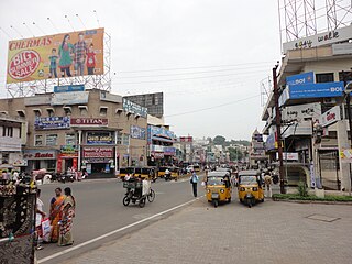
Town Kotha Road, also called Main Road of Visakhapatnam, is one of the important and old business roads in city.
Naidu Thota is a suburb of the city of Visakhapatnam state of Andhra Pradesh, India.

Kirlampudi Layout is a neighbourhood of the city of Visakhapatnam, state of Andhra Pradesh, India.

Scindia is an important neighborhood situated on the coastal part of Visakhapatnam City, India. The area, which falls under the local administrative limits of Greater Visakhapatnam Municipal Corporation, it is one of the main industrial area in the city.
Narava is a neighborhood situated on the western part of Visakhapatnam City, India. The area, which falls under the local administrative limits of Greater Visakhapatnam Municipal Corporation, is about 11 km from the Gajuwaka which is industrial area in the city. there are so many engineering and polytechnic colleges are located hear. APSRTC is providing 400S & 6B city bus routes to this area.
Desapatrunipalem is a suburb situated in Visakhapatnam City, India. The area, which falls within the local administrative limits of Greater Visakhapatnam Municipal Corporation, is quite close to the Visakhapatnam Steel Plant site. Desapatrunipalem is a pleasant residential colony, well connected with Gajuwaka, and has experienced a real estate boom.
Mulagada is a neighbourhood in the city of Visakhapatnam, India. It is one of the 46 mandals in Visakhapatnam District. It is under the administration of Visakhapatnam revenue division and the headquarters is located at Mulagada. It is located on the south fringe of Visakhapatnam city.