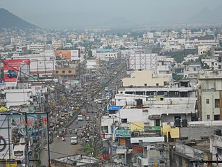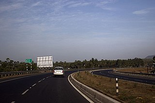
Visakhapatnam, also known as Vizag, Viśākha or Waltair, is the largest and most populous metropolitan city in the Indian state of Andhra Pradesh. It is between the Eastern Ghats and the coast of the Bay of Bengal. It is the second largest city on the east coast of India after Chennai, and the fourth-largest in South India. It is one of the four smart cities of Andhra Pradesh selected under the Smart Cities Mission and is the headquarters of Visakhapatnam district. With an estimated output of $43.5 billion, it is the ninth-largest contributor to India's gross domestic product as of 2016.

Visakhapatnam district is one of the six districts in the Uttarandhra region of the Indian state of Andhra Pradesh, headquartered at Visakhapatnam. It is one of the twenty-six districts in Andhra Pradesh state. The district shares borders within the north and east, Vizianagaram district and South Anakapalli district in the south-west and Bay of Bengal in the south.

Gajuwaka is a major residential area of Visakhapatnam City, India. This neighborhood of Visakhapatnam is considered the biggest shopping district in Andhra Pradesh by revenue. Though conceived as a residential locality, it is now one of the principal shopping districts of the city. The Gajuwaka area of Visakhapatnam has the highest per capita income in Andhra Pradesh.

Padmanabham mandal is one of the 46 mandals in Visakhapatnam District in India. It is under the administration of Bhemunipatnam revenue division and the headquarters is located at Padmanabham. The Mandal is bounded by Bheemunipatnam, Anandapuram mandals in Visakhapatnam District and Bhogapuram mandal in Vizianagaram District. Great freedom fighter Alluri Sitarama Raju was born in Pandrangi village in this Mandal.Rajasagi Suryanarayana Raju, MLA Bheemili from 1972–78 is from this Mandal. Also Rajasagi Appalanarasimha Raju MLA Bheemili from 1985 to 2004 is also from this Mandal.

Atchutapuram is a neighborhood in Visakhapatnam and is part of Anakapalli district, in the Indian state of Andhra Pradesh.

Marripalem is a neighbourhood area in Visakhapatnam. It is a residential area in the city. It has many population settlements with high raised buildings and apartments.

Anandapuram is a suburb and a mandal of Visakhapatnam district in the state of Andhra Pradesh, India.

Kasimkota is a village in Anakapalli district in the state of Andhra Pradesh in India. Kasimkota was one of the notable villages affected by Cyclone Hudhud.
Munagapaka is a village in Anakapalli district in the state of Andhra Pradesh in India. Munagapaka pin code 531033. In Munagapaka there are nearly more than 2000 houses with population more than 8000. Munagapaka is under the Yelamanchili constituency. Munagapaka is also the mandal center for nearly 35 villages.
Pedagantyada is a neighbourhood in the city of Visakhapatnam, India. It is one of the 46 mandals in Visakhapatnam District. It is under the administration of Visakhapatnam revenue division and the headquarters is located at Pedagantyada beside Gajuwaka. The Mandal is bounded by Mulagada and Gajuwaka mandals. It is a major Suburb in Visakhapatnam and got merged in Greater Visakhapatnam Municipal Corporation in 2005. Organisations like Visakhapatnam Steel Plant, and Gangavaram Port are located in this area.

Pendurthi is a neighbourhood in the city of Visakhapatnam, India. The neighbourhood is considered as the major residential and commercial area in the city. It is located within the jurisdiction of the Greater Visakhapatnam Municipal Corporation, which is responsible for the civic amenities in Pendurthi. It is located on the west fringe of Visakhapatnam city. Pendurthi is one of the peaceful neighborhoods of Western Vizag. The pincode of Pendurthi is 531173.

Sabbavaram mandal is a mandal in Anakapalli district in the state of Andhra Pradesh in India.

Rajula Tallavalasa is a village on the Kolkata–Chennai National Highway in Visakhapatnam District. It is a village Panchayat under Bhimili mandal Revenue Division. It is 5 kilometres away from bheemunipatnam beach. This is an educated village. This village has 2 government schools. It is 27 kilometres far from Visakhapatnam city but it has frequent government bus transport as well as private transport available for journey to visakhapatnam city. The pin code of Rajula Tallavalasa is 531162.

Duvvada railway station located in the Indian state of Andhra Pradesh, serves Duvvada, the southern outskirts of Visakhapatnam. It lies on the Howrah–Chennai main line.

Seethammadhara is a neighborhood in the city of Visakhapatnam, India. The neighborhood is considered as the major residential area in the district. It is located within the jurisdiction of the Greater Visakhapatnam Municipal Corporation, which is responsible for the civic amenities in Seethammadhara. It is located in the central of Visakhapatnam city. Seethammadhara mandal is one of the 46 mandals of Visakhapatnam District. It is under the administration of Visakhapatnam revenue division and the headquarters is located at Seethammadhara. The Mandal is bounded by Gopalapatnam, Maharanipeta and Bheemunipatnam mandals.

Visakhapatnam Airport, officially known as Visakhapatnam International Airport, is a customs airport in Visakhapatnam, Andhra Pradesh, India. It also operates as a civil enclave on an Indian Navy airbase named INS Dega. It lies between the city localities of NAD X Road and Gajuwaka. The airport covers an area of 350 acres. The airport has experienced significant growth since the beginning of the 21st century, with the construction of a new terminal and runway and the commencing of international flights.
Prahaladapuram is a suburban area in Visakhapatnam city under Greater Visakhapatnam Municipal Corporation of Pendurthi in Andhra Pradesh, India. It is located 14 km Nomet from Visakhapatnam city center.

Anakapalle railway station is a railway station in Anakapalle, a neighbourhood of Visakhapatnam city, Anakapalli district in Andhra Pradesh. It lies on the Vijayawada–Chennai section and is administered under Vijayawada railway division of South Coast Railway zone. It is the most busiuest railway station in north Andhra.Rajadhani,garibradth,doubledecker,antyodhaya expresses halt at this station. Anakapalle is the main station after the visakhapatnam Junction.

G. Koduru is a village in Anakapalli district of the Indian state of Andhra Pradesh.
Salipeta is a neighbourhood of Visakhapatnam, India.


