Koti is a locality in the city of Hyderabad, Telangana, India. It is one of the best-known commercial Old Suburbs of Hyderabad. There are two areas in the vicinity: King Koti and Ram Koti.

Marripalem is a neighbourhood area in Visakhapatnam. It is a residential area in the city. It has many population settlements with high raised buildings and apartments.
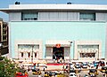
Dvaraka, Dwaraka, Dwarka may refer to:

Visakhapatnam BRTS :-The implementation of the bus rapid transit system has been taken up as a high- capacity public transport system in Visakhapatnam keeping in view the projected multi-fold increase in traffic and constraints of road capacity. A Bus Rapid Transit System (BRTS) was approved for the city under the JNNURM. This project is under construction and will be completed by the end of 2010. The BRTS intends to increase use of public transport from the present share of about 30 per cent to 50 per cent by 2011.

Madhurawada is a major business and residential area of Visakhapatnam City in the Andhra Pradesh State. It is located on the Visakhapatnam-Vizianagaram stretch of NH16 at around 16 km from Visakhapatnam City Centre. Dr.YSR International Cricket stadium and Shilparamam Jathara of Visakhapatnam also lies in this suburb.

Siripuram is an urban commercial center in Visakhapatnam, Andhra Pradesh, India. Visakhapatnam Metropolitan Region Development Authority administrative office is located here. There are many buildings landmark to this area.

Asilmetta is a neighborhood in Visakhapatnam of Andhra Pradesh, India. In the olden days, the government collected taxes in this area and hence, the name Asilmetta.

Daba Gardens is a neighborhood in Visakhapatnam, Andhra Pradesh, India. It is hub for shopping malls, electronic shopping especially, shopping for cell phones, restaurants, educational institutes etc. LIC building is the main landmark in this area. BSNL office is also situated here.

Maddilapalem is an area of Visakhapatnam, in the Indian state of Andhra Pradesh.

Suryabagh is one of the old suburbs in Visakhapatnam, Andhra Pradesh, India, close to, Jagadamba Centre. Suryabagh is the hub of electronics and hardware shops.
Arilova is a residential area of Visakhapatnam, Andhra Pradesh, India. It is located on the north fringe of Visakhapatnam city with hills surrounding on opposite sides. It is located beside Kailasagiri. Arilova is a Part of GVMC Greater Visakhapatnam Municipal Corporation, which is responsible for the civic amenities in Arilova.

Resupuvanipalem is a neighborhood in Visakhapatnam, Andhra Pradesh, India.

Prahaladapuram is a suburban area in Visakhapatnam city under Greater Visakhapatnam Municipal Corporation of Pendurthi in Andhra Pradesh, India.It is located 14 km Nomet from Visakhapatnam city center.
Transport in Visakhapatnam is the network of roads, railways, rapid transit system in the largest city of Andhra Pradesh. The city of Visakhapatnam also serves as the central hub of transport and logistics on the East coast of India and hence it is called as City Of Destiny.

Velmpeta is a popular commercial area in the city of Visakhapatnam in the Indian state of Andhra Pradesh.The area, which falls under the local administrative limits of Greater Visakhapatnam Municipal Corporation, is about 4 km from the Dwaraka bus station.

Sagar Nagar is a neighborhood of the city of Visakhapatnam, Andhra Pradesh, India, on the coast of the Bay of Bengal.

Madhavadhara is a recedential area of the city of Visakhapatnam state of Andhra Pradesh, India.

Kommadi is a suburb of the city of Visakhapatnam state of Andhra Pradesh, India.

The CBM Compound, also called the Canadian Baptist Mission Compound (CBM), is a neighborhood situated in the central part of Visakhapatnam City, India. The area, which falls under the local administrative limits of Greater Visakhapatnam Municipal Corporation, is one of the up-market localities. It is a commercial center of the old residential area in the Visakhapatnam City.
Chengal Rao Peta is one of the oldest settlements in the city of Visakhapatnam in the Indian state of Andhra Pradesh.The area, which falls under the local administrative limits of Greater Visakhapatnam Municipal Corporation, is about 4 km from the Dwaraka bus station.