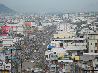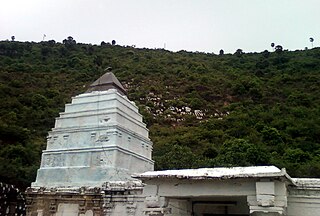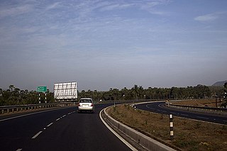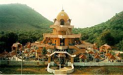
Vizianagaram district is one of the six districts in the Uttarandhra region of the Indian state of Andhra Pradesh with its headquarters located at Vizianagaram. The district was once the part of ancient Kalinga.Saripilli Dibbilingeswara temple, Jayathi Mallikarjuna Temple are the finest examples of ancient Eastern Ganga Dynasty built monuments in the district. The district is bounded on the east by the district of Srikakulam, north by Parvathipuram Manyam south by Visakhapatnam, Anakapalli, southeast by the Bay of Bengal, and west by Alluri Sitharama Raju district. It was formed on 1 June 1979, with some parts carved from the neighbouring districts of Srikakulam and Visakhapatnam. The district is named after the princely state of Vizianagaram. In 2011, it was the least populous district in Andhra Pradesh.

Gajuwaka is a major residential area of Visakhapatnam City, India. This neighborhood of Visakhapatnam is considered the biggest shopping district in Andhra Pradesh by revenue. Though conceived as a residential locality, it is now one of the principal shopping districts of the city. The Gajuwaka area of Visakhapatnam has the highest per capita income in Andhra Pradesh.

Pakala is a town in Tirupati district of the Indian state of Andhra Pradesh. It is the mandal headquarters of Pakala mandal. It comes under Tirupati revenue division.
Saravakota is a village in Srikakulam district of the Indian state of Andhra Pradesh. It is located in Saravakota mandal of Palakonda revenue division.

Atchutapuram is a mandal in Anakapalli district, in the Indian state of Andhra Pradesh.

Anandapuram is a suburb and a mandal of Visakhapatnam district in the state of Andhra Pradesh, India.
Chintapalli is a major tourist and historic town and mandal in Alluri Sitharama Raju district in the Indian state of Andhra Pradesh.

Devarapalli is a village and a Mandal in Anakapalli district in the state of Andhra Pradesh in India.
Golugonda is a village and a Mandal in Anakapalli district in the state of Andhra Pradesh in India. This village is famous for availability of semi-precious stones. Special police squads have been formed to prevent illegal quarrying of semi-precious stones both here and in other mandals in the district.
K.Kotapadu is a mandal in Anakapalli district in the state of Andhra Pradesh in India.

Rambilli is a village and a Mandal in Anakapalli district in the state of Andhra Pradesh in India. There is a famous Lord Shiva Temple "Sri Dharalingeswara Swamy Temple" in Rambilli mandal at Panchadaarla in Dharapalem village It is also the site of INS Varsha, an upcoming Indian Navy base.
Ravikamatham is a village and mandal headquarters of Ravikamatham mandal in Anakapalli district in the state of Andhra Pradesh in India.

Elamanchili is a town in Anakapalli district of the Indian state of Andhra Pradesh. It is a municipality and also the mandal headquarters of Elamanchili mandal. The town is spread over an area of 39 km2 (15 sq mi), which is under the jurisdiction of Visakhapatnam Metropolitan Region Development Authority. This town has historical importance dating back to 7th Century AD.
Bheemunipatnam mandal is one of the 46 mandals in Visakhapatnam District. It is under the administration of Bhemunipatnam revenue division and the headquarters is located at Bheemunipatnam. The Mandal is bounded by Padmanabham, Anandapuram mandals in Visakhapatnam District and Bhogapuram mandal in Vizianagaram District. It is a major Suburb and got merged in Greater Visakhapatnam Municipal Corporation. Organisations like INS Kalinga is located in this area.

Duggirala mandal is one of the 18 mandals in Guntur district of the Indian state of Andhra Pradesh. It is under the administration of Tenali revenue division and the headquarters are located at Duggirala. The mandal is bounded by Mangalagiri, Pedakakani, Tenali and Kollipara mandals. Krishna River lies to the northeast of the Duggirala mandal.

Narasaraopet mandal is one of the 28 mandals in Guntur district of the India state of Andhra Pradesh. It is under the administration of Narasaraopet revenue division and the headquarters are located at Narasaraopet city. The mandal is bounded by Rompicherla, Nekarikallu, Muppalla, Phirangipuram, Nadendla and Chilakaluripeta. It also borders Prakasam district.

Atchampet mandal is one of the 28 mandals in Palnadu district of the Indian state of Andhra Pradesh. The mandal is under the administration of Sattenapalli revenue division and the headquarters are located at Chamarru. The mandal is located on the banks of Krishna River, at a distance 68 km from the district headquarters. It is bounded by Amaravathi, Krosuru, Pedakurapadu, Bellamkonda and Sattenapalli mandals.
Anakapalli mandal is one of the mandals in located in Anakapalli district of the state of Andhra Pradesh, India. It is administered under Anakapalli revenue division and its headquarters are located at Anakapalli. It is bounded by Kasimkota Mandal towards west, Munagapaka Mandal towards South, Paravada Mandal towards East, Achutapuram Mandal towards South.
Rowthulapudi Mandal is one of the 21 mandals in Kakinada District of Andhra Pradesh. As per census 2011, there are 38 villages.

Anakapalli district is a district in the Indian state of Andhra Pradesh. It was formed on 4 April 2022 from Anakapalli and Narsipatnam revenue divisions of the old Visakhapatnam district. The administrative headquarters are at Anakapalli.


