
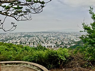
Visakhapatnam, formerly known as Vizagapatam is the proposed executive capital of the Indian state of Andhra Pradesh. It is also the most populated and largest city of Andhra Pradesh. It lies between the Eastern Ghats and the coast of the Bay of Bengal. It is the second largest city in the east coast of India after Chennai and also the fourth largest city in South India. It is one of the four smart cities of Andhra Pradesh selected under Smart Cities Mission. It also serves as the headquarters of Visakhapatnam district. With an estimated output of $43.5 billion, the city is the ninth largest contributor to India's overall Gross domestic product as of 2016. In 2020, Visakhapatnam emerged as the finalist in the World Smart City Awards under Living and Inclusion category.

Damanjodi is a town located in the Koraput district of the Indian state of Odisha in the Eastern Ghats. As of 2001, its population was 8,469. The town was founded as a residential area for employees of the National Aluminium Company (NALCO), a company that was established to harness the bauxite-rich deposits of the Panchpatmali Range. Damanjodi contains the NALCO Township, a residential area for employees of NALCO, Mathalput, a semi-urban neighborhood with shops, and Bhejaput, a shopping complex. The population is considered cosmopolitan in nature with employees from all over India and locals from the tribal region...

Gajuwaka is a major residential area of Visakhapatnam City, India. The neighborhood of Visakhapatnam is considered the biggest shopping district in Andhra Pradesh by revenue. Though conceived as a residential locality, it is now one of the principal shopping districts of the city. Gajuwaka area of Visakhapatnam has the Highest per capita income in Andhra Pradesh.
Yousufguda is a neighbourhood in Hyderabad, Telangana, India. It is a major residential suburb.

LuLu International Shopping Mall is a shopping mall located in Edappally Kochi, Kerala. The mall its car parking facility, the convention center and the hotel altogether got total area of 1.85 million sq ft. With an average daily footfall of more than 80,000, it is one of the most visited places in Kerala. Spanning 17 acres (6.9 ha), the mall has a total retail space of 6.2 lakh sq ft. A hotel and convention center totaling 0.35 million sq feet is also build along with the project. The mall was opened in March 2013. It contains more than 225 outlets, including food courts, restaurants, family entertainment zones, a multiplex, ice skating rink, gaming arena, Beauty parlours, a toy train joy ride and bowling alley. Multiple events are usually conducted in the main atrium. The estimated cost for this project is more than ₹16 billion or US$250 million. The property is owned and managed by Yusuff Ali M.A. Chairman and Managing Director of Lulu Group International. LuLu Mall in Kochi was their maiden retail venture in India.

Asilmetta is a neighborhood in Visakhapatnam of Andhra Pradesh, India. In the olden days, the government collected taxes in this area and hence, the name Asilmetta.

Maddilapalem is an area of Visakhapatnam, in the Indian state of Andhra Pradesh.

Suryabagh is one of the old suburbs in Visakhapatnam, Andhra Pradesh, India, close to, Jagadamba Centre. Suryabagh is the hub of electronics and hardware shops.

NAD X Road, or NAD Kotha Road, is one of the major junctions and commercial centers in Visakhapatnam, India. It is named for the Naval Armament Depot. The Naval Armament Depot and (NSTL) Naval Science and Technological Laboratories is located here.

Railway New Colony is one of the commercial and residential centers in Visakhapatnam, India. Railway New Colony name coming from Railway colony. Indian Railways Residential area is located here.

Arilova is a residential area of Visakhapatnam, Andhra Pradesh, India. It is located on the north fringe of Visakhapatnam city with hills surrounding on opposite sides. It is located beside Kailasagiri. Arilova is a Part of GVMC Greater Visakhapatnam Municipal Corporation, which is responsible for the civic amenities in Arilova.

Dondaparthy is a mixed residential zone and commercial area in central Visakhapatnam. It is an important neighborhood in Visakhapatnam.
Sivajipalem is a locality in Visakhapatnam, Andhra Pradesh, India. It is one of the costliest suburbs with high real estate cost both for commercial and residential properties.

Pothinamallayya Palem or PM Palem, is a residential neighbourhood within Madhurawada situated in Visakhapatnam city in the Indian state of Andhra Pradesh. It is located in the Greater Visakhapatnam Municipal Corporation area. It is located to the north of Visakhapatnam city on National Highway 16 (NH16) to Srikakulam. This place is well connected to other parts of the city such as Asilmetta and Maddilapalem. The only international cricket stadium in Andhra Pradesh is located here.
Isukathota is a locality in the Maddilapalem neighbourhood of Visakhapatnam, India. It is situated between Sivajipalem and Venkojipalem.

Ramnagar is a neighborhood situated on the central part of Visakhapatnam City, India. The area, which falls under the local administrative limits of Greater Visakhapatnam Municipal Corporation. Ramnagar is located near Dwaraka Nagar, Asilmetta and Daba Gardens.

The CBM Compound, also called the Canadian Baptist Mission Compound (CBM), is a neighborhood situated in the central part of Visakhapatnam City, India. The area, which falls under the local administrative limits of Greater Visakhapatnam Municipal Corporation, is one of the up-market localities. It is a commercial center of the old residential area in the Visakhapatnam City.
Rama Talkies Road is a major road in the Indian city of Visakhapatnam. The name of the road is derived from a movie theater that is located nearby. It is one of the busiest roads that connects to Dwaraka Bus Station.

