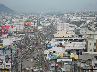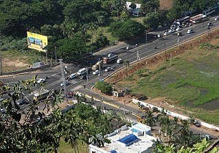
Gajuwaka is a major residential area of Visakhapatnam City, India. This neighborhood of Visakhapatnam is considered the biggest shopping district in Andhra Pradesh by revenue. Though conceived as a residential locality, it is now one of the principal shopping districts of the city. The Gajuwaka area of Visakhapatnam has the highest per capita income in Andhra Pradesh.

Andhra Pradesh State Road Transport Corporation, officially Andhra Pradesh Raastra Roadu Ravaana Samstha, is the state-owned road transport corporation in the Indian state of Andhra Pradesh. Its headquarters is located at NTR Administrative Block of RTC House in Pandit Nehru bus station of Vijayawada. Many other Indian metro towns in Telangana, Tamil Nadu, Karnataka, Odisha, Yanam, Kerala, Maharashtra and Chhattisgarh are also linked with the APSRTC services.
Pedagantyada is a neighbourhood in the city of Visakhapatnam, India. It is one of the 46 mandals in Visakhapatnam District. It is under the administration of Visakhapatnam revenue division and the headquarters is located at Pedagantyada beside Gajuwaka. The Mandal is bounded by Mulagada and Gajuwaka mandals. It is a major Suburb in Visakhapatnam and got merged in Greater Visakhapatnam Municipal Corporation in 2005. Organisations like Visakhapatnam Steel Plant, and Gangavaram Port are located in this area.

Pendurthi is a neighbourhood in the city of Visakhapatnam, India. The neighbourhood is considered as the major residential and commercial area in the city. It is located within the jurisdiction of the Greater Visakhapatnam Municipal Corporation, which is responsible for the civic amenities in Pendurthi. It is located on the west fringe of Visakhapatnam city. Pendurthi is one of the peaceful neighborhoods of Western Vizag. The pincode of Pendurthi is 531173.

Visakhapatnam BRTS :-The implementation of the bus rapid transit system has been taken up as a high-capacity public transport system in Visakhapatnam keeping in view the projected multi-fold increase in traffic and constraints of road capacity. A Bus Rapid Transit System (BRTS) was approved for the city under the Jawaharlal Nehru National Urban Renewal Mission. This project was started in 2008 and most of the route has been constructed except for a 2km stretch near Simhachalam. The delay is due to issues in land acquisition from railways, defence and private parties.

Madhurawada is a major business and residential area of Visakhapatnam in the state of Andhra Pradesh. It is located on the Visakhapatnam-Vizianagaram stretch of National Highway 16 around 16 km from the city center of Visakhapatnam.

Maddilapalem is an area of Visakhapatnam, in the Indian state of Andhra Pradesh.

Seethammadhara is a neighborhood in the city of Visakhapatnam, India. The neighborhood is considered as the major residential area in the district. It is located within the jurisdiction of the Greater Visakhapatnam Municipal Corporation, which is responsible for the civic amenities in Seethammadhara. It is located in the central of Visakhapatnam city. Seethammadhara mandal is one of the 46 mandals of Visakhapatnam District. It is under the administration of Visakhapatnam revenue division and the headquarters is located at Seethammadhara. The Mandal is bounded by Gopalapatnam, Maharanipeta and Bheemunipatnam mandals.

NAD Kotha Road, or NAD X Road, is one of the major junctions and commercial centers in Visakhapatnam, India. It is named for the Naval Armament Depot. The Naval Armament Depot and (NSTL) Naval Science and Technological Laboratories is located here.

Kancharapalem is a locality in the city of Visakhapatnam, India. Kancharapalem is an old settlement of Visakhapatanam. It has the oldest railway locomotive shed, the first Industrial estate of Visakhapatnam, Govt. Industrial training Institute. Government polytechnic college railway quarters, port and Navy quarters are located in this area. The oldest bridge in the town is located here known as Gnanapuram Bridge.

Bheemili Beach is located at the origin of the Gosthani River, at a distance of 24 km from Visakhapatnam in Visakhapatnam district of the Indian state of Andhra Pradesh. The beach reflects the British and Dutch settlements of the 17th century.

Hanumanthuwaka is an area of Visakhapatnam, Andhra Pradesh, India. The Visakhapatnam BRTS connects Hanumanthuwaka to Simhachalam. Hanumanthuwaka was an initially a small suburb outside Visakhapatnam.

Sriharipuram is a neighbourhood in the city of Visakhapatnam, India. The neighbourhood is considered as the major residential area in the district. It is located within the jurisdiction of the Greater Visakhapatnam Municipal Corporation, which is responsible for the civic amenities in Sriharipuram. It is located on the south fringe of Visakhapatnam city.
Allipuram is one of the oldest suburbs in Visakhapatnam, Andhra Pradesh, India, close to Visakhapatnam Railway Station. It is near shore to Bay of Bengal. In 1753, Nizam Fauzdar Zafar Ali Khan ruled Visakhapatnam as the center of Chicaco. Allipuram was once a prosperous village, which was frequented by traders who picked up the produce of smiths and weavers. More importantly, the village was once known as Alivelu Manga Puram. Over time it became Allipuram in popular usage. As part of the Salt Satyagraha, Mahatma Gandhi walked along the Allipuram main road to the coast. Because of this, the locals set up a statue of Gandhi on the main road.

Resupuvanipalem is a neighborhood in Visakhapatnam, Andhra Pradesh, India.

Pothinamallayya Palem or PM Palem, is a residential neighbourhood situated in Visakhapatnam city in the Indian state of Andhra Pradesh. It is located in the Greater Visakhapatnam Municipal Corporation area. It is located to the north of Visakhapatnam city on National Highway 16 (NH16) to Srikakulam. This place is well connected to other parts of the city such as Asilmetta and Maddilapalem. The only international cricket stadium in Andhra Pradesh is located here.
Abidnagar is a residential area located in Akkayyapalem, Visakhapatnam, India. It comes under Greater Visakhapatnam Municipal Corporation.

Aganampudi is a suburb of the city of Visakhapatnam state of Andhra Pradesh, India.

Scindia is an important neighborhood situated on the coastal part of Visakhapatnam City, India. The area, which falls under the local administrative limits of Greater Visakhapatnam Municipal Corporation, it is one of the main industrial area in the city.
Narava is a neighborhood situated on the western part of Visakhapatnam City, India. The area, which falls under the local administrative limits of Greater Visakhapatnam Municipal Corporation, is about 11 km from the Gajuwaka which is industrial area in the city. there are so many engineering and polytechnic colleges are located hear. APSRTC is providing 400S & 6B city bus routes to this area.


