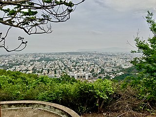
Visakhapatnam, also known as Vizag, Viśākha or Waltair, is the largest and most populous metropolitan city in the Indian state of Andhra Pradesh. It is between the Eastern Ghats and the coast of the Bay of Bengal. It is the second largest city on the east coast of India after Chennai, and the fourth largest in South India. It is one of the four smart cities of Andhra Pradesh selected under the Smart Cities Mission and is the headquarters of Visakhapatnam district. With an estimated output of $43.5 billion, it is the ninth largest contributor to India's gross domestic product as of 2016.

Srungavarapukota, popularly known by its abbreviated form S.Kota, is a neighbourhood in the district of Vizianagaram, India. S.Kota is located on Visakhapatnam – Araku road. The town was upgraded from gram panchayat to Nagar Panchayat in the year 2011.
Pedagantyada is a neighbourhood in the city of Visakhapatnam, India. It is one of the 46 mandals in Visakhapatnam District. It is under the administration of Visakhapatnam revenue division and the headquarters is located at Pedagantyada beside Gajuwaka. The Mandal is bounded by Mulagada and Gajuwaka mandals. It is a major Suburb in Visakhapatnam and got merged in Greater Visakhapatnam Municipal Corporation in 2005. Organisations like Visakhapatnam Steel Plant, and Gangavaram Port are located in this area.

Pendurthi is a neighbourhood in the city of Visakhapatnam, India. The neighbourhood is considered as the major residential and commercial area in the city. It is located within the jurisdiction of the Greater Visakhapatnam Municipal Corporation, which is responsible for the civic amenities in Pendurthi. It is located on the west fringe of Visakhapatnam city. Pendurthi is one of the peaceful neighborhoods of Western Vizag. The pincode of Pendurthi is 531173.

Malkapuram is a neighbourhood in the city of Visakhapatnam, India. The neighbourhood is considered as the major residential area in the district. It is located within the jurisdiction of the Greater Visakhapatnam Municipal Corporation, which is responsible for the civic amenities in Malkapuram. It is located on the south fringe of Visakhapatnam city.

Sriharipuram is a neighbourhood in the city of Visakhapatnam, India. The neighbourhood is considered as the major residential area in the district. It is located within the jurisdiction of the Greater Visakhapatnam Municipal Corporation, which is responsible for the civic amenities in Sriharipuram. It is located on the south fringe of Visakhapatnam city.
Isukathota is a locality in the Maddilapalem neighbourhood of Visakhapatnam, India. It is situated between Sivajipalem and Venkojipalem.
Rushikonda is a neighbourhood situated on Visakhapatnam and Bheemili road. Visakhapatnam Metropolitan Region Development Authority undertakes the development activities related to infrastructure and tourism.

Yendada is a neighbourhood situated on Visakhapatnam and Madhurawada road.
Transport in Visakhapatnam is the network of roads, railways, rapid transit system in the largest city of Andhra Pradesh. The city of Visakhapatnam also serves as the central hub of transport and logistics on the East coast of India and hence it is called as City Of Destiny.

Lankelapalem is a neighbourhood in the city of Visakhapatnam, state of Andhra Pradesh, India. It is a suburb of the city.
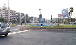
Town Kotha Road, also called Main Road of Visakhapatnam, is one of the important and old business roads in city.

Pandurangapuram is a neighborhood situated on the coastal part of Visakhapatnam City, India. The area, which falls under the local administrative limits of Greater Visakhapatnam Municipal Corporation, is about 4 km from the Dwaraka Nagar which is city centre. Pandurangapuram is located at the besides of Bay of Bengal and its totally surrounded by Maharanipeta, Kirlampudi Layout and Daspalla Hills.

Waltair Uplands is a neighbourhood situated in the central part of Visakhapatnam City. The area, which falls under the local administrative limits of Greater Visakhapatnam Municipal Corporation, is one of the most expensive residential and commercial areas in the city. Waltair Uplands is located between Ramnagar and Siripuram and is known for the city's famous coffee shops like Third wave of coffee, Barista Lavazza, Yallop Gourmet Lavazza and Café Coffee Day. Waltair Uplands has become an area in which young people congregate. It is also known for its many shopping outlets.
Mulagada is a neighbourhood in the city of Visakhapatnam, India. It is one of the 46 mandals in Visakhapatnam District. It is under the administration of Visakhapatnam revenue division and the headquarters is located at Mulagada. It is located on the south fringe of Visakhapatnam city.
Sontyam is a neighbourhood in the city of Visakhapatnam, state of Andhra Pradesh, India. It is a suburb of the city.
Vadlapudi is a neighbourhood in the city of Visakhapatnam, state of Andhra Pradesh, India. It is a suburban area of the city.
Balayya Sastri Layout is a neighbourhood of Visakhapatnam, Andhra Pradesh, India.
Soldierpet is one of the oldest neighbourhoods in Visakhapatnam, Andhra Pradesh, India. In the 18th century the area was a residential colony for the British Army.