
Visakhapatnam, also known as Vizag, Viśākha or Waltair, is the largest and most populous metropolitan city in the Indian state of Andhra Pradesh. It is between the Eastern Ghats and the coast of the Bay of Bengal. It is the second largest city on the east coast of India after Chennai, and the fourth-largest in South India. It is one of the four smart cities of Andhra Pradesh selected under the Smart Cities Mission and is the headquarters of Visakhapatnam district. With an estimated output of $43.5 billion, it is the ninth-largest contributor to India's gross domestic product as of 2016.

Araku Valley is a hill station in Alluri Sitharama Raju district in the Indian state of Andhra Pradesh, lying 111 km west of Visakhapatnam city. It is a valley in the Eastern Ghats inhabited by different tribes, mainly Araku Tribes.

Vizianagaram district is one of the six districts in the Uttarandhra region of the Indian state of Andhra Pradesh with its headquarters located at Vizianagaram. The district was once the part of ancient Kalinga.Saripilli Dibbilingeswara temple, Jayathi Mallikarjuna Temple are the finest examples of ancient Eastern Ganga Dynasty built monuments in the district. The district is bounded on the east by the district of Srikakulam, north by Parvathipuram Manyam south by Visakhapatnam, Anakapalli, southeast by the Bay of Bengal, and west by Alluri Sitharama Raju district. It was formed on 1 June 1979, with some parts carved from the neighbouring districts of Srikakulam and Visakhapatnam. The district is named after the princely state of Vizianagaram. In 2011, it was the least populous district in Andhra Pradesh.

Visakhapatnam district is one of the six districts in the Uttarandhra region of the Indian state of Andhra Pradesh, headquartered at Visakhapatnam. It is one of the twenty-six districts in Andhra Pradesh state. The district shares borders within the north and east, Vizianagaram district and South Anakapalli district in the south-west and Bay of Bengal in the south.

Gajuwaka is a major residential area of Visakhapatnam City, India. This neighborhood of Visakhapatnam is considered the biggest shopping district in Andhra Pradesh by revenue. Though conceived as a residential locality, it is now one of the principal shopping districts of the city. The Gajuwaka area of Visakhapatnam has the highest per capita income in Andhra Pradesh.

Andhra Pradesh State Road Transport Corporation, officially Andhra Pradesh Raastra Roadu Ravaana Samstha, is the state-owned road transport corporation in the Indian state of Andhra Pradesh. Its headquarters is located at NTR Administrative Block of RTC House in Pandit Nehru bus station of Vijayawada. Many other Indian metro towns in Telangana, Tamil Nadu, Karnataka, Odisha, Yanam, Kerala, Maharashtra and Chhattisgarh are also linked with the APSRTC services.
Anandapuram is a suburb and a mandal of Visakhapatnam district in the state of Andhra Pradesh, India.

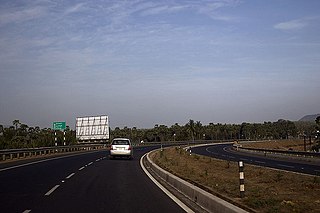
National Highway 16 is a major National Highway in India that runs along east coast of West Bengal, Odisha, Andhra Pradesh, and Tamil Nadu. It was previously known as National Highway 5.

The economy of the Indian state of Andhra Pradesh is primarily dependent on agriculture, which directly and indirectly employs 62% of the population. GSDP as per the first revised estimate, for the year 2022-23 is ₹13,17,728 crore. The state is ranked 1st in the country for the year 2021-22 in terms of the Gross State Domestic Product (GSDP) growth at constant prices with growth rate of 11.43%.
Andhra Pradesh is well connected with various destinations in India, as well as other countries. It has road, rail, airways. With a long coast of Bay of Bengal and many sea ports, it flourishes in sea trade as well. The state has one of the largest railway junctions at Vijayawada and Visakhapatnam Port being one of the largest cargo handling seaport.

The state of Andhra Pradesh has a coastline of 970 km2 (370 sq mi) and hence, there exist many beaches. The seacoast extends along the Bay of Bengal from Srikakulam district to Nellore district.

Pothinamallayya Palem or PM Palem, is a residential neighbourhood situated in Visakhapatnam city in the Indian state of Andhra Pradesh. It is located in the Greater Visakhapatnam Municipal Corporation area. It is located to the north of Visakhapatnam city on National Highway 16 (NH16) to Srikakulam. This place is well connected to other parts of the city such as Asilmetta and Maddilapalem. The only international cricket stadium in Andhra Pradesh is located here.
National Highway 216 is a National Highway in the Indian state of Andhra Pradesh. The former highways of NH 214 and 214A were merged and renumbered as NH 216. It starts from NH 16 junction at Kattipudi and passes through Kakinada, Amalapuram, Digamarru (Palakollu), Narasapuram, Machilipatnam, Repalle, Cherukupalle, Bapatla, Chirala before it junctions NH 16 again at Ongole. Visakhapatnam–Kakinada Petro Chemical Corridor, is a proposed project along the highway.
State Highway 31 is a state highway in the Indian state of Andhra Pradesh which connects Renigunta and Muddanur in the state. It is the longest known state highway in Kadapa and Chittoor districts collectively.
Prahaladapuram is a suburban area in Visakhapatnam city under Greater Visakhapatnam Municipal Corporation of Pendurthi in Andhra Pradesh, India. It is located 14 km Nomet from Visakhapatnam city center.
Simhachalam bus station is a bus station located in temple town Simhachalam of the Indian state of Andhra Pradesh. It is owned by Andhra Pradesh State Road Transport Corporation. This is one of the major bus stations in the district, with services to Visakhapatnam, all towns and villages in the district.
Transport in Visakhapatnam is the network of roads, railways, rapid transit system in the largest city of Andhra Pradesh. The city of Visakhapatnam also serves as the central hub of transport and logistics on the East coast of India and hence it is called as City Of Destiny.

Kommadi is a suburb of the city of Visakhapatnam state of Andhra Pradesh, India.

Dr. Lankapalli Bullayya College, also known as Dr. L. Bullayya College, Dr. L.B. College, or simply LBC, is an affiliated college of Andhra University established in 1973. It is named in honor of Dr. Lankapalli Bullayya, who server as a Vice Chancellor Of Andhra University. The college campus is located in Resapuvanipalem, Visakhapatnam, Andhra Pradesh, India. The college is awarded an ‘A’ grade by the NAAC.
