Srikakulam is a city and the headquarters of Srikakulam district in the Indian state of Andhra Pradesh. As of 2011 census,. it has a population of 165,735. There are many other places of Buddhist Tourism such as Salihundam, Calinga Patnam, Dabbaka Vaani Peta, Nagari Peta, Jagati Metta, Singupuram etc. in Srikakulam District. The Buddhist heritage site of Salihundam has some unique features. It has a beautiful star atop a stupa, rock cut massive stupaas inside chaitya grihas, brick stupas with wheel pattern plan, votive stupas, inscriptions on the steps leading to the stupas and museum housing over two dozen sculpted statue and figurines of Buddha, Jain Teerthankars and other deities

Bhadrachalam is a census town in Bhadradri Kothagudem district in the Indian state of Telangana. It is an important Hindu pilgrimage town with the Bhadrachalam Temple of Lord Rama, situated on the banks of Godavari river. It is located 312 kilometres (194 mi) east of state capital, Hyderabad,115 kilometres (71 mi) from Khammam,192 kilometres (119 mi) from Vijayawada,177 kilometres (110 mi) from Suryapet, 180 kilometres (112 mi) from Warangal, 220 kilometres (137 mi) from the Andhra Pradesh state capital Amaravathi and 350 kilometres (217 mi) from Visakhapatnam.

Vizianagaram district is one of the eleven districts in the Coastal Andhra region of the Indian state of Andhra Pradesh with its headquarters located at Vizianagaram. The district is bounded on the east by the district of Srikakulam, southwest by the City of Bheemunipatnam, southeast by the Bay of Bengal, and northwest by the state of Odisha. It was formed on 1 June 1979, with some parts carved from the neighbouring districts of Srikakulam and Visakhapatnam. The district is named after the princely state of Vizianagaram. It is the least populous district in Andhra Pradesh.

Nuzvid is a city in Eluru district of the Indian state of Andhra Pradesh. It serves as the administrative headquarters for Nuzvid mandal and Nuzvid revenue division.

Gajuwaka is a major residential area of Visakhapatnam City, India. This neighborhood of Visakhapatnam is considered the biggest shopping district in Andhra Pradesh by revenue. Though conceived as a residential locality, it is now one of the principal shopping districts of the city. The Gajuwaka area of Visakhapatnam has the highest per capita income in Andhra Pradesh.

Tadepalligudem is a City in West Godavari district of the Indian state of Andhra Pradesh. It is a Selection Grade municipality and the mandal headquarters of Tadepalligudem mandal in Bhimavaram revenue division. Tadepalligudem is second biggest town next to Bhimavaram city in west godavari District as per 2011 census in terms of population.

Anakapalle is a City in the Indian state of Andhra Pradesh. It is the headquarters of Anakapalle District.The Municipality was emerged with GVMC.It has the second largest jaggery market of the country.Anakapalle near by major villages Thummapala,AMAL Kothuru,Kondakoppaka,Kundram,Kasimkota Mandal,Mungapaka Mandals.it is around 41 km distance from Visakhapatnam.

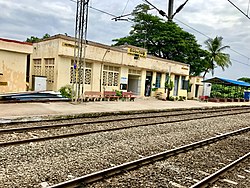
Kothavalasa is a Suburb in Visakhapatnam city but present in Vizianagaram district of the Indian state of Andhra Pradesh. It is located in Kothavalasa mandal of Vizianagaram revenue division. It is located 30 km from the city of Visakhapatanam

Narsipatnam is a town in Anakapalle district of the Indian state of Andhra Pradesh. It was upgraded from a gram panchayat into municipality in 2012. The town is spread over an area of 42 km2 (16 sq mi) The resting place of the revolutionary Indian freedom fighter Alluri Sitarama Raju is located in Krishna Devi Peta village of Narsipatnam.
Pedana is a municipality and the headquarters of Pedana mandal under Machilipatnam revenue division of Krishna district of the Indian state of Andhra Pradesh. It is located at a distance of 8 km (5.0 mi) from the district headquarters, Machilipatnam.
Samalkota, also called Samalkot andSamarlakota (Telugu:సామర్లకోట) is a town in Kakinada district of the Indian state of Andhra Pradesh. The town forms a part of Godavari Urban Development Authority. It was previously known as Chamarlakota (Telugu:చామర్లకోట), which dates back to a local Kaifiyat that was written in the mid-eighteenth century.

Tuni is a town in Kakinada district of the Indian state of Andhra Pradesh. It is a major commercial marketing center for more than 40 surrounding villages in the district. Tuni is a border point for the district of Kakinada. It is known for mango production, with nearly 250 varieties being exported from the area. Tuni is also famous for the production of betel leaves and jute bags. A variety of cashew nuts are also produced in Tuni.

Srungavarapukota popularly known by its abbreviated form S.Kota is a neighbourhood in the district of Vizianagaram, India. S.Kota is located on Visakhapatnam – Araku road. The town was upgraded from gram panchayat to Nagar Panchayat in the year 2011.

Narasannapeta is a census town in Srikakulam district of the Indian state of Andhra Pradesh. It is the mandal headquarters of Narasannapeta mandal in Srikakulam revenue division. 43 villages are there under the administrative division of Narasannapeta.

Pathapatnam is a town in Srikakulam district of the Indian state of Andhra Pradesh. It is located in Pathapatnam mandal of Palakonda revenue division. Pathapatnam is located on the border of Srikakulam district of Andhra Pradesh and Gajapati district of Odisha. Parlakhemundi, the headquarters of Gajapati District, can be considered as twin town of Pathapatnam because of its close proximity. It is located around 65 km from srikakulam.
Butchayyapeta is a Mandal in Anakapalli district of the Indian state of Andhra Pradesh. It is located in Butchayyapeta mandal of Anakapalli revenue division.

Dhone or Dronachalam is a town in Nandyal district of the Indian state of Andhra Pradesh. It is a Municipality located in Dhone mandal. And it is the head quarters of Dhone revenue division.
Sattenapalle is a town in Palnadu district of the Indian state of Andhra Pradesh. It is a municipality and the headquarters of Sattenapalle mandal under Sattenapalle revenue division.
Golagam is a village in Anakapalli district of the Indian state of Andhra Pradesh. It is located in gurla Mandal of gurla. It is located at a distance of 1 km from gurla and at a distance of 1 km from vizayanagaram.
Anakapalle mandal is one of the mandals in located in Anakapalli district of the state of Andhra Pradesh, India. It is administered under Anakapalle revenue division and its headquarters are located at Anakapalle. It is bounded by Kasimkota Mandal towards west, Munagapaka Mandal towards South, Paravada Mandal towards East, Achutapuram Mandal towards South.