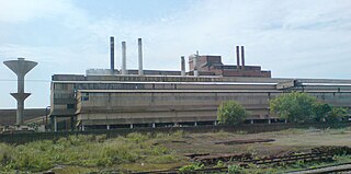
Tadepalligudem (TPG) is a city in West Godavari district of the Indian state of Andhra Pradesh. It is a municipality and the mandal headquarters of Tadepalligudem mandal in Eluru revenue division.

Bheemunipatnam popularly known by its abbreviated form Bheemili, is a neighbourhood in the city of Visakhapatnam, India. The town was named after Bhima a character in the Hindu epic Mahabharata. Bheemunipatnam municipality was merged into Greater Visakhapatnam Municipal Corporation

Chintalavalasa is a census town in Vizianagaram district of the Indian state of Andhra Pradesh. It is located in Denkada mandal of Vizianagaram revenue division.

Gajapathinagaram is a census town in Vizianagaram district of the Indian state of Andhra Pradesh. It is located in Gajapathinagaram mandal of Vizianagaram revenue division. It is located on National Highway 26 between Vizianagaram and Ramabhadrapuram.

Jarajapupeta is a census town in Vizianagaram district of the Indian state of Andhra Pradesh. It is located in Nellimarla mandal of Vizianagaram revenue division.

Kandukur or Kandukuru is a town in Prakasam district of the Indian state of Andhra Pradesh. It is a municipality and the mandal headquarters of Kandukur mandal in Kandukur revenue division.

Kothavalasa is a census town in Vizianagaram district of the Indian state of Andhra Pradesh. It is located in Kothavalasa mandal of Vizianagaram revenue division. It is located 30 km from City Visakhapatanam

Narayanavanam is a census town in Chittoor district of the Indian state of Andhra Pradesh. It is the mandal headquarters of Narayanavanam mandal in Chittoor revenue division. The town is known for Kalyana Venkateswara Temple dedicated to Lord Venkateswara and was constructed in the year 1541 AD.

Narsipatnam is a town in Visakhapatnam district of the Indian state of Andhra Pradesh. It is a municipality and also the mandal headquarters of Narsipatnam mandal. The town is spread over an area of 42 km2 (16 sq mi) The resting place of the revolutionary Indian freedom fighter Alluri Sitarama Raju is located in Krishna Devi Peta village of Narsipatnam.

Papampeta is a census town in Anantapur district of the Indian state of Andhra Pradesh. It is located in Anantapur mandal of Anantapur revenue division. The town is a constituent of Anantapur urban agglomeration.

Ramanayyapeta is a census town in East Godavari district of the Indian state of Andhra Pradesh. It is located in Kakinada (rural) mandal of Kakinada revenue division. The town is a constituent of Kakinada urban agglomeration.

Singarayakonda is a census town in Prakasam district of the Indian state of Andhra Pradesh. It is the mandal headquarters of Singarayakonda mandal.

Sriramnagar is a census town in Vizianagaram district of the Indian state of Andhra Pradesh. It is located in Garividi mandal of Vizianagaram revenue division.

Uravakonda is a census town in Anantapur district of the Indian state of Andhra Pradesh. It is the headquarters of Uravakonda mandal in Anantapur revenue division. The town is a constituent of urban agglomeration.

Vetapalem is a census town in Prakasam district of the Indian state of Andhra Pradesh. It is the mandal headquarters of Vetapalem mandal in Ongole revenue division.

Nagari is a town in Chittoor district of the Indian state of Andhra Pradesh. It is the mandal headquarters of Nagari mandal in Chittoor revenue division.

Palasa is a town in Srikakulam district of the Indian state of Andhra Pradesh. It is a municipality and the mandal headquarters of Palasa mandal. It is located near to the National Highway 5 between Srikakulam and Berhampur. Along with its twin town kasibugga, it is often referred to as Palasa-Kasibugga.

Nakkapalle or Nakkapalli is a census town in Visakhapatnam district in the state of Andhra Pradesh in India.

Payakaraopeta is a Census Town in Visakhapatnam district in the state of Andhra Pradesh in India.sarpanch of payakaraopeta : Dhanisetti Nagamani


