
Pulicat Lake is the second largest brackish water lagoon in India,, measuring 759 square kilometres (293 sq mi). A major part of the lagoon lies in the Tirupati district of Andhra Pradesh. The lagoon is one of three important wetlands that attracts northeast monsoon rain clouds during the October to December season. The lagoon comprises the following regions: Pulicat Lake, Marshy/Wetland Land Region (AP), Venadu Reserve Forest (AP), and Pernadu Reserve Forest (AP). The lagoon was cut across in the middle by the Sriharikota Link Road, which divided the water body into lagoon and marshy land. The lagoon encompasses the Pulicat Lake Bird Sanctuary. The barrier island of Sriharikota separates the lagoon from the Bay of Bengal and is home to the Indian Space Research Organisation's Satish Dhawan Space Centre.

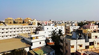
Vizianagaram, also known as Vijayanagaram, is a city and the headquarters of the Vizianagaram district in the Indian state of Andhra Pradesh. It is located in the Eastern Ghats, about 24 km (15 mi) west of the Bay of Bengal and 40 km (25 mi) north-northeast of Visakhapatnam. The city has a population of 228,025 and was established as the capital of the Vizianagaram estate by Raja Vijayaram Raj from the Pusapati dynasty. The rulers had a notable role in the history of the region in the 18th century and were patrons of education and arts.

Mandasa is a village in Srikakulam district of the Indian state of Andhra Pradesh. Mandasa is also known by the name Manjusha in Odia. It was ruled by erstwhile odia zamindar Rajamani royal family during British Raj. Srinivasa Rajamani was the famous Ruling chief Rajah of this estate.
Kavali is a town in Nellore district of Andhra Pradesh of India. It also serves as headquarters of Kavali mandal and Kavali revenue division.It is one of the few cities from Andhra Pradesh which were selected for Atal Mission for Rejuvenation and Urban Transformation (AMRUT) Scheme.

Srikakulam district is one of the twenty-six districts of the Indian state of Andhra Pradesh, located in the Uttarandhra region of the state, with its headquarters located at Srikakulam. It is one of the six districts, located in the extreme northeastern direction of the state. It was formerly known as Chicacole, and was under Ganjam district till 1 April 1936, then merged under Vizagapatam district. Srikakulam district forms the core area of Kalinga where most of its historical capitals like Kalinganagari, pithunda, Dantapuram are located.

Palakollu or Palacole is a town and the administrative headquarters of Palakollu Mandal in Narasapuram revenue division in West Godavari district of the Indian state of Andhra Pradesh. Palakollu is situated in Coastal Andhra region of the state. It occupies 4.685 square kilometres (1.809 sq mi). As of 2011 census, it had a population of about 61,284 and a Metro population of about 81,199. Palakollu Municipality merged five Grama panchayats of Seven village's on 7 January 2020. The Seven Villages' had a population of 42,932 as of 2011 Census. It around occupies 20.08 square kilometres (7.75 sq mi) and after merged palakollu municipality, It around occupies 24.68 square kilometres (9.53 sq mi) with 35 election wards it is total population of 1,04,216 and making it the third most populous urban area in West Godavari District in Andhra Pradesh. It is a part of Eluru Urban Development Authority.

(MP = Sri Bharat Bheemunipatnam, is a suburb of Visakhapatnam, India. The town was named after Bhima, a character in the Hindu epic Mahabharata. It formerly administered under the Bheemunipatnam municipality, but merged into GVMC in 2017. It is currently under the administration of Bheemunipatnam revenue division and the headquarters is located at Bheemunipatnam.

Nelli-marla is a census town in Vizianagaram district of the Indian state of Andhra Pradesh. It is in Nellimarla mandal of Vizianagaram revenue division.
Gudlavalleru is a village and Mandal in Krishna district of the Indian state of Andhra Pradesh. It is located on the Gudivada – Machilipatnam route.
Nagayalanka is a village in Krishna district of Indian state of Andhra Pradesh. It is the mandal headquarters of Nagayalanka mandal in Machilipatnam revenue division.

Kalingapatnam is a village in Srikakulam district of the Indian state of Andhra Pradesh. It is located in Gara mandal of Srikakulam revenue division. It has one of the major beach sand deposits of the state. In medieval era it was famous for the ancient port city of Kalinga. Kalingapatnam is located at a distance of 26 km from the district headquarters and 17 km from Singupuram.

Baruva is a village and a beach resort located near Sompeta in Srikakulam district, Andhra Pradesh, India. It is located at 18.53N 84.35E., at an average elevation of 10 m (33 ft). The Mahendratanaya River merges into the Bay of Bengal at this place. This village is situated at a distance of 109 km from Srikakulam town, the district headquarters.
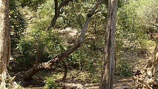
The Central Deccan Plateau dry deciduous forests in Western and Southern India, containing large protected areas of natural tiger habitat.

Ramayapatnam is a small village in Ulavapadu mandal of Nellore district of Andhra Pradesh, India on the bank of the Bay of Bengal. It is located 4.5 km (2.8 mi) East of Tettu on NH-16. Its population is 2,236 as on 2011.

Andhra Pradesh is a state in India. Andhra Pradesh Tourism Development Corporation (APTDC) is a state government agency which promotes tourism in Andhra Pradesh, describing the state as the Koh-i-Noor of India. Andhra Pradesh has a variety of tourist attractions including beaches, hills, caves, wildlife, forests and temples.
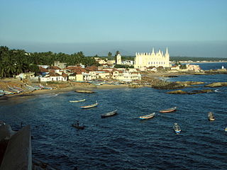
Muttom is a village in Kanyakumari District of Tamil Nadu, India. It is a well-known beach with rocks and caves. The major occupation of people in Muttom is fishing. Due to the natural beauty of the beach, It attracts tourists from all over India. Many people come to the beach every day and spend their time on the seashore. This beach is known as the best sunset point in the district. Muttom Harbor work has been under construction for the last 3 years and was expected to be completed before the end of 2014.

Kakinada Port is located at Kakinada off the east coast of India. It is 170 km (106 mi) south of Visakhapatnam Port.
Lower Manair Dam also known as LMD was constructed across the Manair River, at Alugunur village, Thimmapur mandal, Karimnagar District, in the Indian state of Telangana during 1974 to 1985. It provides irrigation to a gross command area of 163,000 hectares.

Arma Konda or Sitamma Konda, is a mountain peak in the northern part of the Eastern Ghats and located in Godavari River basin. It is located in the Madugula Konda sub-range north of Paderu village in Alluri district of Andhra Pradesh, India.

The Yarada Hills are a range of hills at Yarada to the south of Visakhapatnam City beside the Bay of Bengal in Andhra Pradesh state, India.

