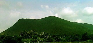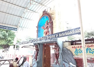
Vizianagaram district is one of the six districts in the Uttarandhra region of the Indian state of Andhra Pradesh with its headquarters located at Vizianagaram. The district was once the part of ancient Kalinga.Saripilli Dibbilingeswara temple, Jayathi Mallikarjuna Temple are the finest examples of ancient Eastern Ganga Dynasty built monuments in the district. The district is bounded on the east by the district of Srikakulam, north by Parvathipuram Manyam south by Visakhapatnam, Anakapalli, southeast by the Bay of Bengal, and west by Alluri Sitharama Raju district. It was formed on 1 June 1979, with some parts carved from the neighbouring districts of Srikakulam and Visakhapatnam. The district is named after the princely state of Vizianagaram. In 2011, it was the least populous district in Andhra Pradesh.

Visakhapatnam district is one of the six districts in the Uttarandhra region of the Indian state of Andhra Pradesh, headquartered at Visakhapatnam. It is one of the twenty-six districts in Andhra Pradesh state. The district shares borders within the north and east, Vizianagaram district and South Anakapalli district in the south-west and Bay of Bengal in the south.

Bethamcherla is a town with Nagar panchayat civic status and mandal headquarters located in Nandyal district of the Indian state of Andhra Pradesh. It comes under Dhone assembly constituency and Nandyal Parliament Constituency.

Gajapathinagaram is a census town in Vizianagaram district of the Indian state of Andhra Pradesh. It is located in Gajapathinagaram mandal of Vizianagaram revenue division. It is located on National Highway 26 between Vizianagaram and Ramabhadrapuram.
Kantabamsuguda is a census town in Anakapalli district of the Indian state of Andhra Pradesh.

Kothavalasa is a town in Vizianagaram district of the Indian state of Andhra Pradesh. It is located in Kothavalasa mandal of Vizianagaram revenue division. It is located 30 km from the city of Visakhapatanam

Narsipatnam is a census town in Anakapalle district of the Indian state of Andhra Pradesh. It was upgraded from a gram panchayat into municipality in 2012. The town is spread over an area of 42 km2 (16 sq mi) The resting place of the revolutionary Indian freedom fighter Alluri Sitarama Raju is located in Krishna Devi Peta village of From Narsipatnam to labasingi Village 30 km only.. labasingi most popular winter tourism place..so many Tourists enjoy -2 degree's temparature there.. Narsipatnam town is 43 km away from Tuni. And it is 72 km away from Visakhapatnam.

Nelli-marla is a census town in Vizianagaram district of the Indian state of Andhra Pradesh. It is in Nellimarla mandal of Vizianagaram revenue division.

Chodavaram is a town in Anakapalli district in the Indian state of Andhra Pradesh. The town is located on the country's east coast. It falls under Visakhapatnam Metropolitan Region Development Authority. The town has one of the largest cooperative Sugar factories in state.

Bhogapuram is a village in Vizianagaram district of the Indian state of Andhra Pradesh. It is located in Bhogapuram mandal of Vizianagaram revenue division.
Gurla is a village in Vizianagaram district of the Indian state of Andhra Pradesh, India.
Komarada is a village in Parvathipuram Manyam district of the Indian state of Andhra Pradesh.
Kotabommali is a mandal in the Srikakulam district of the Indian state of Andhra Pradesh.
Laveru is a village in Srikakulam district of the Indian state of Andhra Pradesh. Laveru is located on Subhadrapuram-Cheepurupalli road that connects National Highway-5 to Cheepurupalli railway station on Howrah-Chennai mainline. The village is located in Pedda Gedda river basin.

Pathapatnam is a town in Srikakulam district of the Indian state of Andhra Pradesh. It is located in Pathapatnam mandal of Palakonda revenue division. Pathapatnam is located on the border of Srikakulam district of Andhra Pradesh and Gajapati district of Odisha. Parlakhemundi, the headquarters of Gajapati District, can be considered as twin town of Pathapatnam because of its close proximity. It is located around 65 km from srikakulam. It was the old capital of Paralakhemundi Gajapati Maharajah of his erstwhile kingdom.
Polaki is a village in Srikakulam district of Andhra Pradesh in India.
Madapam is a village in Narasannapeta mandal, located in Srikakulam district of the Indian state of Andhra Pradesh.

Nakkapalle or Nakkapalli is a census town in Anakapalli district in the state of Andhra Pradesh in India.

Narasingapalli is a village in Anakapalli district of the Indian state of Andhra Pradesh. It is situated in Kasimkota mandal of Anakapalli revenue division.

Anakapalli district is a district in the Indian state of Andhra Pradesh. It was formed on 4 April 2022 from Anakapalli and Narsipatnam revenue divisions of the old Visakhapatnam district. The administrative headquarters are at Anakapalli. Sankaram, 3 km from Anakapalli is identified to be developed as the headquarters of the new district.


