Meghadri Gedda Reservoir

Last updated

Meghadri Gedda Reservoir
Meghadri Gedda Reservoir from space.jpg
Meghadri gedda reservoir satellite imagery
Visakhapatnam City Area Map.png
Red pog.svg
Meghadri Gedda Reservoir
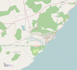
Location Visakhapatnam, India
Coordinates 17°46′17″N83°11′02″E / 17.771376°N 83.183766°E / 17.771376; 83.183766
Type reservoir
Managing agency Greater Visakhapatnam Municipal Corporation

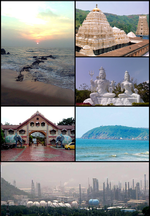
Meghadri Gedda Reservoir is a reservoir in Visakhapatnam, India. It is one of the main water source for the entire Visakhapatnam city. [1] This reservoir capacity is 11 MGD and maintained by Greater Visakhapatnam Municipal Corporation. [2]
Meghadri gedda river beside Visakhapatnam Airport Meghadri gedda river beside Visakhapatnam Airport.JPG
Meghadri gedda river beside Visakhapatnam Airport

Related Research Articles

<span class="mw-page-title-main">Visakhapatnam</span> Metropolis in Andhra Pradesh, India

Visakhapatnam is the largest and most populous metropolitan city in the Indian state of Andhra Pradesh. It is between the Eastern Ghats and the coast of the Bay of Bengal. It is the second largest city on the east coast of India after Chennai, and the fourth largest in South India. It is one of the four smart cities of Andhra Pradesh selected under the Smart Cities Mission and is the headquarters of Visakhapatnam district. With an estimated output of $43.5 billion, it is the ninth largest contributor to India's gross domestic product as of 2016.

<span class="mw-page-title-main">Coastal Andhra</span> Geographic region of Andhra Pradesh, India

Coastal Andhra or Kosta Andhra is a geographic region in the Indian state of Andhra Pradesh. Vijayawada is the largest city in this region. The region share borders with Rayalaseema, Uttarandhra and Telangana. It was a part of Madras State before 1953 and Andhra State from 1953 to 1956. According to the 2011 census, it has an area of 91,915 square kilometres (35,489 sq mi) which is 57.99% of the total state area and a population of 34,193,868 which is 69.20% of Andhra Pradesh state population. This area includes the coastal districts of Andhra Pradesh on the Circar Coast between the Eastern Ghats and the Bay of Bengal, from the northern border with Odisha to Rayalaseema in the south.

<span class="mw-page-title-main">Araku Valley</span> Hill Station in Andhra Pradesh, India

Araku Valley is a hill station in Alluri Sitharama Raju district in the Indian state of Andhra Pradesh, lying 111 km west of Visakhapatnam city. It is a valley in the Eastern Ghats inhabited by different tribes, mainly Araku Tribes.

The Jalaput Dam is a hydroelectric dam built on the Machkund River, a tributary of the Godavari River in India which rises in the Mudugal hills of Alluri Sitharama Raju district District and nearby Ondra Gadda it becomes the boundary between Andhra Pradesh and Odisha. This Dam is the most ignored one in India, currently, it is in dilapidated condition. For over 48 km the river runs nearly north along a meandering course through the Padwa Valley. About 48 km south of Jeypore, it winds westward along the edge of the Plateau and then suddenly tums at a short angle to the south-west down a steep descent popularly known as Duduma Falls.

<span class="mw-page-title-main">Vizianagaram district</span> District of Andhra Pradesh in India

Vizianagaram district is one of the six districts in the Uttarandhra region of the Indian state of Andhra Pradesh with its headquarters located at Vizianagaram. The district was once the part of ancient Kalinga.Saripilli Dibbilingeswara temple, Jayathi Mallikarjuna Temple are the finest examples of ancient Eastern Ganga Dynasty built monuments in the district. The district is bounded on the east by the district of Srikakulam, north by Parvathipuram Manyam south by Visakhapatnam, Anakapalli, southeast by the Bay of Bengal, and west by Alluri Sitharama Raju district. It was formed on 1 June 1979, with some parts carved from the neighbouring districts of Srikakulam and Visakhapatnam. The district is named after the princely state of Vizianagaram. In 2011, it was the least populous district in Andhra Pradesh.

<span class="mw-page-title-main">ACA–VDCA Cricket Stadium</span> Cricket stadium

ACA–VDCA Cricket Stadium is a multi-purpose stadium in Visakhapatnam, Andhra Pradesh, India. It is primarily used for international cricket matches. The stadium has two-tiers and was designed to avoid any restricted views, eliminating pillars or columns which come in the field of view of spectators. The pitch is known to be batsman-friendly.

<span class="mw-page-title-main">Gosthani River</span> River in India

The Gosthani river is a river in India. It rises in the Ananthagiri Hills of the Eastern Ghats and flows through the Borra Caves which lie near its source. It is the largest river flowing through Visakhapatnam city. It flows for 120 km before joining the Bay of Bengal through an estuary near Bheemunipatnam. The river basin drains the two coastal districts of Vizianagaram and Visakhapatnam. The basin exhibits a subdendritic and dendritic pattern of drainage. The Gosthani's is a minor river basin with a total drainage area of less than 2000 km2. Much of the basin is covered by khondalite group of gneissic rocks. About 3% of the total area of the Visakhapatnam district is under the Gosthani basin. The river is rainfed, receiving an average rainfall of 110 cm most of which comes from the south-west monsoon. There are several red sand hills near Bheemunipatnam, where the Gosthani joins the Bay of Bengal, which are reminiscent of the Chambal ravines. These are thought to have been formed six millennia ago due to shifts in the river's course following tectonic activity. The river joins the Bay of Bengal at Bhimli where it forms an estuary.

<span class="mw-page-title-main">Sarada River</span>

River Sarada is a medium-sized river in Visakhapatnam district of Andhra Pradesh, India.

<span class="mw-page-title-main">Kanithi Balancing Reservoir</span> Indian reservoir

Kanithi Balancing Reservoir (KBR) is a reservoir in Ukkunagaram, Visakhapatnam, India. It is the water source for the entire Vizag steel plant and steel plant township.

<span class="mw-page-title-main">Polavaram Project</span> Dam in Eluru district, Andhra Pradesh, India

The Polavaram Project is an under construction multi-purpose irrigation project on the Godavari River in the Eluru District and East Godavari District in Andhra Pradesh. The project has been accorded National project status by the Central Government of India. Its reservoir back water spreads up to the Dummugudem Anicut and approx 115 km on Sabari River side. Thus back water spreads into parts of Chhattisgarh and Odisha States. It gives major boost to tourism sector in Godavari Districts as the reservoir covers the famous Papikonda National Park, Polavaram hydro electric project (HEP) and National Waterway 4 are under construction on left side of the river. It is located 40 km to the upstream of Sir Arthur Cotton Barrage in Rajamahendravaram City and 25 km from Rajahmundry Airport.

<span class="mw-page-title-main">Tatipudi Reservoir</span> Dam in Vizianagaram district, Andhra Pradesh

"Tatipudi Reservoir" is a dam located on River Gosthani in Andhra Pradesh. It is a water supply reservoir to the city of Visakhapatnam. Thatipudi Reservoir Project was constructed across Gosthani River during 1963–1968. The Project is aimed to irrigate a total ayacut of 15,378 acres (62 km2) in Vizianagaram District and to provide drinking water to Visakhapatnam City. The Project utilizes 3.325 tmcft of the available water and the reservoir storage capacity is about 3 tmcft. The Cost of the project is Rs. 1,820 crores. The Ayacut of 15,378 acres (62 km2) has been stabilised in Gantyada, S.Kota and Jami Mandals of Vizianagaram District.

<span class="mw-page-title-main">Arilova</span> Neighborhood in Visakhapatnam, Andhra Pradesh, India

Arilova is a residential area of Visakhapatnam, Andhra Pradesh, India. It is located on the north fringe of Visakhapatnam city with hills surrounding on opposite sides. It is located beside Kailasagiri. Arilova is a Part of GVMC Greater Visakhapatnam Municipal Corporation, which is responsible for the civic amenities in Arilova.

<span class="mw-page-title-main">Isukathota</span> Neighbourhood in Visakhapatnam, Andhra Pradesh, India

Isukathota is a locality in the Maddilapalem neighbourhood of Visakhapatnam, India. It is situated between Sivajipalem and Venkojipalem.

<span class="mw-page-title-main">Greater Visakhapatnam Municipal Corporation</span> Local civic body in Visakhapatnam, Andhra Pradesh, India

Greater Visakhapatnam Municipal Corporation (GVMC) is the civic body that governs the city of Visakhapatnam, largest city of the Indian state of Andhra Pradesh. Its jurisdiction encompasses an area of 640 km2 (250 sq mi). It is also part of the planning body of the Visakhapatnam Metropolitan Region Development Authority. Established in the year 1979, the executive power of the GVMC is vested in the Municipal Commissioner, an Indian Administrative Service officer appointed by the Government of Andhra Pradesh. The position is held by Saikanth Varma. Golagani Hari Venkata Kumari (YSRCP) was elected as the Mayor and Jiyyani Sridhar (YSRCP) as the Deputy Mayor by the newly elected general body in March 2021. In January 2021, the number of wards were increased to 98 from 81 earlier.

GMR Visakhapatnam International Airport is an international airport and a greenfield airport under construction at Bhogapuram in Vizianagaram district, about 40 kilometres (25 mi) north-east of Visakhapatnam and 15 km south east of Vizianagaram. By the time of completion in Dec 2025, it is projected to be India’s 7th largest airport by area and 15th by Passenger traffic. It is proposed to be a focus city for 2 airlines and the primary international gateway to the state of Andhra Pradesh.

<span class="mw-page-title-main">Indian Institute of Petroleum and Energy</span>

Indian Institute of Petroleum and Energy (IIPE), is an institute of national importance established in 2016, in Visakhapatnam, Andhra Pradesh. It is a domain-specific Institute at par with IITs and IIMs, is established by the Government of India under the aegis of the Ministry of Petroleum and Natural Gas (MoPNG) in the year 2016. The Indian Institute of Petroleum and Energy Act, 2017 enacted by the Parliament and declared the Institute as an 'Institution of National Importance'.

<span class="mw-page-title-main">Mudasarlova Park</span>

Mudasarlova Park is an urban park in the Indian city of Visakhapatnam. It is spread over 20 acres (8.1 ha) of land. it was constructed in 1902 and is one of the oldest parks in this Coastal Andhra. The water reservoir in the park supplies drinking water to the city. It was named one of the best picnic spots for local citizens.. The land for the construction of Mudasarlova was donated by Maharaja Sri Pusapati Ananda Gajapati Raju from his family trust.

<span class="mw-page-title-main">Raiwada Reservoir</span> Dam in Anakapalli, Andhra Pradesh

Sri Varada Narayana Murty Raiwada Reservoir Project or Raiwada Reservoir is a reservoir constructed across the Sarada River near Raiwada village, Devarapalli mandal, Anakapalli district, 58 km from Visakhapatnam city. It is one of the main water sources for Visakhapatnam city. Its capacity is 2,360 tcm, and it is maintained by Irrigation & CAD Dept.

<span class="mw-page-title-main">Administration of Visakhapatnam</span> Municipality in India

The Administration of Visakhapatnam officially started in 1803, with the municipality of Visakhapatnam being established in 1861. Currently, it is known as the Greater Visakhapatnam Municipal Corporation (GVMC). Its total area is 681 km2 (263 sq mi) with 98 wards and 8 zones. The mayor is elected by corporators who are representative of their wards.

References

  1. "Andhra Pradesh: Rains fail to fill tanks". 31 August 2017.
  2. "Slow monsoon raises fears of water scarcity in Visakhapatnam | Visakhapatnam News - Times of India". The Times of India. 6 August 2017.