Andhra Pradesh is a state in the south-eastern coastal region of India. It is the seventh-largest state by area covering an area of 162,975 km2 (62,925 sq mi) and tenth-most populous state with 49,386,799 inhabitants, with the state capital being Amaravati and the largest city being Visakhapatnam. It is bordered by Telangana to the north-west, Chhattisgarh to the north, Odisha to the north-east, Tamil Nadu to the south, Karnataka to the west and the Bay of Bengal to the east. It has the second longest coastline in India after Gujarat, of about 974 km (605 mi). Andhra State was the first state to be formed on a linguistic basis in India on 1 October 1953. On 1 November 1956, Andhra State was merged with the Telugu-speaking areas of the Hyderabad State to form Andhra Pradesh. The state was then reorganised in June 2014 to form a separate Telangana state.

Visakhapatnam, also known as Vizag, Viśākha or Waltair, is the largest and most populous city in the Indian state of Andhra Pradesh, and its proposed administrative capital. It is between the Eastern Ghats and the coast of the Bay of Bengal. It is the second-largest city on the east coast of India after Chennai, and the fourth-largest in South India. It is one of the four smart cities of Andhra Pradesh selected under the Smart Cities Mission and serves as the headquarters of Visakhapatnam district. With an estimated output of $43.5 billion, it is the ninth-largest contributor to India's gross domestic product as of 2016.

East Godavari is a district in the Coastal Andhra region of Andhra Pradesh, India. Its district headquarters is at Rajahmundry. As of census 2011, it became the most populous district of the state with a population of 5,151,549.

Coastal Andhra is a region in the state of Andhra Pradesh, India. It was part of Madras State before 1953 and Andhra State from 1953 to 1956. According to the 2011 census, it has an area of 91,915 square kilometres (35,489 sq mi) which is 57.99% of the total state area and a population of 34,193,868 which is 69.20% of Andhra Pradesh state population. This area includes the coastal districts of Andhra Pradesh on the Circar Coast between the Eastern Ghats and the Bay of Bengal, from the northern border with Odisha to Tirupati district in the South. Amaravati, the capital of Andhra Pradesh also falls under Coastal Andhra region.
Rajahmundry, officially known as Rajamahendravaram, is a city in the Indian state of Andhra Pradesh and District headquarters of East Godavari district. It is the seventh most populated city in the state. During British rule, the District of Rajahmundry was created in the Madras Presidency in 1823. It was reorganised in 1859 and bifurcated into the Godavari and Krishna districts. Rajahmundry was the headquarters of Godavari district, which was further bifurcated into East Godavari and West Godavari districts in 1925. When the Godavari district was bifurcated, Kakinada became the headquarters of East Godavari and Eluru became the headquarters of West Godavari. It is administered under Rajahmundry revenue division of the East Godavari district. The city is known for its floriculture, history, culture, agriculture, economy, tourism, and its heritage. It is known as the "Cultural Capital of Andhra Pradesh".

West Godavari district is one of the twenty-six districts in the Andhra region of the Indian state of Andhra Pradesh. The administrative headquarters of the district is situated at Bhimavaram. As of 2011 census of India, the district has an area of 7,742 km2 (2,989 sq mi) and a population of 1,779,935. It is bounded by Eluru District to the north, Krishna district and Bay of Bengal to the south, East Godavari district to the east, and Eluru District, Kolleru Lake and Upputeru Drain to the west.

Machilipatnam, also known as Bandar, is a city in Krishna district of the Indian state of Andhra Pradesh. It is a municipal corporation and the administrative headquarters of Krishna district. It is also the mandal headquarters of Machilipatnam mandal in Machilipatnam revenue division of the district. The ancient port town served as the settlement of European traders from the 16th century, and it was a major trading port for the Portuguese, British, Dutch and French in the 17th century.

Kakinada is the sixth largest city of the Indian state of Andhra Pradesh and serves as the district headquarters of the Kakinada District. It lies on the coast of the Bay of Bengal. J.N.T.U. College of Engineering Kakinada, established in 1946 is the oldest and popular Government college in the state of Andhra Pradesh. The First Polytechnic college of Andhra Pradesh, Andhra Polytechnic was established here in 1946. It was also the origin point of Buckingham Canal where goods used to be transported by boats during the British rule. It was once home for Asia's largest sea port. Many people from the city migrated from this sea port to countries like Burma, Mauritius, Fiji and various southeast Asian countries to work there as workers where they were called as Coringas. They still live in those countries, learn Telugu and practice the Andhra culture.

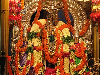
Tirupati is a city in the Indian state of Andhra Pradesh. It is the administrative headquarters of the Tirupati district. Located 415 km (258 mi) southwest of state's capital Amaravati, the city is home to the important Hindu shrine of Tirumala Venkateswara Temple and other historic temples and is referred to as the "Spiritual Capital of Andhra Pradesh". It is one of the eight Swayam vyaktha kshetras dedicated to Vishnu. Tirupati is a municipal corporation and the headquarters of Tirupati (urban) mandal, Tirupati (rural) mandal, and the Tirupati revenue division.
Bapatla is a city and District headquarters of Bapatla district in the Indian state of Andhra Pradesh. It is a municipality and the mandal headquarters of Bapatla mandal of Bapatla revenue division. The nearest towns and cities to Bapatla are Chirala, Ponnur, Tenali and Guntur of 17 km, 22 km, 50 km and 53 km respectively.
Narasapuram, or Narsapur, is a city in West Godavari district of the Indian state of Andhra Pradesh. It is a municipality and mandal headquarters of Narasapuram mandal in Narasapuram revenue division. The city is situated on the banks of the Vasista Godavari River. The lace industry is prevalent in the city and its surroundings.
Avanigadda is a town in Krishna district of the Indian state of Andhra Pradesh. It is the mandal headquarters of Avanigadda mandal in Machilipatnam revenue division.

Andhra Pradesh is a state in India. Andhra Pradesh Tourism Development Corporation (APTDC) is a state government agency which promotes tourism in Andhra Pradesh, describing the state as the Koh-i-Noor of India. Andhra Pradesh has a variety of tourist attractions including beaches, hills, caves, wildlife, forests and temples.

The GSDP at constant (2011–12) Prices for the year 2018-19 is estimated at ₹850,000 crores as against ₹490,134 crores for 2015-16 indicating a growth of 11.61%. Per Capita Income at current prices increased to ₹122,376 from ₹108,163 in 2015-16 registering a growth of 13.14%.
Indian Institutes of Information Technology (IIITs) are a group of 25 interdisciplinary technology-based-engineering research institutions in India which are focused on information technology. Five of them are established, funded and managed by the Ministry of Education (MOE). The other 20 are set up on the public-private partnership (PPP) model, funded by the central government, state governments and industry partners in the ratio 50:35:15.

Kakinada Port is located at Kakinada off the east coast of India. It is 170 km (106 mi) south of Visakhapatnam Port.
Kotipalli railway station, located in the Indian state of Andhra Pradesh, serves Kotipalli in East Godavari district.

The state of Andhra Pradesh has a coastline of 970 km2 (370 sq mi) and hence, there exist many beaches. The seacoast extends along the Bay of Bengal from Srikakulam district to Nellore district.

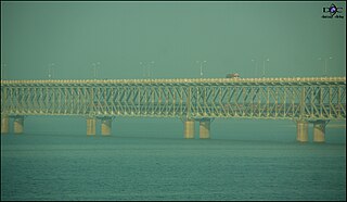
The Coastline of Andhra Pradesh is located on the southeast coast of Indian Peninsula, and forms a part of Northern Circars, with waters of Bay of Bengal. It has the second longest coastline with a length of 975 km (606 mi), next to Gujarat. The coastal corridor consists of several ports, harbours, vast stretches of sandy beaches, wildlife and bird sanctuaries, fresh water lakes, estuaries etc.
Transport in Visakhapatnam is the network of roads, railways, rapid transit system in the largest city of Andhra Pradesh. The city of Visakhapatnam also serves as the central hub of transport and logistics on the East coast of India and hence it is called as City Of Destiny.