East Godavari is a district in the Coastal Andhra region of Andhra Pradesh, India. Its district headquarters is at Rajamahendravaram.

Coastal Andhra, also known as Kosta Andhra, is a geographic region in the Indian state of Andhra Pradesh, comprising the coastal districts of the state between the Eastern Ghats and the Bay of Bengal, from the northern border with Orissa to Rayalaseema in the south. It includes major cities such as Visakhapatnam and Vijayawada as well as the state capital Amaravati and is recognized for its fertile lands, rich cultural heritage, and economic importance. Coastal Andhra plays a significant role in the state's agricultural output, particularly in rice and tobacco production, supported by abundant water resources from the Godavari, Krishna, and Penna rivers.

The West Godavari district is a coastal district in the Indian state of Andhra Pradesh with an administrative headquarters in Bhimavaram. As of the 2011 Census of India, the district has an area of 2,178 km2 (841 sq mi) and a population of 1,779,935. It is bounded by the Krishna district and Bay of Bengal to the south, East Godavari district to the east, and Eluru district, Kolleru Lake and Upputeru Drain to the northwest.

Eluru is a city and the district headquarters of Eluru district in the Indian state of Andhra Pradesh. It is one of the 14 municipal corporations in the state and the mandal headquarters of Eluru mandal in the Eluru revenue division. Situated on the banks of the Tammileru River, Eluru is strategically positioned in the southeastern part of Andhra Pradesh. It was historically known as Helapuri. As of 2011 Census of India, the city had a population of 214,414, reflecting its status as a major urban centre. The city's historical significance dates back to the second century CE, with evidence of its ancient roots found in various archaeological sites and historical records. Eluru was a prominent town under the rule of the Qutub Shahis, who governed the region in the 16th century. It came under the control of the Mughal Empire in the 17th century as the empire expanded its influence across South India. The town later became part of the Nawab of Hyderabad's dominions in the 18th century. During British India, Eluru was incorporated into the Madras Presidency and made capital for Northern Circars in the early 19th century. The British established administrative and infrastructural developments in the town, shaping its modern identity.

{ 9687766003 contact for Nal Sarovar information }

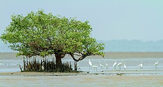
Coringa Wildlife Sanctuary is an estuary situated near Kakinada in Andhra Pradesh, India. It is the third largest stretch of mangrove forests in India with 24 mangrove tree species and more than 120 bird species. It is home to the critically endangered white-backed vulture and the long billed vulture. Mangroves are a group of trees and shrubs that live in the coastal intertidal zone, with a dense tangle of prop roots that make the trees appear to be standing on stilts above the water. This tangle of roots allows the trees to handle the daily rise and fall of tides; hence, the mangrove forest gets flooded at least twice per day. The roots also slow the movement of tidal waters, causing sediments to settle out of the water and build up the muddy bottom.

Nawabganj Bird Sanctuary, renamed in 2015 Shahid Chandra Shekhar Azad Bird Sanctuary, is a bird sanctuary located in Unnao district on the Kanpur-Lucknow highway in Uttar Pradesh, India consisting of a lake and the surrounding environment. It is one of the many wetlands of Northern India. The sanctuary provides protection for 250 species of migratory birds mostly from CIS countries, but the numbers have been dwindling since the 1990s, most having relocated to newer areas in Himachal and Rajasthan. The sanctuary also houses a deer park, watchtowers and boats.

Kaikaluru is a town in Eluru district of the Indian state of Andhra Pradesh. Kaikalur is home to Kolleru Lake, one of the largest freshwater lakes in India, covering about 90,100 hectares and is a tourist attraction.

Andhra Pradesh is a state in India. Andhra Pradesh Tourism Development Corporation (APTDC) is a state government agency which promotes tourism in Andhra Pradesh, describing the state as the Koh-i-Noor of India. Andhra Pradesh has a variety of tourist attractions including beaches, hills, caves, wildlife, forests and temples.

Manjira wildlife sanctuary is a wildlife sanctuary and reservoir located in the Sangareddy district of Telangana State, India. Originally a crocodile sanctuary developed to protect the vulnerable species mugger crocodile, today it is home to more than 70 species of birds. The reservoir, located in the sanctuary, provides drinking water to Hyderabad and Secundarabad.

Vedanthangal Bird Sanctuary is a bird sanctuary in the Madurantakam taluk of the Chengalpattu district in the Indian state of Tamil Nadu. Established in 1936, it is the oldest wildlife sanctuary in India. It has been designated as a protected Ramsar site since 2022. More than 40,000 birds have been recorded in the sanctuary during the migratory season every year.

The Central Asian Flyway (CAF), Central Asian-Indian Flyway, or Central Asian-South Asian Flyway is a flyway covering a large continental area of Eurasia between the Arctic Ocean and the Indian Ocean and the associated island chains. The CAF comprises several important migration routes of waterbirds, most of which extend from the northernmost breeding grounds in Siberia to the southernmost non-breeding wintering grounds in West Asia, India, the Maldives and the British Indian Ocean Territory.

Vaduvoor Bird Sanctuary is a 128.10-hectare area located in Vaduvoor lake, Mannargudi Taluk, Thiruvarur District, Tamil Nadu, India. The sanctuary is about 25 kilometers from Thanjavur and 14 kilometers from Mannargudi on the Thanjavur-Kodiakkarai State Highway 63. It was created in the year 1999. The irrigation tank receives water from November to April every year which attracts numerous foreign birds from Europe and America. The sanctuary attracts more than 40 species of water birds like the white ibis, painted stork, grey pelican, pintails, cormorants, teals, herons, spoonbills, darters, coots, Open bill storks, and pheasant–tailed jacana. The sanctuary is a favorite spot for the migratory birds and during the months of November and December more than 20000 winged visitors reach this area. The sanctuary has basic facilities for tourists to stay overnight and enjoy watching the birds from the two watch towers.

Khijadiya Bird Sanctuary is a bird sanctuary located in Jamnagar district of Gujarat, India. About 300 species of migratory birds have been recorded here.

The state of Andhra Pradesh is considered one of the rich 123 bio-diversified states in India. Natural vegetation (flora) and animal life (fauna) depend mainly on climate, relief, and soil. Krishna and Godavari are the two largest rivers flowing through the state. The Andhra Pradesh Forest Department deals with protection, conservation and management of forests.

Peddintlamma Temple is a Hindu pilgrimage center. It is located on the shores of Kolleru Lake in Kolletikota of Eluru district in Andhra Pradesh. During the 13th century, the temple was constructed by an Eastern Ganga Dynasty Army General under the reign of the Eastern Ganga king Narasingha Deva I.

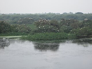
Kolleru Bird Sanctuary is a sanctuary in Andhra Pradesh, India. It covers 673 square kilometers. It was established in November 1999, under the Wildlife Protection Act of 1972. The sanctuary protects part of the Kolleru Lake wetland, which gained Ramsar Convention for International importance in 2002.

The Karaivetti Bird Sanctuary is a 4.537-square-kilometre (1.752 sq mi) protected area and Ramsar site, located in the Ariyalur District of the state of Tamil Nadu, India. The sanctuary is about 25 kilometres (16 mi) from Thanjavur. This freshwater lake is fed by Pullambadi, Kattalal canal and attracts thousands of birds every year. This lake was declared as a sanctuary in 1999 by the Government of Tamil Nadu and in 2024, it became a Ramsar site. About 200 birds are species recorded from this sanctuary. Karaivetti Bird Sanctuary is one of the Important Bird Areas (IBA's) of Tamil Nadu.
Parvati Arga Bird Sanctuary is situated in the Gonda District and about 45 Km. from Gonda at Mankapur-Nawabganj Road and Mankapur-Faizabad Railway Line in the state of Uttar Pradesh, India. The sanctuary is spread over an area of 1084.47 ha. The lake is naturally able to sustain resident birds throughout the year and migratory birds during winter season. It was a part of the Saryu River. As the river changed its flow path these lakes were left as its remains. Thus, both the lakes are oxbow lakes. Parvati Arga Bird Sanctuary was declared vide Government. Notification No. 1021/14-3-14/90 dated 23.05.1990. The sanctuary consists of two lakes i.e. Parvati and Arga situated about 1.5 Km. apart. Tikri Reserve Forest falling under jurisdiction of Gonda Forest Division is at about 1 Km. The nearest town is Wajeerganj which is at a distance of 12 km from the Sanctuary.

Eluru district is a district in coastal Andhra Region in the Indian state of Andhra Pradesh. With Eluru as its administrative headquarters, it was proposed on 26 January 2022 to become one of the resultant twenty six districts in the state once a final notification is issued by the government of Andhra Pradesh. It is formed from Eluru revenue division and Jangareddygudem revenue division from West Godavari district and Nuzvid revenue division from Krishna district.


