Jalipudi

Last updated

Jalipudi
Village
Location map India Andhra Pradesh EN.svg
Red pog.svg
Jalipudi
Location in Andhra Pradesh, India
Coordinates: 16°40′50″N81°09′36″E / 16.680648°N 81.159869°E / 16.680648; 81.159869 Coordinates: 16°40′50″N81°09′36″E / 16.680648°N 81.159869°E / 16.680648; 81.159869
Country India
State Andhra Pradesh
District West Godavari
Government
  Body village
Population (2011)
  Total 3,818
Languages
  Official Telugu
Time zone UTC+5:30 (IST)
PIN 534004
Vehicle registration AP-37

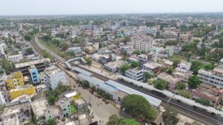
Jalipudi is a village in West Godavari district of the Indian state of Andhra Pradesh. It is located in Eluru mandal of Eluru revenue division. The town is a constituent of Eluru urban agglomeration. [1] [2]

Village Small clustered human settlement smaller than a town

A village is a clustered human settlement or community, larger than a hamlet but smaller than a town, with a population ranging from a few hundred to a few thousand. Though villages are often located in rural areas, the term urban village is also applied to certain urban neighborhoods. Villages are normally permanent, with fixed dwellings; however, transient villages can occur. Further, the dwellings of a village are fairly close to one another, not scattered broadly over the landscape, as a dispersed settlement.

West Godavari district District of Andhra Pradesh in India

West Godavari district or Paschima Godavari Jilla is one of the 13 districts in the Indian state of Andhra Pradesh. The district is situated in Coastal Andhra region of the state. The administrative headquarters of the district is situated at Eluru. As of 2011 census of India, the district has an area of 7,742 km2 (2,989 sq mi) and a population of 3,936,966. It is bounded by Krishna district on the west, East Godavari district on the east, Bay of Bengal on the south and the state of Telangana on the north.

India Country in South Asia

India, also known as the Republic of India, is a country in South Asia. It is the seventh largest country by area and with more than 1.3 billion people, it is the second most populous country as well as the most populous democracy in the world. Bounded by the Indian Ocean on the south, the Arabian Sea on the southwest, and the Bay of Bengal on the southeast, it shares land borders with Pakistan to the west; China, Nepal, and Bhutan to the northeast; and Bangladesh and Myanmar to the east. In the Indian Ocean, India is in the vicinity of Sri Lanka and the Maldives, while its Andaman and Nicobar Islands share a maritime border with Thailand and Indonesia.

Contents

Demographics

As of 2011 Census of India, Jalipudi had a population of 3818. The total population constitute, 1880 males and 1938 females with a sex ratio of 1031 females per 1000 males. 400 children are in the age group of 0–6 years with child sex ratio of 1062 girls per 1000 boys. The average literacy rate stands at 73.34 % [1]

The decennial Census of India has been conducted 15 times, as of 2011. While it has been undertaken every 10 years, beginning in 1872, the first complete census was taken in 1881. Post 1949, it has been conducted by the Registrar General and Census Commissioner of India under the Ministry of Home Affairs, Government of India. All the censuses since 1951 were conducted under the 1948 Census of India Act. The last census was held in 2011. The next will be held in 2021.

Transport

Jalipudi is well connected by road. For this village till date there is no bus facility from APSRTC. Eluru railway station is the nearest railway station and Vatluru, Powerpet being the other.

Eluru railway station

Eluru railway station is an Indian railway station in Eluru city of Andhra Pradesh. It lies on the Howrah-Chennai main line and is administered under Vijayawada railway division of South Coast Railway zone. It is ranked as 85th most busiest railway station in India.

Powerpet railway station

Powerpet railway station is an Indian railway station in Eluru city of Andhra Pradesh. It lies on the Vijayawada–Nidadavolu loop line of Howrah-Chennai main line and is administered under Vijayawada railway division of South Central Railway zone.

Related Research Articles

Bhimadole Village in Andhra Pradesh, India

Bhimadole is a village in Bhimadole mandal of West Godavari district of the Indian state of Andhra Pradesh. It is located in Bhimadole mandal.

Vatluru Village in Andhra Pradesh, India

Vatluru is a village in West Godavari district of the Indian state of Andhra Pradesh. It is located in Pedapadu mandal.

Tangellamudi Census Town in Andhra Pradesh, India

Tangellamudi is a census town in West Godavari district of the Indian state of Andhra Pradesh. It is located in Eluru mandal of Eluru revenue division. The town is a constituent of Eluru urban agglomeration.

Gavaravaram Census Town in Andhra Pradesh, India

Gavaravaram is a census town in West Godavari district of the Indian state of Andhra Pradesh. It is located in Eluru mandal of Eluru revenue division. The town is a constituent of Eluru urban agglomeration.

Vijayarai Village in Andhra Pradesh, India

Vijayarai is a village in West Godavari district of the Indian state of Andhra Pradesh. It is located in Pedavegi mandal of Eluru revenue division. It is located at a distance of 15 km from district headquarters Eluru city.

Denduluru Village in Andhra Pradesh, India

Denduluru is a village in the West Godavari district of the Indian state of Andhra Pradesh. It is located on the north-east side of district headquarters Eluru at a distance of 11 km. It is a member of the Eluru revenue division. The Bhimalingadibba or the mounds are one of the centrally protected monuments of national importance.It is the birth place of indians famous celebrity bhanu

Tadikalapudi Tadikalapudi in Andhra Pradesh, India

Tadikalapudi is a village in West Godavari district of the Indian state of Andhra Pradesh. It is located in Kamavarapukota mandal of Eluru revenue division. It is located at a distance of 26 km from district headquarters Eluru city.

Vanguru Village in Andhra Pradesh, India

Vanguru is a village in West Godavari district of the Indian state of Andhra Pradesh. It is located in Pedavegi mandal of Eluru revenue division. It is located at a distance of 6 km from district headquarters Eluru city.

Pinakadimi Village in Andhra Pradesh, India

Pinakadimi is a village in West Godavari district of the Indian state of Andhra Pradesh. It is located in Pedavegi mandal of Eluru revenue division. It is located at a distance of 7 km from district headquarters Eluru city.

Dondapadu, West Godavari district Village in Andhra Pradesh, India

Dondapadu is a village in West Godavari district of the Indian state of Andhra Pradesh. It is located in Pedavegi mandal of Eluru revenue division. It is located at a distance of 5 km from district headquarters Eluru city.

Chodimella Village in Andhra Pradesh, India

Chodimella is a village in West Godavari district of the Indian state of Andhra Pradesh. It is located in Eluru mandal of Eluru revenue division. The town is a constituent of Eluru urban agglomeration.

Madepalle Village in Andhra Pradesh, India

Madepalle is a village in West Godavari district of the Indian state of Andhra Pradesh. It is located in Eluru mandal of Eluru revenue division. The town is a constituent of Eluru urban agglomeration.

Malkapuram, West Godavari Village in Andhra Pradesh, India

Malkapuram is a village in West Godavari district of the Indian state of Andhra Pradesh. It is located in Eluru mandal of Eluru revenue division. The town is a constituent of Eluru urban agglomeration.

Gudivakalanka Village in Andhra Pradesh, India

Gudivakalanka is a village in West Godavari district of the Indian state of Andhra Pradesh. It is located in Eluru mandal of Eluru revenue division.

Kalakurru Village in Andhra Pradesh, India

Kalakurru is a village in West Godavari district of the Indian state of Andhra Pradesh. It is located in Eluru mandal of Eluru revenue division.

Kokkirailanka Village in Andhra Pradesh, India

Kokkirailanka is a village in West Godavari district of the Indian state of Andhra Pradesh. It is located in Eluru mandal of Eluru revenue division.

Katlampudi Village in Andhra Pradesh, India

Katlampudi is a village in West Godavari district of the Indian state of Andhra Pradesh. It is located in Eluru mandal of Eluru revenue division.

Manuru Village in Andhra Pradesh, India

Manuru is a village in West Godavari district of the Indian state of Andhra Pradesh. It is located in Eluru mandal of Eluru revenue division.

Ponangi Village in Andhra Pradesh, India

Ponangi is a village in West Godavari district of the Indian state of Andhra Pradesh. It is located in Eluru mandal of Eluru revenue division.

Pydichintapadu Village in Andhra Pradesh, India

Pydichintapadu is a village in West Godavari district of the Indian state of Andhra Pradesh. It is located in Eluru mandal of Eluru revenue division.

References

  1. 1 2
  2. "Police Rescue Tribal Girl".