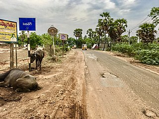
East Godavari is a district in the Coastal Andhra region of Andhra Pradesh, India. Its district headquarters is at Rajamahendravaram.

The West Godavari district is a coastal district in the Indian state of Andhra Pradesh with an administrative headquarters in Bhimavaram. As of the 2011 Census of India, the district has an area of 2,178 km2 (841 sq mi) and a population of 1,779,935. It is bounded by the Krishna district and Bay of Bengal to the south, East Godavari district to the east, and Eluru district, Kolleru Lake and Upputeru Drain to the northwest.

Eluru is a city and the district headquarters of Eluru district in the Indian state of Andhra Pradesh. It is one of the 14 municipal corporations in the state and the mandal headquarters of Eluru mandal in the Eluru revenue division. The city is on the Tammileru river. The city is well known for its wool-pile carpets and hand woven products. As of 2011 Census of India, the city had a population of 214,414. Its history dates back to the second century CE.

Dwaraka Tirumala is a census town in Eluru district of the Indian state of Andhra Pradesh. It is located in Dwaraka Tirumala mandal of Jangareddygudem revenue division. The Venkateswara Temple is a pilgrimage center for hindus, which is the abode of Lord Venkateswara. This is often referred by the locals as Chinna Tirupati, meaning mini Tirupati.

Pedavegi is a village in Eluru district in the state of Andhra Pradesh in India, 10 km north of Eluru. It is administered under Eluru revenue division. Pedavegi also serves as the mandal headquarters of Pedavegi mandal. The nearest railway station is Denduluru (DEL) located at a distance of 9.15 km.
Eluru mandal is one of the 28 mandals in Eluru district of the Indian state of Andhra Pradesh. It is administered under Eluru revenue division and its headquarters are located at Eluru city. The mandal is bounded by Pedapadu mandal, Pedavegi mandal, Denduluru mandal, Bhimadole mandal and it also borders Krishna district.
Pedavegi mandal is one of the 28 mandals in Eluru district of the Indian state of Andhra Pradesh. It is administered under Eluru revenue division and its headquarters are located at Pedavegi. The mandal is bounded by Eluru mandal, Denduluru mandal, Kamavarapukota mandal.
Bhimadole mandal is one of the 28 mandals in Eluru district of the Indian state of Andhra Pradesh. It is administered under Eluru revenue division and its headquarters are located at Bhimadole.
Pedapadu mandal is one of the 28 mandals in Eluru district of the Indian state of Andhra Pradesh having population of 76,793 as of 2011 census. It is administered under Eluru revenue division and its headquarters are located at Pedapadu.
Polavaram mandal is one of the 28 mandals in Eluru district of the Indian state of Andhra Pradesh. It is under the administration of Jangareddigudem revenue division and the headquarters are located at Polavaram. The mandal lies on the banks of Godavari River which separates it from East Godavari district and is bounded by Gopalapuram and Buttayagudem mandals.
Sreeparru is a village in Eluru district in the state of Andhra Pradesh in India. It is 22 km from the city of Eluru, the headquarters of Eluru district.
Komadavole is an out growth of Eluru city in Eluru district of the Indian state of Andhra Pradesh. It is located in Eluru mandal of Eluru revenue division. It is also a constituent of Eluru Urban Agglomeration.
Chodimella is a village and census town in Eluru district of the Indian state of Andhra Pradesh. It is located in Eluru mandal of Eluru revenue division. The town is a constituent of Eluru urban agglomeration.
Jalipudi is a village in Eluru district of the Indian state of Andhra Pradesh. It is located in Eluru mandal of Eluru revenue division. The town is a constituent of Eluru urban agglomeration.
Madepalle is a village in Eluru district of the Indian state of Andhra Pradesh. It is located in Eluru mandal of Eluru revenue division. The town is a constituent of Eluru urban agglomeration.
Malkapuram is a village in Eluru district of the Indian state of Andhra Pradesh. It is located in Eluru mandal of Eluru revenue division. The town is a constituent of Eluru urban agglomeration.
Ganapavaram mandal is one of the 20 mandals in West Godavari district of the Indian state of Andhra Pradesh. It is under the administration of Bhimavaram revenue division and the headquarters are located at Ganapavaram. Ganapavaram Mandal is bounded by Nidamarru Mandal towards west, Pentapadu Mandal towards North, Undi Mandal towards South, Unguturu Mandal towards North. Tadepalligudem, Bhimavaram, Tanuku, Eluru are the nearby Cities to Ganapavaram. It is located 55 km from Eluru and 22 km from Bhimavaram.
Chintalapudi mandal is one of the 28 mandals in Eluru district of the Indian state of Andhra Pradesh. It is administered under Nuzvidu revenue division and its headquarters are located at Chintalapudi. The mandal is bounded by T.Narasapuram mandal, Lingapalem mandal, Khammam district
Lingapalem Mandal is one of 28 mandals in the Eluru district of Andhra Pradesh in India. Its headquarters are located in Lingapalem. It is bordered by T.Narasapuram and Chintalapudi in the North, Khammam district tin the West, Kamavarapukota mandal in the East, and Pedavegi mandal in the South.

Eluru district is a district in coastal Andhra Region in the Indian state of Andhra Pradesh. With Eluru as its administrative headquarters, it was proposed on 26 January 2022 to become one of the resultant twenty six districts in the state once a final notification is issued by the government of Andhra Pradesh. It is formed from Eluru revenue division and Jangareddygudem revenue division from West Godavari district and Nuzvid revenue division from Krishna district.


