
Krishna district is a district in the coastal Andhra Region in Indian state of Andhra Pradesh, with Machilipatnam as its administrative headquarters. It is surrounded on the East by Bay of Bengal, West by Guntur, Bapatla and North by Eluru and NTR districts and South again by Bay of Bengal.

The West Godavari district is a coastal district in the Indian state of Andhra Pradesh with an administrative headquarters in Bhimavaram. As of the 2011 Census of India, the district has an area of 2,178 km2 (841 sq mi) and a population of 1,779,935. It is bounded by the Krishna district and Bay of Bengal to the south, East Godavari district to the east, and Eluru district, Kolleru Lake and Upputeru Drain to the northwest.
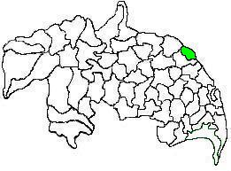
Vijayawada Rural mandal is one of the 20 mandals in NTR district of the Indian state of Andhra Pradesh. It is under the administration of Vijayawada revenue division and has its headquarters at Nunna. The mandal is bounded by Ibrahimpatnam, G. Konduru, Gannavaram, Kankipadu, Penamaluru and Patamata Mandals. The mandal is also a part of the Andhra Pradesh Capital Region under the jurisdiction of APCRDA.
Vizianagaram mandal is one of the 34 mandals in Vizianagaram district of Andhra Pradesh, India. Vizianagaram city is the headquarters of the mandal. The mandal is bounded by Gantyada, Bondapalle, Nellimarla, Denkada, Jami mandals and Visakhapatnam district.
Bhimavaram mandal is one of the 19 mandals in West Godavari district of the Indian state of Andhra Pradesh. It has headquarters at Bhimavaram town. The mandal is bounded by Undi mandal, Palacoderu mandal, Veeravasaram mandal, Narasapuram mandal, Mogalthur mandal and Kalla mandal mandals.

Mangalagiri mandal is one of the 18 mandals in Guntur district of the Indian state of Andhra Pradesh. It is under the administration of Tenali revenue division and the headquarters are located at Mangalagiri town part of Mangalagiri Tadepalli Municipal Corporation. The mandal is bounded by Thullur, Tadepalle, Tadikonda, Pedakakani and Duggirala mandals and a portion of the mandal lies on the banks of Krishna River.
Tadepalli mandal is one of the 18 mandals in Guntur district of the Indian state of Andhra Pradesh. It is under the administration of Tenali revenue division and the headquarters are located at Tadepalli town. The mandal is situated on the banks of Krishna River, bounded by Thullur and Mangalagiri mandals. from the mandal are under the jurisdiction of Andhra Pradesh Capital City.
Penamaluru mandal is one of the 25 mandals in Krishna district of the Indian state of Andhra Pradesh. Penamaluru Mandal is the major suburb of Vijayawada.It is under the administration of Vuyyuru revenue division and its headquarters are located at Penamaluru. The mandal lies on the banks of Krishna River and is bounded by Vijayawada (urban), Vijayawada (rural) and Kankipadu mandals. The mandal is also a part of the Andhra Pradesh Capital Region under the jurisdiction of APCRDA.
Pedavegi mandal is one of the 28 mandals in Eluru district of the Indian state of Andhra Pradesh. It is administered under Eluru revenue division and its headquarters are located at Pedavegi. The mandal is bounded by Eluru mandal, Denduluru mandal, Kamavarapukota mandal.
Bhimadole mandal is one of the 28 mandals in Eluru district of the Indian state of Andhra Pradesh. It is administered under Eluru revenue division and its headquarters are located at Bhimadole.
Pedapadu mandal is one of the 28 mandals in Eluru district of the Indian state of Andhra Pradesh having population of 76,793 as of 2011 census. It is administered under Eluru revenue division and its headquarters are located at Pedapadu.
Undrajavaram mandal is one of the 19 mandals in East Godavari district of the Indian state of Andhra Pradesh having population of 37,774 as of 2011 census. It is administered under Kovvur revenue division and its headquarters are located at Undrajavaram.
Nallajerla mandal is one of the 19 mandals in East Godavari district of the Indian state of Andhra Pradesh having population of 80,388 as of 2011 census. It is administered under Kovvur revenue division and its headquarters are located at Nallajerla.
Ganapavaram mandal is one of the 20 mandals in West Godavari district of the Indian state of Andhra Pradesh. It is under the administration of Bhimavaram revenue division and the headquarters are located at Ganapavaram. Ganapavaram Mandal is bounded by Nidamarru Mandal towards west, Pentapadu Mandal towards North, Undi Mandal towards South, Unguturu Mandal towards North. Tadepalligudem, Bhimavaram, Tanuku, Eluru are the nearby Cities to Ganapavaram. It is located 55 km from Eluru and 22 km from Bhimavaram.
Chintalapudi mandal is one of the 28 mandals in Eluru district of the Indian state of Andhra Pradesh. It is administered under Nuzvidu revenue division and its headquarters are located at Chintalapudi. The mandal is bounded by T.Narasapuram mandal, Lingapalem mandal, Khammam district
Lingapalem Mandal is one of 28 mandals in the Eluru district of Andhra Pradesh in India. Its headquarters are located in Lingapalem. It is bordered by T.Narasapuram and Chintalapudi in the North, Khammam district tin the West, Kamavarapukota mandal in the East, and Pedavegi mandal in the South.
Palakollu mandal is one of the 46 mandals in the West Godavari district of the Indian state of Andhra Pradesh. The headquarters is located at Palakollu City. The mandal is bordered by Yelamanchili mandal in the north, Narasapuram mandal in the east, Poduru mandal in the south and Veeravasaram mandal in the west.
Chagallu mandal is one of the 19 mandals in East Godavari district of the Indian state of Andhra Pradesh. It is administered under Kovvur revenue division and its headquarters are located at Chagallu. The mandal is bounded by Kovvur, Nidadavole and Devarapalle mandals.
Gopalapuram mandal is one of the 19 mandals in East Godavari district of the Indian state of Andhra Pradesh. It is administered under Kovvur revenue division and its headquarters are located at Gopalapuram. The mandal is bounded by Polavaram, Koyyalagudem, Devarapalle and Tallapudi mandals.

Eluru district is a district in coastal Andhra Region in the Indian state of Andhra Pradesh. With Eluru as its administrative headquarters, it was proposed on 26 January 2022 to become one of the resultant twenty six districts in the state once a final notification is issued by the government of Andhra Pradesh. It is formed from Eluru revenue division and Jangareddygudem revenue division from West Godavari district and Nuzvid revenue division from Krishna district.

