
Vijayawada is a city on the banks of Krishna River, in Krishna district of the Indian state of Andhra Pradesh. It is one of the twelve urban local bodies and is a highly developed area in the Andhra Pradesh Capital Region The city is the second largest city in the state by population and third most densely populated urban built-up areas in the world.
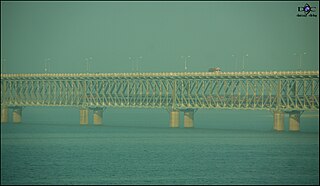
Rajahmundry, officially known as Rajamahendravaram, is a city located in East Godavari district in the Indian state of Andhra Pradesh. The city is located on the banks of Godavari River. In the Madras Presidency, the District of Rajahmundry was created in 1823. It was reorganised in 1859 and was bifurcated into Godavari and Krishna districts. During British rule, Rajahmundry was the headquarters of Godavari District, which was further bifurcated into East Godavari and West Godavari districts in 1925. When the Godavari District was bifurcated, Kakinada became the headquarters of East Godavari and Eluru became headquarters of West Godavari. It is administered under Rajahmundry revenue division. The city is known for its Floriculture, History, Culture, Agriculture, Economy, Tourism, Industrial potential and its Heritage. It is known as the Cultural Capital of Andhra Pradesh.

Eluru is a city and the district headquarters of West Godavari district in the Indian state of Andhra Pradesh. It is one of the 14 municipal corporations in the state and the mandal headquarters of Eluru mandal in the Eluru revenue division. The city is on the Tammileru river. The city is well known for its wool-pile carpets and hand woven products. As of 2011 Census of India, the city had a population of 217,876. Its history dates back to the second century CE.

Palakollu is the administrative headquarters of Palakollu Mandal in Narasapuram revenue division in West Godavari district of the Indian state of Andhra Pradesh. Palakollu is situated in Coastal Andhra region of the state. It occupies 19.49 square kilometres (7.53 sq mi). As of 2011 census, it has a population of about 61,200 and a Metro population of about 81,199, making it the fourth most populous city in West Godavari District in Andhra Pradesh. It is a part of Eluru Urban Development Authority.
Kochi is a major port city in the Indian state of Kerala. The city is widely known as the commercial or economic capital of the state of Kerala and thus good transport infrastructure is critical for the city's economy. The road infrastructure in Kochi has not been able to meet the growing traffic demand and hence traffic congestion is a major problem in the city. A comprehensive transport development plan has been included in the Kochi Masterplan hoping to improve the transport infrastructure. Kochi Metro, the rapid transit system for the city was inaugurated on 17 June 2017. A Suburban Railway system, intended to considerably ease congestion, is also to be built in the near future.

Gummudipoondi is an industrial town in Chennai Metropolitan Region of Thiruvallur district in the Indian state of Tamil Nadu.
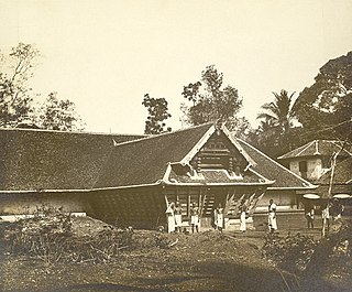
Elathur is a part of calicut corporation in Kozhikode district in the Indian state of Kerala. It is located about 12 km north of Kozhikode city on the [[</ref> Highway 17 (India)|Kozhikode-Kannur National Highway 17]] and is bounded by the Arabian Sea at the west and Korapuzha River at the north. The Elathur River is generally considered to be the boundary between the North Malabar and South Malabar in the erstwhile district of Malabar.
Tirunelveli City being the district headquarters of Tirunelveli District in the Indian state of Tamil Nadu. It has a very extensive transport network. Tirunelveli is a vital tourist destination with lot of religious places, monuments and hill stations. Tirunelveli is also a major junction for transportation around Tirunelveli, Thoothukudi and Kanyakumari Districts.
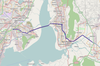
The Sion Panvel Expressway is a 25 km Indian highway located entirely in the state of Maharashtra, that connects Sion in Mumbai with Panvel, via Navi Mumbai. It is one of the busiest and most important roads in the Mumbai Metropolitan Region (MMR), and connects Mumbai with the city of Pune. The National Highway 4 and Mumbai Pune Expressway begin at the eastern end of the expressway, at Kalamboli junction, near Panvel. The highway is also used by vehicles traveling towards Mumbai from Konkan and Goa.
Erode city being the headquarters of Erode district, in India, has an extensive road, rail and water transport network, as it lies on the Kaveri (Cauvery) River.

Thanjavur has a well-developed transport infrastructure. Thanjavur is well connected by Road, and Rail with most cities and towns in India
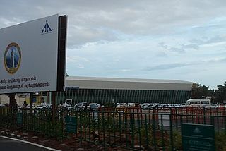
Coimbatore has a well-developed transport infrastructure. The city and its suburbs is traversed using its road networks. Coimbatore is well connected by Road, Rail and Air with most cities and towns in India except through waterways. The city has fairly better transport infrastructure, though road infrastructures are not well maintained and developed according to the growing needs of transport, making traffic congestion a major problem in the city. A comprehensive transport development plan is made part of Coimbatore Masterplan as part to ease many of traffic problems.

The Duvvada–Vijayawada section is a railway line connecting Duvvada of Visakhapatnam and Vijayawada, both in the Indian state of Andhra Pradesh. The main line is part of the Howrah-Chennai main line. The track from Duvvada to Thadi is under the administrative jurisdiction of South Coast Railway, and the rest of the line from Anakapalle to Vijayawada is under the administrative jurisdiction of South Coast Railway zone headquartered in Visakhapatnam.
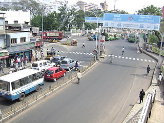
EVR Periyar Salai (EVR High Road), earlier known as Poonamallee High Road(NH 48), is an arterial road in Chennai, India. It is the longest road in Chennai. Running from east to west, the 14-kilometre (8.7 mi) road starts at Muthuswamy Bridge near Madras Medical College at Park Town and ends near Maduravoyal Junction via Kilpauk, Aminjikarai, Anna Nagar Arch, Arumbakkam, Koyambedu. It further continues west towards Poonamallee and traverses Sriperumbudur, Walajapet, and Ranipet.
Andhra Pradesh is well connected with various destinations in India, as well as other countries. It has road, rail, airways. With a long coast of Bay of Bengal and many ports, it flourishes in sea trade as well. The state has one of the largest railway junctions at Vijayawada and Visakhapatnam Port being one of the largest cargo handling seaport.

Transport in Kollam includes various modes of road, rail and water transportation in the city and its suburbs. State-owned Kerala State Road Transport Corporation buses, private buses, Indian Railways, state-owned Kerala State Water Transport Department boats & ferry, taxis and auto rickshaws are serving the city of Kollam. The city had a strong commercial reputation since the days of the Phoenicians and Romans. Ibn Battuta mentioned Kollam Port as one of the five Indian ports he had seen during the course of his twenty-four year travels.

Powerpet is a suburb of Eluru city. It is located in the II-town area of the city. An underpass is constructed below the railway line to connect Powerpet with 1-Town area. It is named after British railway engineer Sir Power in memory of his contribution to the locality's development.

There are various modes of transportation available in Eluru and its region. It includes auto rickshaws, bicycles to mass transit systems – such as buses and trains. The city was once famed for its traffic problems with the railway gates at Vatluru, Venkatraopet, Powerpet, Old bus stand and Eastern Locks areas. When the National Highway passed through the city, the traffic hurried to pass over the railway gates in the city and outskirts, which makes traffic worse.
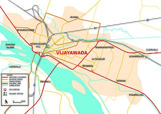
There are various modes of transportation available in Vijayawada and its region. It includes auto rickshaws, bicycles to mass transit systems – such as buses and trains. Most of the city commuters uses private transit when compared to public.
National Highway 216A is a National Highway in the Indian state of Andhra Pradesh. It starts from Rajamahendravaram and passes through Ravulapalem, Tanuku, Tadepalligudem and terminates at Eluru.


