
The West Godavari district is a coastal district in the Indian state of Andhra Pradesh with an administrative headquarters in Bhimavaram. As of the 2011 Census of India, the district has an area of 2,178 km2 (841 sq mi) and a population of 1,779,935. It is bounded by the Krishna district and Bay of Bengal to the south, East Godavari district to the east, and Eluru district, Kolleru Lake and Upputeru Drain to the northwest.

Tadepalligudem is a city in West Godavari district of the Indian state of Andhra Pradesh. Tadepalligudem is the judicial headquarter of West Godavari. It is a Selection Grade municipality and the mandal headquarters of Tadepalligudem mandal and Tadepalligudem Revenue Division. Tadepalligudem is one of the biggest cities in West Godavari district
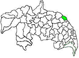
Peravali is a village in East Godavari district of the Indian state of Andhra Pradesh. The nearest railway station is Tanuku (TNKU) located at a distance of 7.25 Km. Postal index code of this village is 534328
Bhimavaram mandal is one of the 19 mandals in West Godavari district of the Indian state of Andhra Pradesh. It has headquarters at Bhimavaram town. The mandal is bounded by Undi mandal, Palacoderu mandal, Veeravasaram mandal, Narasapuram mandal, Mogalthur mandal and Kalla mandal mandals.

Mangalagiri mandal is one of the 18 mandals in Guntur district of the Indian state of Andhra Pradesh. It is under the administration of Tenali revenue division and the headquarters are located at Mangalagiri town part of Mangalagiri Tadepalli Municipal Corporation. The mandal is bounded by Thullur, Tadepalle, Tadikonda, Pedakakani and Duggirala mandals and a portion of the mandal lies on the banks of Krishna River.
Tadepalle mandal is one of the 18 mandals in Guntur district of the Indian state of Andhra Pradesh. It is under the administration of Tenali revenue division and the headquarters are located at Tadepalle town. The mandal is situated on the banks of Krishna River, bounded by Thullur and Mangalagiri mandals. from the mandal are under the jurisdiction of Andhra Pradesh Capital City.
Eluru mandal is one of the 28 mandals in Eluru district of the Indian state of Andhra Pradesh. It is administered under Eluru revenue division and its headquarters are located at Eluru city. The mandal is bounded by Pedapadu mandal, Pedavegi mandal, Denduluru mandal, Bhimadole mandal and it also borders Krishna district.
Narasaraopet mandal is one of the 28 mandals in Guntur district of the India state of Andhra Pradesh. It is under the administration of Narasaraopet revenue division and the headquarters are located at Narasaraopet city. The mandal is bounded by Rompicherla, Nekarikallu, Muppalla, Phirangipuram, Nadendla and Chilakaluripeta. It also borders Prakasam district.
Kovvur mandal is one of the 19 mandals in East Godavari district of the Indian state of Andhra Pradesh. Its headquarters are located in the town of Kovvur. The mandal is bounded by Nidadavole, Chagallu, Devarapalle, Tallapaudi mandals and on the east by the Godavari River.

Narasapuram Mandal is one of the 19 mandals in the West Godavari district of the Indian state of Andhra Pradesh. Its headquarters are in Narasapuram, a town in the mandal. The mandal is bordered by the Godavari River to the north, the Bay of Bengal to the east, the Mogalthur mandal to the south, and the Palacole mandal to the west.
Tanuku mandal is one of the 48 mandals in West Godavari district of the Indian state of Andhra Pradesh. It is under the administration of Tadepalligudem revenue division and the headquarters are located at Tanuku. The mandal is bounded by Iragavaram, Nallajerla, Devarapalle, Nidadavolu, Unguturu, Pentapadu, Tanuku and Undrajavaram mandals.
Dwaraka Tirumala mandal is one of the 28 mandals in Eluru district of the Indian state of Andhra Pradesh. It is under the administration of Eluru revenue division, and the headquarters are located at Dwaraka Tirumala. The mandal is bounded by Jangareddygudem, Koyyalagudem, Kamavarapukota, Nallajerla, Pedavegi, Unguturu, Denduluru and Bhimadole mandals.
Polavaram mandal is one of the 28 mandals in Eluru district of the Indian state of Andhra Pradesh. It is under the administration of Jangareddigudem revenue division and the headquarters are located at Polavaram. The mandal lies on the banks of Godavari River which separates it from East Godavari district and is bounded by Gopalapuram and Buttayagudem mandals.
Ganapavaram mandal is one of the 20 mandals in West Godavari district of the Indian state of Andhra Pradesh. It is under the administration of Bhimavaram revenue division and the headquarters are located at Ganapavaram. Ganapavaram Mandal is bounded by Nidamarru Mandal towards west, Pentapadu Mandal towards North, Undi Mandal towards South, Unguturu Mandal towards North. Tadepalligudem, Bhimavaram, Tanuku, Eluru are the nearby Cities to Ganapavaram. It is located 55 km from Eluru and 22 km from Bhimavaram.

Biccavolu mandal is one of the 19 mandals in East Godavari district of the Indian state of Andhra Pradesh. It is under the administration of Rajahmundry revenue division and the headquarters are located at Biccavolu village. Biccavolu Mandal is bounded by Rayavaram Mandal towards South, Pedapudi Mandal towards East, Anaparthy Mandal towards west, Ramachandrapuram Mandal towards north. It is located ata distance of 41 kilometres from Rajahhmundry.
Unguturu mandal is one of 28 mandals in the Eluru district of the Indian state of Andhra Pradesh. The headquarters are located at Unguturu. The mandal is bordered by Tadepalligudem mandal and Pentapadu mandal to the north, Nallajerla mandal to the west, Nidamarru mandal to the east, and by Dwaraka Tirumala mandal and Bhimadole mandal to the south

Pentapadu mandal is one of 19 mandals in the West Godavari district of the Indian state of Andhra Pradesh.
Akividu mandal is one of the 19 mandals in West Godavari district of the Indian state of Andhra Pradesh. The headquarters is located at Akividu town. The mandal is bordered by Nidamarru mandal to the west, Krishna district to the south, Tanuku and Undi mandal to the north and Kalla mandal to the east.
Palakollu mandal is one of the 46 mandals in the West Godavari district of the Indian state of Andhra Pradesh. The headquarters is located at Palakollu City. The mandal is bordered by Yelamanchili mandal in the north, Narasapuram mandal in the east, Poduru mandal in the south and Veeravasaram mandal in the west.
Achanta Mandal is one of the 46 mandals in West Godavari district of the Indian state of Andhra Pradesh. Its headquarters are located in Achanta. The mandal is bordered by Godavari River to the north, Yelamanchili mandal to the east, Poduru mandal to the south, and Penugonda mandal to the west.

