The Godavari is India's second longest river after the Ganga River and drains the third largest basin in India, covering about 10% of India's total geographical area. Its source is in Trimbakeshwar, Nashik, Maharashtra. It flows east for 1,465 kilometres (910 mi), draining the states of Maharashtra (48.6%), Telangana (18.8%), Andhra Pradesh (4.5%), Chhattisgarh (10.9%) and Odisha (5.7%). The river ultimately empties into the Bay of Bengal through an extensive network of distributaries. Its 312,812 km2 (120,777 sq mi) drainage basin is one of the largest in the Indian subcontinent, with only the Ganga and Indus rivers having a larger drainage basin. In terms of length, catchment area and discharge, the Godavari is the largest in peninsular India, and had been dubbed as the Dakshina Ganga.
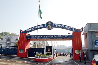
Visakhapatnam is the largest and most populous metropolitan city in the Indian state of Andhra Pradesh. It is between the Eastern Ghats and the coast of the Bay of Bengal. It is the second largest city on the east coast of India after Chennai, and the fourth largest in South India. It is one of the four smart cities of Andhra Pradesh selected under the Smart Cities Mission and is the headquarters of Visakhapatnam district. Vizag is popularly knows as shipbuilding capital of India due to presence of multiple shipyard such as Hindustan Shipyard, Naval Dockyard and being the central naval command of the east coast.

Coastal Andhra, also known as Kosta Andhra, is a geographic region in the Indian state of Andhra Pradesh, comprising the coastal districts of the state between the Eastern Ghats and the Bay of Bengal, from the northern border with Orissa to Rayalaseema in the south. It includes major cities such as Visakhapatnam and Vijayawada as well as the state capital Amaravati and is recognized for its fertile lands, rich cultural heritage, and economic importance. Coastal Andhra plays a significant role in the state's agricultural output, particularly in rice and tobacco production, supported by abundant water resources from the Godavari, Krishna, and Penna rivers.

Vizianagaram district is one of the six districts in the Uttarandhra region of the Indian state of Andhra Pradesh with its headquarters located at Vizianagaram. The district was once the part of ancient Kalinga.Saripilli Dibbilingeswara temple, Jayathi Mallikarjuna Temple are the finest examples of ancient Eastern Ganga Dynasty built monuments in the district. The district is bounded on the east by the district of Srikakulam, north by Parvathipuram Manyam south by Visakhapatnam, Anakapalli, southeast by the Bay of Bengal, and west by Alluri Sitharama Raju district. It was formed on 1 June 1979, with some parts carved from the neighbouring districts of Srikakulam and Visakhapatnam. The district is named after the princely state of Vizianagaram. In 2011, it was the least populous district in Andhra Pradesh.

Srikakulam district is a district in the Indian state of Andhra Pradesh, located in the Uttarandhra region of the state, with its headquarters located at Srikakulam. It is one of the six districts, located in the extreme northeastern direction of the state. It was formerly known as Chicacole, and was under Ganjam district till 1 April 1936, then merged under Vizagapatam district. Srikakulam district forms the core area of Kalinga where most of its historical capitals like Kalinganagari, pithunda, Dantapuram are located.

The Borra Caves(Borrā Guhalu) are located on the East Coast of India, in the Ananthagiri hills of the Araku Valley of the Alluri Sitharama Raju district in Andhra Pradesh. The caves, one of the largest in the country, at an elevation of about 705 m (2,313 ft), distinctly exhibit a variety of speleothems ranging in size and irregularly shaped stalactites and stalagmites. The caves are basically karstic limestone structures extending to a depth of 80 m (260 ft), and are considered the deepest caves in India. The native name for the caves is Borrā Guhalu where Borra means abdomen in and Guhalu means caves in Telugu language.

(Bheemunipatnam ), is a suburb of Visakhapatnam, India. The town was named after Bhima, a character in the Hindu epic Mahabharata. It was formerly administered under the Bheemunipatnam municipality but merged into GVMC in 2017. It is currently under the administration of Bheemunipatnam Revenue Division and its headquarters is at Bheemunipatnam.

The River Nagavali also known as Langulya is one of the main rivers of Southern Odisha and Andhra States in India, between Rushikulya and Godavari basins.

North Andhra or Uttara Andhra, also known as Kalinga Andhra, is a geographic region in the Indian state of Andhra Pradesh. It is between the Eastern Ghats and the coast of the Bay of Bengal. It comprises six northern districts of the state, Srikakulam, Parvathipuram Manyam, Vizianagaram, Visakhapatnam, half of the Alluri Sitharama Raju district and Anakapalli. Alluri Sitharama Raju district was carved out of Erstwhile Visakhapatnam and East Godavari districts. So, half of the Alluri Sitharamaraju district belongs to North Andhra/ Uttara Andhra and the southern part of this district belongs to Coastal Andhra region/ Godavari region. As of 2011 census of India, the region with six districts has a population of 9,338,177.

River Champavathi is a small river which originates in the Eastern Ghats at an altitude of 1,200 metres above mean sea level near Andra village and flows eastwards and joins the Bay of Bengal near the village Konada. The river passes through Gajapathinagaram, Nellimarla, Saripalli, Denkada, Palem and Natavalasa of Vizianagaram district. The river has four main tributaries Eduvampula Gedda, Chitta Gedda, Pothula Gedda and Gadi Gedda. The basin has a drainage area of 1,410 square kilometres. This area is divisible into Hilly terrain, Vizianagaram plains and Coastal plains.

River Sarada is a medium-sized river in Alluri Sitharama Raju and Anakapalli districts of Andhra Pradesh, India.

The Gundlakamma River is a seasonal waterway that flows through the east-central part of the state of Andhra Pradesh, India. It arises in the Nallamala Hills, an offshoot of the Eastern Ghats. Gundlakamma is the largest of all the rivers that originate from the Nallamalla Hills.

The Polavaram Project is an under construction multi-purpose irrigation project on the Godavari River in the Eluru District and East Godavari District in Andhra Pradesh. The project has been accorded National project status by the Central Government of India. Its reservoir back water spreads up to the Dummugudem Anicut and approx 115 km on Sabari River side. Thus back water spreads into parts of Chhattisgarh and Odisha States. It gives major boost to tourism sector in Godavari Districts as the reservoir covers the famous Papikonda National Park, Polavaram hydro electric project (HEP) and National Waterway 4 are under construction on left side of the river. It is located 40 km to the upstream of Sir Arthur Cotton Barrage in Rajamahendravaram City and 25 km from Rajahmundry Airport.
Pavurallakonda or Pavurallabodu is a hill popularly known as Narasimhaswamy Konda. It is located near Bheemunipatnam, about 25 km north of Visakhapatnam, Andhra Pradesh, India.

"Tatipudi Reservoir" is a dam located on River Gosthani in Andhra Pradesh. It is a water supply reservoir to the city of Visakhapatnam. Thatipudi Reservoir Project was constructed across Gosthani River during 1963–1968. The Project is aimed to irrigate a total ayacut of 15,378 acres (62 km2) in Vizianagaram District and to provide drinking water to Visakhapatnam City. The Project utilizes 3.325 tmcft of the available water and the reservoir storage capacity is about 3 tmcft. The Cost of the project is Rs. 1,820 crores. The Ayacut of 15,378 acres (62 km2) has been stabilised in Gantyada, S.Kota and Jami Mandals of Vizianagaram District.

The Khurda Road–Visakhapatnam section is a railway line connecting Khurda Road in the Indian state of Odisha and Visakhapatnam in Andhra Pradesh. The main line is part of the Howrah–Chennai main line.

Gudiwada Dibba is a small hillock at Gudiwada village in Bhogapuram mandal, Vizianagaram district, Andhra Pradesh. It located on the banks of River Gosthani.

Tagarapuvalasa is a neighbourhood on the banks of River Gosthani is a part of Bheemunipatnam Municipality (BMC) in Andhra Pradesh. It is located on the Kolkata–Chennai National Highway 16.
National Highway 43 diverts from Maharajupeta village north of Tagarapuvalasa.

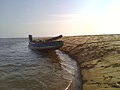
The state of Andhra Pradesh has a coastline of 970 km2 (370 sq mi) and hence, there exist many beaches. The seacoast extends along the Bay of Bengal from Srikakulam district to Nellore district.

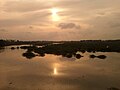
The coastline of Andhra Pradesh is located on the southeastern coast of the Indian Peninsula in the Bay of Bengal and is part of the Northern Circars. With a length of 975 km, it has the second longest coastline in India after Gujarat. The coastal corridor boasts several ports, harbors, vast stretches of sandy beaches, wildlife and bird sanctuaries, as well as fresh water lakes and estuaries.