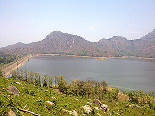
The Tungabhadra River starts and flows through the state of Karnataka, India, during most of its course, then through Andhra Pradesh, and ultimately joins the Krishna River near Murvakonda in Andhra Pradesh.

Pothundi Dam is an irrigation dam near Pothundi village in the Palakkad district of Kerala state, India. Constructed in the 19th century, it is considered one of the oldest dams in India. It provides irrigation to an area of 5,470 hectares in the Palakkad district and drinking water supply to the Nemmara, Ayalur, Melarcode Panchayat. An unusual feature of the earth dam is the core wall, which is built with a mixture of jaggery and quick lime.

Kadapa district is one of the twenty six districts in the Indian state of Andhra Pradesh. In the 2022 reorganisation of Andhra Pradesh districts, the district boundary was largely restricted to the Kadapa parliamentary constituency area. It is one of the eight districts in the Rayalaseema region. Kadapa is the administrative headquarters for this district.
Rayachoti is a Municipality and District headquarters of Annamayya district which is formed after Rajampet of the Indian state of Andhra Pradesh. Also It is the headquarters of Rayachoti revenue division. It is one of the oldest towns in Andhra Pradesh.
Varahi River originate and flows through Western Ghats in the Indian state of Karnataka. It is also known as Halady or Haladi river in downstream areas. It joins the Arabian sea after flowing through places like Halady, Basrur, Kundapura and Gangolli. It joins with the Souparnika River, Kedaka River, Chakra River, and Kubja River which are known by Panchagangavalli River and merges into the Arabian Sea. Pancha means five in Kannada and Samskrita and Ganga means river. According to mythology, Varaha is one of the incarnations of Lord Vishnu. Varahi is the sister of lord Varaha-vishnu

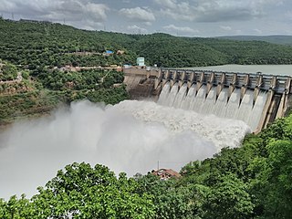
The Srisailam Dam is constructed across the Krishna River in Nandyal district, Andhra Pradesh and Nagarkurnool district, Telangana near Srisailam temple town and is the 2nd largest capacity working hydroelectric station in India.

The Bear River is a tributary of the Feather River in the Sierra Nevada, winding through four California counties: Yuba, Sutter, Placer, and Nevada. About 73 miles (117 km) long, the river flows generally southwest through the Sierra then west through the Central Valley, draining a narrow, rugged watershed of 295 square miles (760 km2).

The Polavaram Project is an under construction multi-purpose irrigation project on the Godavari River in the Eluru District and East Godavari District in Andhra Pradesh. The project has been accorded National project status by the Central Government of India. Its reservoir back water spreads up to the Dummugudem Anicut and approx 115 km on Sabari River side. Thus back water spreads into parts of Chhattisgarh and Odisha States. It gives major boost to tourism sector in Godavari Districts as the reservoir covers the famous Papikonda National Park, Polavaram hydro electric project (HEP) and National Waterway 4 are under construction on left side of the river. It is located 40 km to the upstream of Sir Arthur Cotton Barrage in Rajamahendravaram City and 25 km from Rajahmundry Airport.

The Bhadra Dam or Lakkavalli Dam, which has created the Bhadra Reservoir, is located on the Bhadra River a tributary of Tungabhadra River. Bhadra Dam is located in the border of Bhadravathi and Tarikere, in the western part of Karnataka in India. The benefits derived from the reservoir storage are irrigation with gross irrigation potential of 162,818 hectares, hydro power generation of 39.2 MW, drinking water supply and industrial use. The dam commissioned in 1965 is a composite earth cum masonry structure of 59.13 metres (194.0 ft) height with length of 1,708 metres (5,604 ft) at the crest level, which submerges a land area of 11,250.88 hectares.

Kodiveri Dam is a masonry dam located on the Bhavani river in Gobichettipalayam taluk, Erode district in the Indian state of Tamil Nadu. The dam is situated along the State Highway 15 about 15 km (9.3 mi) from Gobichettipalayam towards Sathyamangalam in the western region of the state.
Handri-Neeva Sujala Sravanthi project is the longest water canal project in the region of Rayalaseema, Andhra Pradesh, India. The project was conceived to provide a reliable irrigation and drinking water supply for the region through drawing flood waters from the Srisailam reservoir.

Mylavaram Dam is a medium irrigation project in Andhra Pradesh, India. This barrage is located across the Penna river in Kadapa district near Mylavaram. With the completion of srisailam right bank canal, Krishna River water would be fed from Srisailam reservoir to this reservoir. The reservoir has a gross storage capacity of 9.96 tmcft.
Jeedipalli Reservoir is an irrigation project located in Anantapur district in Andhra Pradesh, India. It receives water from Handri-Neeva canal which draws water from Srisailam reservoir. It is located in Jeedipalli village of Beluguppa mandal.

The Pazhassi Dam also called Kulur Barrage is a stone masonry diversion structure in Kannur district, Kerala, India. It is named after king Pazhassi Raja, a patriot who died a heroic death in the war. The dam is constructed across the west flowing Bavali river near Veliyambra. It was commissioned by Prime Minister Morarji Desai in 1979. It mainly functions as an irrigation dam, serving a command area of 11,525 hectares in Iritty taluk of the Kannur District. The water from this dam also meets the drinking water requirement of Kannur district. The dam site and the reservoir are known for their scenery.

The Chitravathi is an inter-state river in southern India that is a tributary of the Penna River. Rising in Karnataka, it flows into Andhra Pradesh and its basin covers an area of over 5,900 km2. The pilgrim town of Puttaparthi is located on its banks.

Cheyyeru river is a river in the southern Indian state of Andhra Pradesh that is a tributary of the Pennar river.

Kulamavu Dam is a gravity/masonry dam on Kilivillithode, which is a tributary of the Periyar river in Arakkulam village, Idukki district in the Indian state of Kerala. It is one of three dams associated with the Idukki hydroelectric power project in the Indian state of Kerala. This dam is located towards the western side of the Idukki Arch Dam. This is a gravity dam with the top portion in concrete and the bottom in masonry.

Gandikota Reservoir is an irrigation project located across Penna River of Andhra Pradesh in the Indian state. It receives water from Galeru Nagari Sujala Sravanthi Project canal. It is located between Gandikota village and Kondapur village of Kadapa district.

Annamayya district is one of the eight districts in the Rayalaseema region of Andhra Pradesh, established in 2022. Rayachoti is the district administrative headquarters, and Madanapalle is the most populated city in the district.
Galiveedu mandal is one of the 30 mandals in Annamayya district in the Indian state of Andhra Pradesh. It is a part of Rayachoti revenue division. The mandal used to be a part of Kadapa district and was made part of the newly formed Annamayya district on 4 April 2022.


