Tumkur, officially Tumakuru,[5][6] is a city and the headquarters of Tumkur district in Karnataka state, India.[7][8] It is known for the Siddaganga Matha Lingayat monastery. Tumkur hosts India's first mega food park, a project of the ministry of food processing. The India Food Park was inaugurated by Prime Minister of India in September 2014.[9] It is also included in the Smart Cities Mission list and is among the 100 smart cities to be developed in India.[10] Since 28 August 2010, Tumkur has been accorded the status of a city corporation.[11]
Tumkur is an emerging industrial hub in India, and has a large upcoming industrial corridor as well as a Japanese township.[12] A new International stadium is expected to be completed in Tumkur by 2028, where international cricket tournaments can be hosted.[13] The Green Line of the Bengaluru Namma Metro extension is planned to connect with Tumkur after 2030.[14]
Etymology
Etymologically, the name of the city is believed to have been mutated possibly from "Tumbe ooru" because of the abundance of thumbe hoovu, a kind of flower, or thamate ooru because of the folk musical percussion instrument thamate, that might have been used most here. It is also called Kalpatharu Nadu (land of coconut trees), due to the abundance of coconut trees in the area.[1]
Another story says that during the rule of cholas Gulur was their capital. Since Tumkur is at high elevation the guards used to be there on any hill with tumaki (a kind of drum) and used to make sound in case of any alerts, hence the name. The Indian central government approved the request to officially rename the Tumkur and 12 other cities in October 2014. The city officially became "Tumakuru" on 1 November 2014.[15]
Geography
Tumkur is located at 13°20′N77°06′E / 13.34°N 77.1°E / 13.34; 77.1.[16] Tumkur is a city located in the southern state of Karnataka, India. It is situated at an altitude of around 800 meters above sea level and is located about 70 kilometres northwest of the state capital, Bengaluru.
The surrounding district features elevated terrain intersected by river valleys. The region also contains hilly and forested areas, including the scenic Devarayanadurga hill range.[17]
Agriculture in Tumakuru district is supported by monsoon rainfall and favourable terrain. Major crops cultivated include coconut, areca nut, rice, ragi, groundnut, and several oilseeds.[18]
Climate
Climate data for Tumkur (1981–2010, extremes 1972–1999)
As per the 2011 India census,[21] the population of Tumkur was approximately 542,000. The city has a population density of 3,100 people per square kilometre. The majority of the population belongs to the Hindu religion, with a small minority of Muslims and Christians.[21]
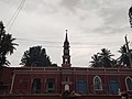
Kannada is the language of the majority in Tumkur, which is also the state's official language.[4][22] The city has a significant number of Urdu speakers, and small populations of Telugu, Tamil and Hindi speakers.[22]
Hindus form the majority of the population, with a significant Muslim minority.[23]
Transportation
The city's railway station comes under the South Western Railway Zone (India), and has been renovated recently.[24][25][26] It is on the Bangalore-Hubli main line, and is located in the centre of the city, close to the bus stand and the town hall.
Municipal buses are available for transportation within the city, and are run by KSRTC. The service is known as Sri Siddaganga Nagara Sarige, named after the holy place, Siddaganga.
Tbe Siddaganga Matha provides free education and accommodation for more than 9000 children. Karnataka Rathna Shivakumara Swami was the president of this matha.[30]
Media
Tumkur has a private FM radio channel, Siddhartha, situated at SSIT campus, broadcasting in Kannada language. Amogha local channel is Amogha Networks.
This page is based on this Wikipedia article Text is available under the CC BY-SA 4.0 license; additional terms may apply. Images, videos and audio are available under their respective licenses.