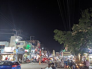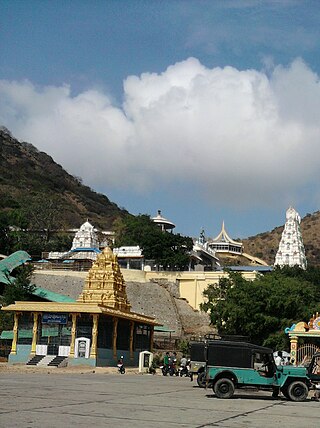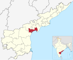
Prakasamdistrict is one of the twelve districts in the coastal Andhra region of the Indian state of Andhra Pradesh. It was formed in 1970 and reorganised on 4 April 2022. The headquarters of the district is Ongole. It is located on the western shore of Bay of Bengal and is bounded by Bapatla district and Palnadu districts in the north, Nandyal district in the west, Kadapa and Nellore districts in the south. A part of north west region also borders with Nagarkurnool district of Telangana. It is the largest district in the state with an area of 14,322 km2 (5,530 sq mi) and had a population of 22,88,026 as per 2011 Census of India.

Bapatla is a town and district headquarters of Bapatla district in the Indian state of Andhra Pradesh. It is a municipality and the mandal headquarters of Bapatla mandal of Bapatla revenue division. The nearest towns and cities to Bapatla are Chirala, Ponnur, Tenali and Guntur of 17 km, 22 km, 50 km and 53 km respectively.
Narasaraopeta is a city and district headquarters of Palnadu District of the Indian state of Andhra Pradesh. The town is a municipality and mandal headquarters of Narasaraopet mandal and Headquarters of Narasaraopet revenue division. The town also is the seat of the court of Additional District Judge. Kotappakonda in Narasaraopeta was famous for Kotappakonda Tirunalla. The town is also referred as the 'Gateway of Palnadu'. The main offices of Nagarjuna Sagar Jawahar Canal Operation & Maintenance Lingamguntla Circle are located in this town. Also it is considered as holy place.
Ponnur is a major city/town in the Guntur district of the Indian state of Andhra Pradesh. A road to Chandole goes south-east and comes to Nidubrolu, where there is a temple with a stone-bearing inscription recording the erection of 90 temples in 1132 CE. An ancient Telugu manuscript entitled 'Ponnuru-Chandavolu Shasanam' was present in Potti Sreeramulu Telugu University. Dhulipalla Narendra Kumar of the Telugu Desam Party is the current MLA of the constituency, who won the 2024 Andhra Pradesh Legislative Assembly election. It is a municipality, and the mandal headquarter of Ponnur mandal is under the Tenali revenue division.
Kammanadu is a historical region in the Indian state of Andhra Pradesh. It consisted of parts of the present day Guntur and Prakasam districts.

Chirala, is a city in Bapatla district of the Indian state of Andhra Pradesh. It is a municipality and the headquarters of Chirala mandal in Chirala revenue division. As of 2011, it had a population of above 170,000.
Nizampatnam is a village in Bapatla district of the Indian state of Andhra Pradesh. It is the mandal headquarters of Nizampatnam mandal in Repalle revenue division. The Dutch occupied the city for trading from 1606−1668.
Vemuru is a village in Bapatla district of the India state of Andhra Pradesh. It is the headquarters of Vemuru Mandal of Bapatla revenue division.
Addanki is a Municipal city in Bapatla district of the Indian State, Andhra Pradesh. Addanki North is the mandal headquarters of Addanki mandal in Addanki revenue division.
Inkollu is a small town in the Bapatla district of the Indian state of Andhra Pradesh. It serves as the administrative center of Inkollu Mandal and is part of the Chirala revenue division. The nearest cities include Chirala, Bapatla, Guntur, Ongole, Addanki, and Chilakaliripeta.
Kondapaturu is a village in Kakumanu Mandal in the Guntur District of Andhra Pradesh, India. It is located 35 km south of the main district of Guntur, 3 km from Kakumanu, and 296 km from Hyderabad, the state capital. Between March and April, Thirunalla is celebrated by 200,000 to 300,000 visiting worshippers every year. According to tradition of Bhavanarayana temple situated in Bapatla The Consort of the lord Bhavanarayana Belongs to Kondapaturu village.to signify this fact from over 1490 years traditional Puttinti sare sent to Lord Bhavanarayana during his annual Kalyanostavam.
Kollur mandal is one of the 25 mandals in Bapatla district of the Indian state of Andhra Pradesh. It is under the administration of Repalle revenue division and the headquarters are located at Kollur.

Nizampatnam mandal is one of the 25 mandals in Bapatla district of the state of Andhra Pradesh, India. It is under the administration of Repalle Revenue Division and the headquarters are located at Nizampatnam. The mandal is bounded by Repalle, Nagaram, Pittalavanipalem and Karlapalem mandals. The mandals lies on the shore of Bay of Bengal and a portion of the mandal lies on the banks of Krishna River.
Chirala mandal is one of the 25 mandals in Bapatla district of the Indian state of Andhra Pradesh. It is administered under Chirala revenue division and its headquarters are located at Chirala. The mandal is situated at the shore of Bay of Bengal and is bounded by Parchur, Karamchedu and Vetapalem mandals.
National Highway 216 is a National Highway in the Indian state of Andhra Pradesh. The former highways of NH 214 and 214A were merged and renumbered as NH 216. It starts from NH 16 junction at Kattipudi and passes through Kakinada, Amalapuram, Digamarru (Palakollu), Narasapuram, Machilipatnam, Repalle, Cherukupalle, Bapatla, Chirala before it junctions NH 16 again at Ongole. Visakhapatnam–Kakinada Petro Chemical Corridor, is a proposed project along the highway.
Bhattiprolu mandal is one of the 25 mandals in Bapatla district of the Indian state of Andhra Pradesh. It is under the administration of Tenali revenue division and the headquarters are located at Bhattiprolu. The mandal is situated on the banks of Krishna River, bounded by Kollur, Vemuru, Cherukupalle, Nagaram and Repalle mandals. The mandal headquarters ten villages are included in Andhra Pradesh Capital Region.

NTR district is a district in coastal Andhra Region in the Indian state of Andhra Pradesh. The district headquarters is located at Vijayawada. The district is named after former Chief Minister of Andhra Pradesh N. T. Rama Rao. The district shares boundaries with Guntur, Palnadu, Krishna, Eluru, Khammam and Suryapet districts.

Palnadu district is a district in coastal Andhra Region in the Indian state of Andhra Pradesh. With Narasaraopet as its administrative headquarters, it was formed on 4 April 2022 to become one of the resultant twenty-six districts The district was formed from Gurazala, Sattenapalli and Narasaraopet revenue divisions from Palnadu district. The district covers most of the Palnadu region.
Bapatla revenue division is an administrative division in the Bapatla district of the Indian state of Andhra Pradesh. It is one of the two revenue divisions in the district and comprises 12 mandals. It was formed on 4 April 2022 along with the newly formed Bapatla district.
Chirala revenue division is an administrative division in the Bapatla district of the Indian state of Andhra Pradesh. It is one of the two revenue divisions in the district and comprises 13 mandals. It was formed on 4 April 2022 along with the newly formed Bapatla district. Initially, Chirala revenue division was created with 13 Mandals.


