
Guntur district is one of the twenty six districts in the Coastal Andhra region of the Indian state of Andhra Pradesh. The administrative seat of the district is located at Guntur, the largest city of the district in terms of area and with a population of 670,073. It has a coastline of approximately 100 km (62 mi) on the right bank of Krishna River, that separates it from Krishna district and NTR district. It is bounded on the south by Bapatla district and on the west by Palnadu district. It has an area of 2,443 km2 (943 sq mi), with a population of 20,91,075, as per 2011 census of India.
Bapatla is a town and district headquarters of Bapatla district in the Indian state of Andhra Pradesh. It is a municipality and the mandal headquarters of Bapatla mandal of Bapatla revenue division. The nearest towns and cities to Bapatla are Chirala, Ponnur, Tenali and Guntur of 17 km, 22 km, 50 km and 53 km respectively.
Ponnur is a major city/town in Guntur district of the Indian state of Andhra Pradesh. A road to Chandole goes south-east and comes to Nidubrolu, where there is a temple with a stone bearing inscription recording the erection of 90 temple in A.D. 1132. An ancient Telugu manuscript entitled 'Ponnuru-Chandavolu Shasanam' was present in Potti Sreeramulu Telugu University. Kilari Venkata Rosaiah of YSRCP party is the current MLA of the constituency, who won the 2019 Andhra Pradesh Legislative Assembly election. It is a municipality and the mandal headquarter of Ponnur mandal under Tenali revenue division.

Repalle is a town in Bapatla district of the Indian state of Andhra Pradesh. The town is one of the 12 municipalities in Bapatla district and the headquarters of Repalle mandal under the administration of Repalle revenue division. It is situated near Krishna River in the Coastal Andhra region of the state.
Nizampatnam is a village in Bapatla district of the Indian state of Andhra Pradesh. It is the mandal headquarters of Nizampatnam mandal in Repalle revenue division. The Dutch occupied the city for trading from 1606−1668.

Cherukupalli Mandal is one of the fifty seven mandals in Bapatla district of the Indian state of Andhra Pradesh. It is under the administration of Repalle revenue division of the district. The village of Cherukupalli is the administrative seat of the mandal.

Vemuru is a village in Bapatla district of the India state of Andhra Pradesh. It is the headquarters of Vemuru Mandal of Bapatla revenue division.
Chandole is a village in Bapatla district of the Indian state of Andhra Pradesh. It is located in Pittalavanipalem mandal of Bapatla revenue division.
Tenali mandal is one of the 18 mandals in Guntur district of the Indian state of Andhra Pradesh. It is under the administration of Tenali revenue division, headquartered at Tenali. The mandal is located in Velanadu region, bounded by Pedakakani, Duggirala, Kollipara, Vemuru, Amruthalur, Tsundur and Chebrole mandals.
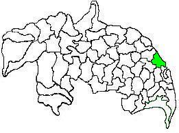
Repalle mandal is one of the 25 mandals in Bapatla district of the state of Andhra Pradesh, India. It is under the administration of Bapatla revenue division and the mandal headquarters are located at Repalle. The mandal is situated on the banks of Krishna River of Velanadu region and is bounded by Bhattiprolu, Nagaram and Nizampatnam mandals.

Duggirala mandal is one of the 18 mandals in Guntur district of the Indian state of Andhra Pradesh. It is under the administration of Tenali revenue division and the headquarters are located at Duggirala. The mandal is bounded by Mangalagiri, Pedakakani, Tenali and Kollipara mandals. Krishna River lies to the northeast of the Duggirala mandal.
Kollur mandal is one of the 25 mandals in Bapatla district of the Indian state of Andhra Pradesh. It is under the administration of Repalle revenue division and the headquarters are located at Kollur.
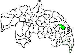
Kollipara mandal is one of the 18 mandals in Guntur district of the state of Andhra Pradesh, India. It is under the administration of Tenali revenue division and the headquarters are located at Kollipara. The mandal is situated on the banks of the Krishna River, bordered by Duggirala, Tenali, Vemuru and Kollur mandal.
Narasaraopet mandal is one of the 28 mandals in Guntur district of the India state of Andhra Pradesh. It is under the administration of Narasaraopet revenue division and the headquarters are located at Narasaraopet city. The mandal is bounded by Rompicherla, Nekarikallu, Muppalla, Phirangipuram, Nadendla and Chilakaluripeta. It also borders Prakasam district.
Vemuru mandal is one of the 25 mandals in Bapatla district of the state of Andhra Pradesh in India. It is under the administration of Tenali Revenue Division and the headquarters are located at Vemuru. The mandal is bounded by Tenali, Kollipara and Kollur, Amruthalur, Cherukupalle and Bhattiprolu mandals. The mandal is also a part of the Andhra Pradesh Capital Region under the jurisdiction of APCRDA.

Pedakakani mandal is one of the 18 mandals in Guntur district of the Indian state of Andhra Pradesh. It is under the administration of Guntur Revenue Division and the headquarters are located at Pedakakani. The mandal is bounded by Tadikonda, Mangalagiri, Duggirala, Tenali, Chebrole and Guntur mandals.

Ponnur mandal is one of the 18 mandals in Guntur district of the Indian state of Andhra Pradesh. Kilari Venkata Rosaiah – YSR Congress Party is the present MLA of the constituency, who won the 2019 Andhra Pradesh Legislative Assembly election from YSR Congress Party. It is under the administration of Tenali revenue division and the headquarters are located at Ponnur town. The mandal is bounded by Vatticherukuru, Chebrole, Tsundur, Kakumanu, Amruthalur, Pittalavanipalem, Karlapalem and Bapatla mandals.
Bhattiprolu mandal is one of the 25 mandals in Bapatla district of the Indian state of Andhra Pradesh. It is under the administration of Tenali revenue division and the headquarters are located at Bhattiprolu. The mandal is situated on the banks of Krishna River, bounded by Kollur, Vemuru, Cherukupalle, Nagaram and Repalle mandals. The mandal headquarters ten villages are included in Andhra Pradesh Capital Region.
Tsundur mandal is one of the 25 mandals in Bapatla district of the Indian state of Andhra Pradesh. It is under the administration of Tenali revenue division and the headquarters are located at Tsundur. The mandal is bounded by Chebrolu, Tenali, Amruthalur and Ponnur mandals. The mandal is a part of Andhra Pradesh Capital Region.

Bapatla district is a district in coastal Andhra in the Indian state of Andhra Pradesh (AP) established on 4 April 2022. The administrative headquarters are in Bapatla. The district is formed from parts of the erstwhile Prakasam district and Guntur districts.


