
Ongole is a city in Prakasam district of the Indian state of Andhra Pradesh. It is the headquarters of Prakasam district and also the mandal headquarters of Ongole mandal in Ongole revenue division. Ongole cattle, an indigenous breed of oxen, derived its name from Ongole.
Yemmiganur is a town in Kurnool district of the Indian state of Andhra Pradesh. It is located in Yemmiganur mandal of Adoni revenue division.

Kurnool district is one of the eight districts in the Rayalaseema region of the Indian state of Andhra Pradesh. It is located in the North western part of the state and is bounded by Jogulamba Gadwal district of Telangana in the north, Raichur district of Karnataka in the northwest, Bellary district of Karnataka in the west, Anantapur district in the south and Nandyal district in the east. The city of Kurnool is the headquarters of the district. It has a population of 4,053,463 of which 28.35% were urban as of 2011.

Prakasam district is one of the 12 districts in the coastal Andhra region of the Indian state of Andhra Pradesh. It was formed in 1970 and reorganised in 2022 on April 4. The headquarters of the district is Ongole. It is located on the western shore of Bay of Bengal and is bounded by Bapatla district and Palnadu districts on the north, Nandyal district on the west, Kadapa and Nellore districts on the south. A part of north west region also borders with Nagarkurnool district of Telangana. It is the largest district in the state with an area of 14,322 km2 (5,530 sq mi) and had a population of 2,288,026 as per 2011 Census of India.

Kovur is a village in Nellore district of the Indian state of Andhra Pradesh. The village is also the headquarters of the Kovur Mandal and Assembly Constituency. It is located in Kovur mandal of Nellore revenue division. It forms a part of Nellore Urban Development Authority. The poet "Thikkanna" was born in this place.
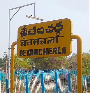
Bethamcherla is a town with Nagar panchayat civic status and mandal headquarters located in Nandyal district of the Indian state of Andhra Pradesh. It comes under Dhone assembly constituency and Nandyal Parliament Constituency.
Chintalavalasa is a census town in Vizianagaram district of the Indian state of Andhra Pradesh. It is located in Denkada mandal of Vizianagaram revenue division.

Gajapathinagaram is a census town in Vizianagaram district of the Indian state of Andhra Pradesh. It is located in Gajapathinagaram mandal of Vizianagaram revenue division. It is located on National Highway 26 between Vizianagaram and Ramabhadrapuram.
Kandukur or Kandukuru is a town in SPSR Nellore district of the Indian state of Andhra Pradesh. It is a municipality and the headquarters of Kandukur mandal as well as Kandukur revenue division.

Pamuru is a town in Prakasam district of the Indian state of Andhra Pradesh. It is the mandal headquarters of Pamur mandal in Kanigiri revenue division. This is the border town of Prakasam district. This is near from Nellore than Ongole around 100 km and also near by Kadapa.

Yerraguntla is town and Nagar Panchayat in YSR Kadapa District. It is an industrial area in YSR Kadapa district, Andhra Pradesh. It is located in Yerraguntla mandal of Kadapa revenue division.

Thulluru is a Village in Guntur district of Indian state of Andhra Pradesh. It is located at a distance of 4 km from Krishna River and was a village in Thulluru mandal of Guntur district, prior to its denotification as gram panchayat.

Chirala, a town in Bapatla district of the Indian state of Andhra Pradesh. It is a municipality and the headquarters of Chirala mandal in Chirala revenue division. As of 2011, it had a population of above 170,000.
Giddaluru is a town in the Prakasam district of the Indian state of Andhra Pradesh. It is the mandal headquarters of the Giddaluru mandal in Markapur revenue division. It was part of kurnool district till 1969 later it was merged into Prakasam district in 1970. Till 2008 it was under Nandyal parliament segment after delimitation it was moved to Ongole MP segment. Giddalur is also known as "3 zilla la muddu bidda " because during the Britishers rule it was in kadapa district later moved to kurnool then in 1970 merged in prakasam district. Giddalur is the only constituency in coastal districts which has Rayalseema culture,slang and traditions. Giddalur town has good transport connectivity to Nandyal, Markapur, Ongole, Kurnool, Kadapa.
Krosuru is a village in Guntur district of the Indian state of Andhra Pradesh. It is the mandal headquarters of Krosuru mandal in Guntur revenue division.

Kanigiri is a Town Municipality in Prakasam district of the Indian state of Andhra Pradesh. It is the mandal headquarters of kanigiri mandal in kanigiri revenue division.
Podili is a municipality town in Prakasam district of the Indian state of Andhra Pradesh. It is the mandal headquarters of Podili mandal. Podili is also known as Prudulapuri. Before British rule its name was "Prudulapuri" meaning "Head quarters of the universe". There is purana reference to this related to Prudhu Chakravarthi.

Angalakuduru is an area of Tenali in Guntur district of the Indian state of Andhra Pradesh. It is located in Tenali mandal of Tenali revenue division. It is a residential area in Tenali. It forms a part of Andhra Pradesh Capital Region.

Kolakaluru is a neighborhood of Tenali city in Guntur district of the Indian state of Andhra Pradesh. It is located in Tenali mandal of Tenali revenue division. It forms a part of Andhra Pradesh Capital Region.

Vykuntapuram, also spelled as Vaikuntapuram, is a village in Guntur district of the Indian state of Andhra Pradesh. It is located in Amaravathi mandal of Guntur revenue division. The village forms a part of Andhra Pradesh Capital Region, under the jurisdiction of APCRDA.
