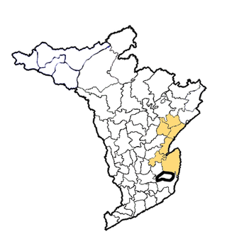
Vizianagaram district is one of the six districts in the Uttarandhra region of the Indian state of Andhra Pradesh with its headquarters located at Vizianagaram. The district was once the part of ancient Kalinga.Saripilli Dibbilingeswara temple, Jayathi Mallikarjuna Temple are the finest examples of ancient Eastern Ganga Dynasty built monuments in the district. The district is bounded on the east by the district of Srikakulam, north by Parvathipuram Manyam south by Visakhapatnam, Anakapalli, southeast by the Bay of Bengal, and west by Alluri Sitharama Raju district. It was formed on 1 June 1979, with some parts carved from the neighbouring districts of Srikakulam and Visakhapatnam. The district is named after the princely state of Vizianagaram. In 2011, it was the least populous district in Andhra Pradesh.

Srikakulam district is one of the twenty-six districts of the Indian state of Andhra Pradesh, located in the Uttarandhra region of the state, with its headquarters located at Srikakulam. It is one of the six districts, located in the extreme northeastern direction of the state. It was formerly known as Chicacole, and was under Ganjam district till 1936 April 1, then merged under Vizagapatam district. Srikakulam district forms the core area of Kalinga where most of its historical capitals like Kalinganagari, pithunda, Dantapuram are located.

Bobbili is a town in Vizianagaram district of the Indian state of Andhra Pradesh.

Parvathipuram is a municipality located at Parvathipuram Manyam district of Indian state of Andhra Pradesh. It is the administrative headquarters of Parvathipuram Manyam district and headquarters of Parvathipuram revenue division and Parvathipuram mandal. This revenue division shares a border with various districts in Odisha.

Cheepurupalli is a census town in Vizianagaram district of the Indian state of Andhra Pradesh. The town is located 30 km to the north of Vizianagaram. The town covers an area of 348 hectares with a population of 78,000 according to the 2011 census.

Kakinada Rural mandal is one of the 21 mandals in the Kakinada district of the state of Andhra Pradesh, India. It has its headquarters at Kakinada. The mandal is bounded by Samalkota mandal, Pedapudi mandal, Karapa mandal, Kothapalle mandal and waters of Bay of Bengal.
Tarapuram or Tharapuram is a Village and Gram panchayat in Ramabhadrapuram mandal of Vizianagaram district, Andhra Pradesh, India.
Bhimavaram mandal is one of the 19 mandals in West Godavari district of the Indian state of Andhra Pradesh. It has headquarters at Bhimavaram town. The mandal is bounded by Undi mandal, Palacoderu mandal, Veeravasaram mandal, Narasapuram mandal, Mogalthur mandal and Kalla mandal mandals.

Duggirala mandal is one of the 18 mandals in Guntur district of the Indian state of Andhra Pradesh. It is under the administration of Tenali revenue division and the headquarters are located at Duggirala. The mandal is bounded by Mangalagiri, Pedakakani, Tenali and Kollipara mandals. Krishna River lies to the northeast of the Duggirala mandal.
Bapatla mandal is one of the 25 mandals in Bapatla district of the state of Andhra Pradesh, India. It is under the administration of Bapatla revenue division and the headquarters are located at Bapatla. The mandal is bounded by Kakumanu, Ponnur, Karlapalem mandals of Guntur district. It also shares borders with Prakasam district and a portion of it lies on the coast of Bay of Bengal.

Machilipatnam mandal is one of the 25 mandals in Krishna district of the Indian state of Andhra Pradesh. It is under the administration of Machilipatnam revenue division, and the headquarters are located in Machilipatnam town. The mandal is bounded by Bantumilli, Pedana, Gudur, Ghantasala, Challapalli, and Koduru mandals.

Kollipara mandal is one of the 18 mandals in Guntur district of the state of Andhra Pradesh, India. It is under the administration of Tenali revenue division and the headquarters are located at Kollipara. The mandal is situated on the banks of the Krishna River, bordered by Duggirala, Tenali, Vemuru and Kollur mandal.
Kamalapuram mandal is one of the 50 mandals in Kadapa district of the Indian state of Andhra Pradesh. It is under the administration of Kadapa revenue division and the headquarters are located at Kamalapuram. The mandal is bounded by Yerraguntla, Proddutur, Chapad, Khajipet, Vallur, Pendlimarri and Veerapunayunipalle mandals.
Salur mandal is one of the 34 mandals in Parvathipuram Manyam district of the Indian state of Andhra Pradesh. It is administration under Parvathipuram revenue division and headquartered at Salur. The mandal is bounded by Makkuva, Ramabhadrapuram, Pachipenta and Bobbili mandals. A portion of it also borders the state of Odisha.
Makkuva mandal is one of the 34 mandals in Parvathipuram Manyam district of the Indian state of Andhra Pradesh. It is administration under Parvathipuram revenue division and headquartered at Makkuva. The mandal is bounded by Salur mandal on South & West, Parvathipuram mandal on North, Seethanagaram mandal on east and Bobbili mandal on south east. A portion of it also borders the Narayanapatna block of the Koraput district of Odisha on north west.
Pachipenta mandal is one of the 34 mandals in Parvathipuram Manyam district of the Indian state of Andhra Pradesh. It is administration under Parvathipuram revenue division and headquartered at Pachipenta. The mandal is bounded by Salur, Ramabhadrapuram and Mentada mandals. A portion of it also borders the state of Odisha.
Mentada mandal is one of the 34 mandals in Vizianagaram district of the Indian state of Andhra Pradesh. It is administration under Parvathipuram revenue division and headquartered at Mentada. The mandal is bounded by Pachipenta, Ramabhadrapuram, Dattirajeru and Gajapathinagaram mandals. A portion of it also borders the state of Odisha.
Ramabhadrapuram mandal is one of the 34 mandals in Vizianagaram district of Andhra Pradesh, India. Ramabhadrapuram is the headquarters of the mandal. The mandal is bounded by Salur, Bobbili, Badangi, Merakamudidam, Dattirajeru, Mentada and Pachipenta mandals.
Badangi mandal is one of the 34 mandals in Vizianagaram district of Andhra Pradesh, India. Badangi is the headquarters of the mandal. In Early 18th century Pinpenki, Badangi, Anavaram and kusumur ruled by Shri Ravu Venkata Rayanym Dora Garu now their family also residing in Pinapenki near Gadhaba valasa their family members Started "RVR Foundation" on the name of Shri Ravu Vittal Rao Dora Garu to help poor children. Founder & President "Shri Ravu Venkata Aditya Mohan", He is conducting child development activities and giving financial / moral support. The mandal is bounded by Bobbili, Therlam, Merakamudidam and Ramabhadrapuram mandals.
Ravu Venkata Sujay Krishna Ranga Rao is the former Minister of Mines in the cabinet of N. Chandrababu Naidu from 2014 to 2019, Andhra Pradesh, India.


