
Vizianagaram district is one of the six districts in the Uttarandhra region of the Indian state of Andhra Pradesh with its headquarters located at Vizianagaram. The district was once the part of ancient Kalinga.Saripilli Dibbilingeswara temple, Jayathi Mallikarjuna Temple are the finest examples of ancient Eastern Ganga Dynasty built monuments in the district. The district is bounded on the east by the district of Srikakulam, north by Parvathipuram Manyam south by Visakhapatnam, Anakapalli, southeast by the Bay of Bengal, and west by Alluri Sitharama Raju district. It was formed on 1 June 1979, with some parts carved from the neighbouring districts of Srikakulam and Visakhapatnam. The district is named after the princely state of Vizianagaram. In 2011, it was the least populous district in Andhra Pradesh.

Srikakulam district is one of the twenty-six districts of the Indian state of Andhra Pradesh, located in the Uttarandhra region of the state, with its headquarters located at Srikakulam. It is one of the six districts, located in the extreme northeastern direction of the state. It was formerly known as Chicacole, and was under Ganjam district till 1936 April 1, then merged under Vizagapatam district. Srikakulam district forms the core area of Kalinga where most of its historical capitals like Kalinganagari, pithunda, Dantapuram are located.

Bobbili is a town in Vizianagaram district of the Indian state of Andhra Pradesh.

Nimmada is a village and panchayat in Kotabommali Mandal, Srikakulam District, Andhra Pradesh, India. It is located approximately 30 km (19 mi) north of Srikakulam town near the sea. It comes under Tekkali assembly constituency.
Paradi or Paradhi is a village and Gram panchayat in Bobbili mandal of Vizianagaram district in Andhra Pradesh, India.
Nuzendla is a village in Palnadu district of the Indian state of Andhra Pradesh. It is located in Nuzendla mandal of Narasaraopet revenue division.
Challapeta is a village panchayat in Mentada mandal of Vizianagaram district, Andhra Pradesh, India. It is located about 29 km from Vizianagaram city. There is a Zilla Parishad High School in the village. There is a post office at Challapeta. PIN code is 535 581.
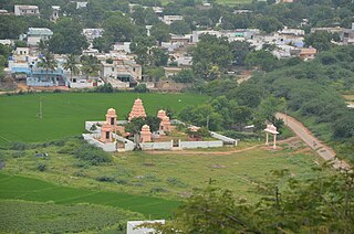
Komati-palli is a village and Gram panchayat in Dattirajeru mandal of Vizianagaram district in Andhra Pradesh, India.
Botsa Jhansi Lakshmi, also spelled as Botcha Jhansi Lakshmi, is an Indian politician and past member of the Lok Sabha from Vizianagaram, Andhra Pradesh.

Kattevaram is a village in Guntur district of the Indian state of Andhra Pradesh. It is located in Tenali mandal of Tenali revenue division. It forms a part of Andhra Pradesh Capital Region.
Koderu or Kodair is a village and mandal headquarters in Nagar Kurnool district, Telangana, India.
Valaparla is a village located west of National Highway 5 in Martur Mandal of Bapatla district in Andhra Pradesh, India. The village was previously called Olupara. The village code in the 2011 census was 590698; its pin code is 523260.
Bobbili is one of the 34 mandals in Vizianagaram district of Andhra Pradesh, India. Bobbili town is the headquarters of the mandal. The mandal is bounded by Makkuva, Seethanagaram, Balajipeta, Salur, Ramabhadrapuram, Badangi and Therlam mandals.
Pedanadipalli is a village in Vizianagaram district of the Indian state of Andhra Pradesh. It is located in Cheepurupalli mandal. It is 13 km from the mandal headquarters and 43km from the district headquarters. It is situated at 14 km from the National Highway 16.
Salur mandal is one of the 34 mandals in Parvathipuram Manyam district of the Indian state of Andhra Pradesh. It is administration under Parvathipuram revenue division and headquartered at Salur. The mandal is bounded by Makkuva, Ramabhadrapuram, Pachipenta and Bobbili mandals. A portion of it also borders the state of Odisha.
Makkuva mandal is one of the 34 mandals in Parvathipuram Manyam district of the Indian state of Andhra Pradesh. It is administration under Parvathipuram revenue division and headquartered at Makkuva. The mandal is bounded by Salur mandal on South & West, Parvathipuram mandal on North, Seethanagaram mandal on east and Bobbili mandal on south east. A portion of it also borders the Narayanapatna block of the Koraput district of Odisha on north west.
Ramabhadrapuram mandal is one of the 34 mandals in Vizianagaram district of Andhra Pradesh, India. Ramabhadrapuram is the headquarters of the mandal. The mandal is bounded by Salur, Bobbili, Badangi, Merakamudidam, Dattirajeru, Mentada and Pachipenta mandals.
Badangi mandal is one of the 34 mandals in Vizianagaram district of Andhra Pradesh, India. Badangi is the headquarters of the mandal. In Early 18th century Pinpenki, Badangi, Anavaram and kusumur ruled by Shri Ravu Venkata Rayanym Dora Garu now their family also residing in Pinapenki near Gadhaba valasa their family members Started "RVR Foundation" on the name of Shri Ravu Vittal Rao Dora Garu to help poor children. Founder & President "Shri Ravu Venkata Aditya Mohan", He is conducting child development activities and giving financial / moral support. The mandal is bounded by Bobbili, Therlam, Merakamudidam and Ramabhadrapuram mandals.
Ganapavaram mandal is one of the 28 mandals in West Godavari district of the Indian state of Andhra Pradesh. It is under the administration of Bhimavaram revenue division and the headquarters are located at Ganapavaram. Ganapavaram Mandal is bounded by Nidamarru Mandal towards west, Pentapadu Mandal towards North, Undi Mandal towards South, Unguturu Mandal towards North. Tadepalligudem, Bhimavaram, Tanuku, Eluru are the nearby Cities to Ganapavaram. It is located 55 km from Eluru and 22 km from Bhimavaram.

Biccavolu mandal is one of the 19 mandals in East Godavari district of the Indian state of Andhra Pradesh. It is under the administration of Rajahmundry revenue division and the headquarters are located at Biccavolu village. Biccavolu Mandal is bounded by Rayavaram Mandal towards South, Pedapudi Mandal towards East, Anaparthy Mandal towards west, Ramachandrapuram Mandal towards north. It is located ata distance of 41 kilometres from Rajahhmundry.


